Submerged

  • Plymouth And Devon Shipwrecks
  • World Shipwrecks
  • Special Reports
  • Recommended Reading

The Longest Wreck Walk

Written by David Page

For many years my good friend and diving partner, Peter Mitchell and I, had been intrigued by the many “Myths and Legends”, circulating in the South West of England, concerning visits supposedly made to the region by Jesus, Joseph of Arimathea, Pontius Pilate, and their various retinues. Even the popular hymn “Jerusalem” asks the same question. The intention had always been to attempt to piece together that which we have been able to discover, from various sources, and for Peter to then “write it up” as one of his “Wreck Walks”.

Sadly, he passed away at the end of June 2015, so, as a “Tribute” to Peter, I shall attempt to put together the many notes we have made into something more “readable”, and hopefully spark off an interest in those others who read it.

****

Punches Cross, Polruan

Punches Cross, Polruan

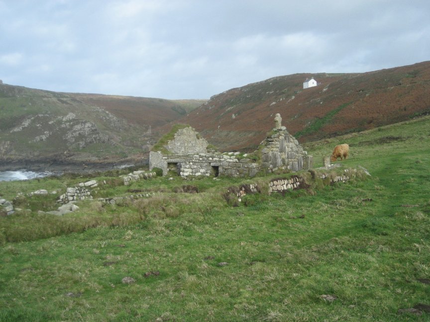
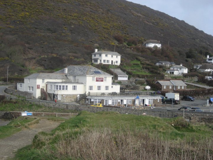
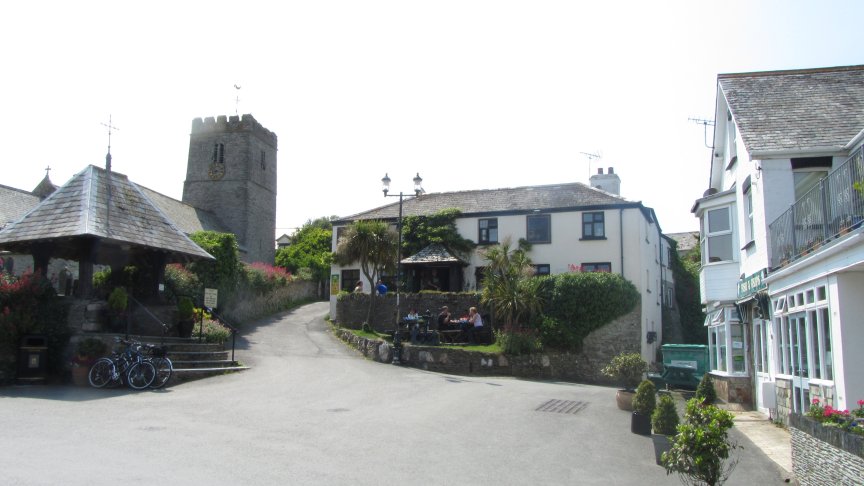
About 2006 or 2007 we were making passage down the coast of Southern Cornwall and decided to enter Fowey Harbour. On the headland to our right, beneath the ruins of St Saviours church at Polruan, was seen a large white cross. It is called “Punches Cross” and, so legend has it, is where “Jesus, Joseph of Arimithea, and Pontius Pilate and their retinues” are reputed to have landed whilst visiting their “Mining Interests” down here in Cornwall. Joseph was Jesus’ uncle and had been his guardian since Joseph of Nazareth had died.

There has supposedly been a “cross” here for many hundreds of years, and its true origins have been lost in the mists of time. It was this cross that ignited our interest, and had led us both into areas of research we had never before thought possible.

It was at first thought that “Punches Cross” was so named as a local attempt at saying “Pontius”. We soon found, however, that it was more than likely to be a “marker” to denote entry or exit from “Church owned” lands further upriver, and thus a “Toll” was payable to the local “Bishop” at Tywardreath, as pilgrims journeyed North and South between Ireland, Wales, and across the English Channel to various holy sites in France and Spain during early Medieval times.

But the Legends and Myths were many and widespread, and as they often contain a fairly large “Grain of Truth”, we both felt they were worth looking deeper into. We soon found out about “The Saints Way”, a path leading across country to the North Coast of Cornwall around the River Camel Estuary. Here are many more legends, and an ancient well, named “Jesus Well” is easily found on the “O.S. 1:25,000 Explorer Map 106” just North West of Rock at “SW 937764”.

Jesus Well

Jesus Well

Once again though, this pathway across Cornwall, Jesus’ well, and the many ancient churches found along the route, such as the one half mile west of “Jesus’ Well”, St Enodoc’s, were found to be more than likely a part of one of the many “Pilgrimage” routes across Cornwall that had developed from around 700 – 800 A.D.

We soon were confronted by “Conventional Archaeology” seeming to have no interest whatsoever in the subject, being intent instead on constructing whole “civilizations” on a piece of broken pot or discarded arrow head. It soon became apparent that no “formal investigations” had ever been carried out, nor were they ever likely to be so.

We therefore had to enter into some really “strange places” via the books we read, and the Internet searches we carried out. Some were quite plausible, even if our credibility was stretched at times !

The most interesting book by far, “The Missing Years of Jesus”, was written by an ex-policeman, Mr. Dennis Price. He had also looked at the many available books and articles, and had decided to investigate further. He had looked into the “Means, Motive, and Opportunity” as if it were a real Police investigation. It must be said that he has convinced me !!

To hopefully get a better understanding and insight into this matter, we must leave our present “modern” ideas behind. We must put aside our presumed “Historical knowledge” for the moment, as it now seems as if the history we have long been taught has been heavily “censored”, and only that which the “Church” wished to be known has been allowed.

We must start way back in history, around 8 – 7,000 B.C. at a time when civilisation was first developing in the “Tigris and Euphrates basin” in what is now modern day Iraq. The peoples there were the “Sumerians”, and later the “Babylonians”. These peoples soon expanded outwards into Egypt and Eastwards into India. They took their knowledge of the “sciences”, their civilizing ideals and their religions with them. The peoples of those areas they moved into were heavily influenced by them and their religions, and even today “Hinduism”, Buddhism, and the now almost extinct “Druidism”, reflects the reverence for nature held by the incoming culture into ancient Egypt.

It has long been accepted that “Phoenician, Early Greek, and Pre-Roman conquest” trading in Tin, Copper, Lead, and even Gold, had been carried out between the South West of England and the Mediterranean cultures for many hundreds of years, well back into the Bronze age.

What was not expected to find was that there had seemingly existed an earlier “Egyptian Trade” in those same commodities, and through the same area of Southern France around Marseille, and then Northwards up through the Rhone Valley to the land the Egyptians had called “Hyperborea” (literally the Land beyond the Celts – Britain).

The Celts were (and some still are) “Druidic”, through their contact with Egyptian traders, and the by now long altered religious ideas held by them. This contact soon spread across the English Channel into Britain. Major Druidic religious centres soon developed in Britain, notably at Avebury, Glastonbury, and Stonehenge. These places will figure once again as this narrative progresses.

Having now established a possible connection with Eastern Mediterranean culture and ideas, we can now move forward in time to when Jesus appears to be missing from the scriptures from when he was around 12 years old, to his re-appearance in them, 18 years later, when he was 30.

Judea, at that time was under “Roman occupation”, and they didn’t take too kindly to anyone questioning their pantheon of Gods. It is often stated in various scriptures that Jesus had an amazing intellect, and would often be found in various temples in deep discussion with many religious teachers. It is felt that it was around this time that he began to question, perhaps a bit too strongly, the current establishment and its leading figures. Bear in mind that he was not a “modern” young teenager, but a product of his time.

Moses, it must be remembered, had earlier led the “Israelites” out of Egypt, and had also had to deal with the “Worship” of the Golden Calf, the result being a set of rules by which we all should abide, “The Ten Commandments”.

What seems to be being ignored in many instances is that “Cattle” are held in esteem in many religions, most of which have evolved from the early Sumerian influence into ancient Egypt and other Mediterranean cultures. In light of this it can also be assumed that many of the other religious ideals, which would have eventually influenced the young Jesus, would have also travelled out of Egypt with Moses and the Israelites, mainly a reverence for nature and a “Love” for all mankind.

St Enodocs Church

St Enodoc’s Church

We can now try and connect the parts into what is, hopefully, a relevant story. Pontius Pilate, the local Roman governor of Judea, was a very wealthy man by the days standards, and had “Interests and connections” with many of the Tin, Copper, Gold and Lead mines in Pre-occupation Britain. The earlier unsuccessful “Roman” invasion attempt by Julius Ceasar in 55 – 54 B.C. had resulted in many trading connections being made between the then continental Roman Empire and Britain, and Pontius Pilate had taken full advantage of them.

Joseph of Arimathea was also a very wealthy man, as well as being high up in the Jewish Sanhedrin, the local Jewish Governing body, and in charge of Trading and Mining interests alongside Pontius Pilate. He had also been made guardian of Jesus by virtue of being his uncle, Mary’s brother.

It therefore seems natural for him and Pontius Pilate to visit those interests and, given who they were, they would have both had large retinues with them. This would have all been well before the finally successful “Roman” invasion of Britain by Claudius, and the later expansion carried out by Vespasian in 43 A.D.

It is felt that Pontius Pilate tipped his friend and business partner, Joseph, off over Jesus’ growing adverse impact he was having in Judean religious circles, and advised the family to flee to Egypt. It would have been here, if he hadn’t already heard of it, that Jesus learnt of the far off land that had not only held off the supposedly invincible Roman Army 60 odd years earlier, but also that its peoples had very similar spiritual ideals and beliefs as his own.

What teenager could resist a visit to such a place, and this is where Dennis Price’s book “The Missing Years of Jesus” and his use of “Means, Motive and Opportunity” becomes so believable.

Means:- Yes, he certainly had the means to visit Britain. His uncle Joseph was well placed within the Judean regional government, had a close financial and personal contact with the local Roman Governor, “Pontius Pilate”, and was also part of the Roman controlling body in charge of mines and mineral extraction.

With this in mind, Joseph would have had access to shipping and transport to anywhere within the then known “Roman world”, and would have had firm contacts with traders beyond it. Jesus’ father, Joseph of Nazareth, had for some reason disappeared from mention in the scriptures, and had been assumed to have already have died.

Joseph of Arimathea, being Jesus’ uncle, would have therefore taken on a role as the young Jesus’ guardian, and thus it is only natural that he would have taken the 12 year old Jesus along with him on any visits to the many mines he had an interest in. Along with Jesus, he would also have taken a large retinue of Clerks, Slaves, and possibly even other family members, such as his sister Mary, Jesus’ mother, given his governmental status.

Given the involvement of “Pontius Pilate”, and the quite probably large retinue he also would have had with him, we can now see that this would certainly not have been a “small group on a weekend visit”, and the memory of it would certainly have passed into record of some sort, even if only as a set of “Legends and Myths”.

Motivation:- As has often been stated in the scriptures, Jesus, as a youngster, had an exceptional intellect and was often to be found in discussions with religious leaders and scholars in his local temples. Through these he would have undoubtedly heard of the stories of the Island peoples on the edge of the then known “Roman” world who had, 60 -70 odd years previously, successfully thwarted 2 invasion attempts by the supposedly “invincible” Roman Army.

There was already a “resistance movement” amongst the population of Judea to the occupying Roman Army, and the chance to “rebel” is a potent force for a young and very receptive mind. He would have understood that “military action” was a non-starter, but to alter the religious mind-set of the Romans pagan beliefs from within, and even that of the ruling Jewish “Pharisees” ? Now that would have been a different matter completely.

He would have heard of the “Druids” of that land and their similar “monotheistic” beliefs as those held by his own people. He would also have heard of “Stonehenge” and it’s design similarities with the “Labyrinth” under the Greek temple at Knossos.

He would have heard of the stories of the Minotaur, half man and half bull who lived in that Labyrinth, and would have been told of the “Bull” worship that had its origins in Greek and even earlier Egyptian religions. A reflection of this “Bull” worship can still be seen in the “Hindu” religion of India, and the reverence placed on all living things amongst “Buddhists”

The connection would then have been easily made, in his mind, when told of a similar belief in, and sacrifice of, “White Oxen” by the Druids at Stonehenge, along with their worship of the “natural world”. Many of our present religious celebrations have been developed from earlier Druid beliefs, and the stories of the “Green Man”, and the habit of “Touching wood” for good luck being with us to this day.!. What young lad, soon to become a teenager, could resist the chance of travelling to such a remote and mystical land, and to learn from, and be educated by, the people living there ?

Opportunity:- These must have been many, given his uncles status, but it would seem that the largest incentive would have been when Joseph was forced to flee with his family to “Egypt”. As this region was also under Roman control at the time, and so therefore also under local Judean overview, it was not a place of complete safety, even if their religious views were, by now, similar to his own.

It is more than likely that this was the spur leading to the family coming to Britain, for Joseph to be in close touch with his mining and trading interests, and for Jesus to study under, and to eventually live amongst, the similarly minded Druids at the great religious centres of Glastonbury and Avebury. The site of Stonehenge is only 30 miles to the east, a good days walk, and it is inconceivable that he did not visit the place and learn of its mysteries during his reputed 18 years living here.

The “Druids” were renowned for their skills at “Oratory and argument”, and their “priests” were known to have walked without fear between warring factions and to have calmed down serious situations, a skill that Jesus is often stated to have put to use in his later ministry.

This book by Dennis Price is, as stated before, a very compelling read and would go a long way in convincing one that Jesus did really spend his “Missing Years” here in Britain before returning to Judea with his ideas fully formed.

****

St Saviours Church, Polruan

St Saviours Church, Polruan

To the ruling religious leaders of Judea he would have been looked on as a major “trouble maker”, a certainly unwanted “voice of the people”, and they would have tried to minimise his influence as much as possible. His teachings in the 3 years after his return certainly did not sit well with them. Jesus finally forced their hand with his return to Jerusalem during “Passover” and his disruption of the temple money-lenders. He was arrested and sentenced to death.

Now the strange part of this is that the “normal” method of execution, for the perceived crimes he had carried out against the ruling classes and religious leaders, would have been “stoning to death”, a method reserved for petty criminals and women, and would probably have resulted in his lifetimes teachings, and manner of death, being completely forgotten about in a matter of days.

To really make his voice and teachings echo down the centuries to follow, he had to “Martyr” himself and to be killed by his own people in the most horrendous manner available,-“Crucifixion”. Jesus had chosen his place and moment well. Jerusalem during “Passover” was then, as it is still now, a place of considerable “tension”, and the occupying Romans had to take great care that these “tensions” did not escalate into major rioting.

This probably goes a long way in explaining why “Pontius Pilate” who, as outlined above, knew Jesus during his youth, and who more than likely still had mining and other business dealings with Jesus’ Uncle, “Joseph of Arimathea”, refused to take any part whatsoever in his conviction and subsequent execution and, basically, “washed his hands” of the whole affair.

This would therefore ensure Jesus’ terrible death at the hands of his own people, the memory of his killing being retained for centuries down to the present day, and the start of one of the worlds major religions.

Hopefully, one day, a proper “Forensic examination” of all existing subject matter will be undertaken but, until that takes place, and unlikely as that examination will be, given the power of censorship still wielded by the “Roman Catholic” church, we are stuck with what we have at present.

There are probably many other “Internet searches” and books available for research into this subject but, given the 2000 year time scale involved, much will now be obscured by Legend, Folklore, and Myth, as well as the obvious resistance in peoples minds to altering their whole historical perception. This is a very intriguing subject though, and it could occupy ones time in searching for years to come, even if it is doubtful that a definitive answer could ever be reached !!

****

My friend Peter would have loved to have been able to put this story into his own words, but sadly he was unable to. I hope therefore that my “precis” of the copious notes we had collected have done the job for him. Only he will now know whether there is any truth in all the Legends and Myths, or whether they will forever remain just that – “Legends and Myths”.

You, the reader, however, can form your own opinion as you follow in our footsteps, and those of the many thousands of “Pilgrims” who have journeyed along “The Saints Way”, and have been captured by the story and think to yourself – “I wonder” !!!

“R.I.P. Peter”.

David Page,
July 2015.

The Wreck of the Liberty at Pendeen Watch

Pendeen Watch on the rugged coast of Cornwall is a notorious graveyard for ships. For instance in the decade between 1890 and 1900 seven steamers were lost,one of them being the nearly new steamer, Busby, three stranded and twenty six poor sailors died. As a result of all this death and destruction Trinity House decided to build a lighthouse on the Pendeen headland and its light finally shone out in 1900. It was to be another decade before ships once again started to pile up on the rocks below Pendeen Watch, ships like the William Cory full of pit props which struck the Enys Rock spewing her pit props into the sea beating back the boats coming to rescue them.

A fantastic shot of Pendeen Watch sadly not my own. It just about tells you all you need to know about this coast.

A fantastic shot of Pendeen Watch sadly not my own. It just about tells you all you need to know about this coast.

Fog of course was the main reason for ships to come to grief at Pendeen, but during the First World War it was the German U-boats sinking vessels as they rounded Cape Cornwall or steered for the Longships. After the two Wars wrecks still continued to pile up, but the ship we are interested in is the Liberian tramp streamer Liberty, ex War Camel, Ex Cairndhu Ex Styrmion. She had the dubious distinction of being the first wreck at Pendeen Watch, since the St.Ives Lugger, Twin Boys struck the delightfully named Three Stone Oar in March 1924.

The William Cory, Sept 1910.

The William Cory, Sept 1910.
The almost new steamer Busby, June 1894.

The almost new steamer Busby, June 1894.

Launched by Palmers of Hebburn-on-Tyne in December 1918 as the War Camel she became the Cairndhu for the Cairns Line of Dundee. Her main beat was between St.Lawence, Leith, and Tyne with cargos of canned goods and wheat, returning often with china clay in ballast. In August 1927 she was laid up sold to a Greek line and renamed as the Styrmion. After the Second World War she was placed on the French North Africa run, and then transferred to Hoogli, Chittagong and Kararchi trade until 1951, when finally as the Liberty she gravitated to the Baltic, hauling iron ore. She had one or two mishaps along the way like stranding near Stockholm, but on the evening of 16 January 1952 the Liberty was leaving Newport in ballast for La Goulette. By the next evening she was off Pendeen Watch in the teeth of a north westerly gale pushing her bows through the violent snow squalls. As her elderly engines raced to keep her on track the steam pressure started to fall alarmingly, so Captain Filinos radioed for a tug and the lifeboat, but is was to be too late for the Liberty. As the tug Merchantman searched in vain for the stricken ship, the Liberty was dangerously wallowing broadside too, near Portheras Cove, right under the cliffs of Pendeen Watch.

The ill fated Liberty.

The ill fated Liberty.

The mate and the bosun escaped down a rope ladder and twenty others, including the Captain, were rescued by breeches buoy. Thirteen of the crew were so overwhelmed by the disaster that they hid on board the sinking ship until the evening, only coming out on deck, after they were furiously harangued by Captain Filinos with a mixture of Arabic and Greek. By now the LSA had turned up and they rescued these poor souls amidst much shouting and gesticulation from the Captain, other crew and the LSA.

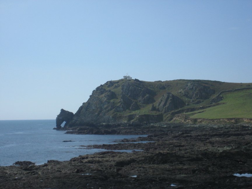
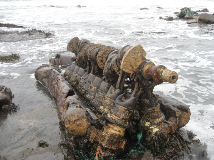
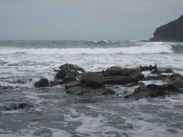
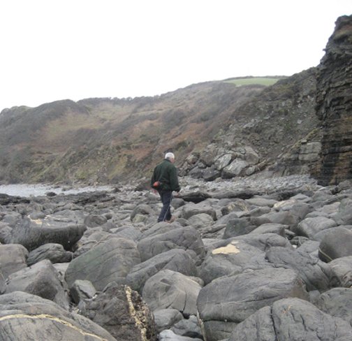
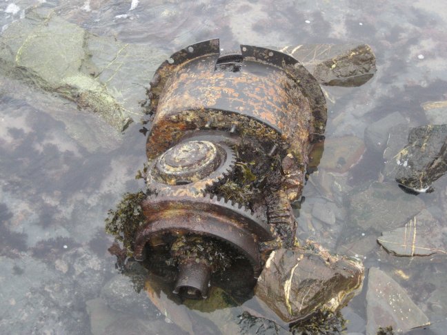
The Walk Pendeen Light is well signposted from St Just and on arrival you can either stop at the top car park, or turn to your right to go down to the lower car. The grassy slope in front of the car park is where the L.S.A. (rocket brigade) launched the breeches buoy to rescue some of the crew, and it is here that you will find a track that will lead you down onto the rocks by most of the wreckage. Its not very steep, but since you want to be there at a spring low tide to see most of he wreckage, bear in mind that the tide will come back in quite quickly. Easily identifiable are the crankshaft, engine block and some of the larger pieces of the ships framing. On the sand of the cove is a half buried anchor and a bollard set amidst other iron work half buried in the sand. Right out in front of you is the wonderfully named Three Stone Oar reef and with a stiff onshore breeze, which we had, you can immediately see why so many ships have piled up around these rocks.

The track down to the cove.

The track down to the cove.
The wreckage to the left, mind the returning tide.

The wreckage to the left, mind the returning tide.
The main wreckage to the right of the cove.

The main wreckage to the right of the cove.
The main body of wreckage.

The main body of wreckage.
Part of the prop shaft.

Part of the prop shaft.
Anchor.

Anchor.
photos courtesy of ‘Dave’ Page

The Lighthouse is quite standard for this part of Cornwall and is unmanned, so not open to the public. Usually the gates are locked shut, but you can walk from the top car park along the enclosure wall down to where it all juts out over the cliff. There is a platform there that allows you very good views of the front of the lighthouse. One of its nice features is the huge pair of bats ear fog horns. Don’t be near these when they go off, as they are likely to give you a heart attack. They are beyond loud. Over to the right of the lighthouse you will see lots of mine chimneys dotted around the cliffs. If you are interested, there are plenty of tourist tours in the area, the closest being the Levant mine, with its working beam engine.

The Foghorns.

The Foghorns.
View of the front of the Light.

View of the front of the Light.

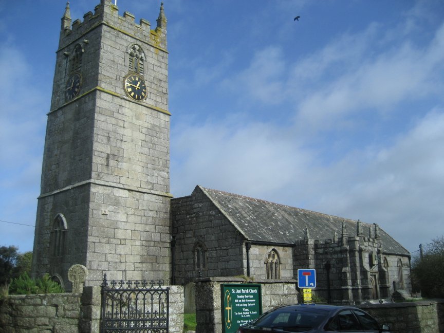
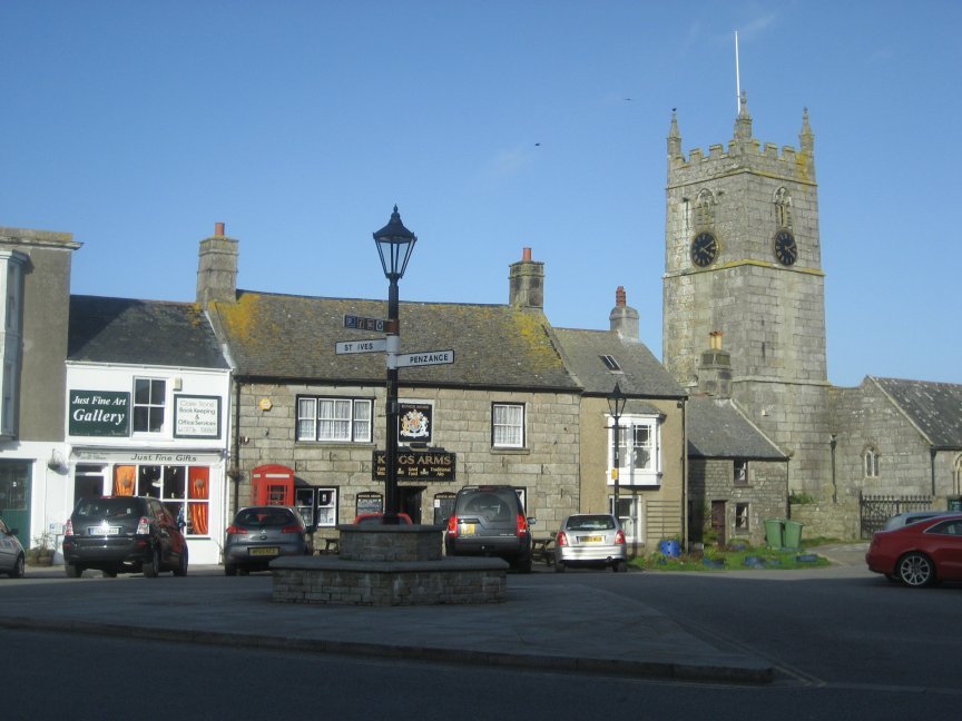
There are a few pubs near the Pendeen Light,but we decided to go back to St Just. Four pubs in the square, and a great pasty shop. All the pubs serve good food and we chose the Kings Arms at random. It sells ‘Tribute’ and ‘Proper Job’ amongst its beers and loads of good sandwiches and other food. If you want a complete alternative there is a ‘Fair trade’ cafe just up from the square. What’s not to like

name of ship/subject of story

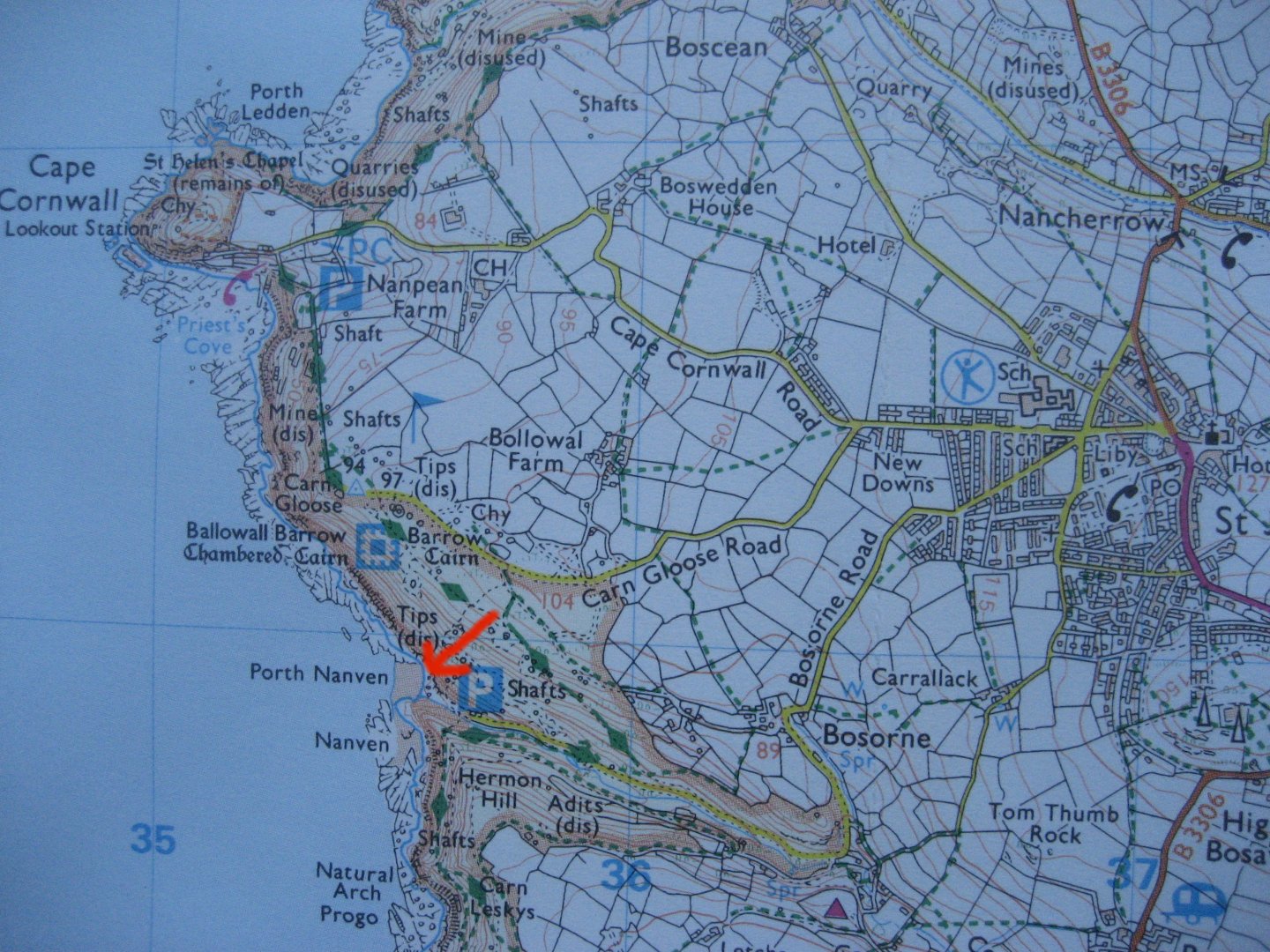
Google Map showing The Lighthouse to the left of the cove where the wreckage is.

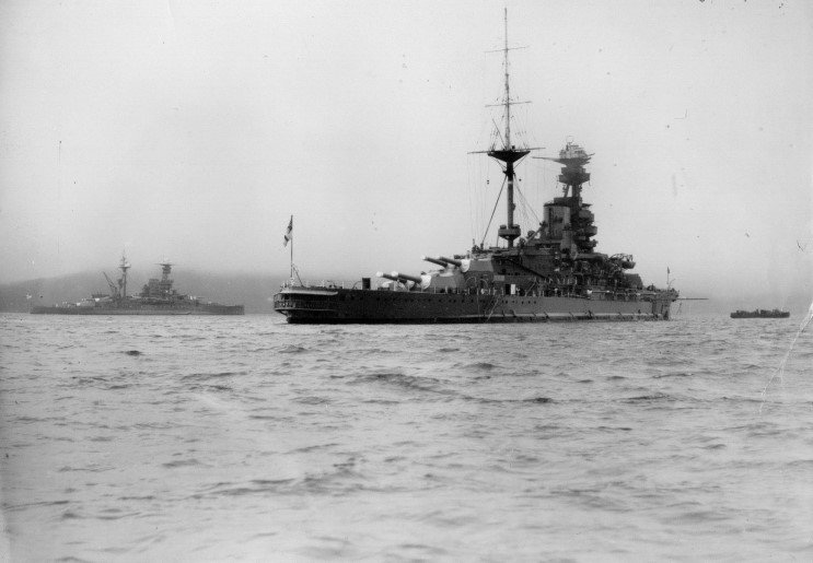
HMS Warspite.

It seems almost inconceivable now, but this short stretch of Cornish coast between Marazion and St Michaels Mount should have witnessed the death of one of the Royal Navy’s most famous battleships, H.M.S. Warspite, During her 32 years service she had endured bombing, shellfire, ramming, mines and a missile attack, and fought all over the world from Jutland in the Great War, to the Normandy Landings in the Second World War. Sailors often say that a ship embodies all their hopes, aspiration and experiences, and because of this, she becomes more than just an expression of sea power, or another collection of men, iron and steel. The Warspite was certainly much more than that, and became known to everyone who served on her as ‘The Grand Old Lady’.

Warspite in the Indian Ocean 1942.

Warspite in the Indian Ocean 1942.

Laid down in Devonport Dockyard Plymouth, in October 1915, she was launched into the River Tamar a year later. Her first Captain, Edward Phillpotts, took command when she commissioned in 1915. The Warspite was one of five Queen Elizabeth class Battleships which were built to combat the threat of new faster German battleships. She was 639 feet long, had a beam of over ninety feet with a draught of thirty feet six inches and a crew which varied in size from about 995 to 1200. Her initial armament consisted of eight 15inch guns in four twin turrets, fourteen single six inch guns, two single QF three inch anti aircraft guns, and four twenty one inch submerged torpedo tubes. When she was commissioned, she was one of the most powerful and flexible super dreadnoughts afloat.

HMS Warspite being launched in 1915

HMS Warspite being launched in 1915

In 1916, at the Battle of Jutland, the Warspite was attached to the 5th Battle Squadron under the overall command of Admiral Beatty. She managed to to score a direct hit on the German Battle Cruiser, Von der Tan, before a stray shell damaged her steering. By the time she was back to full readiness, the German High Seas Fleet had slipped away in the rain and mist. During the battle the Warspite was holed one hundred and fifty times and had fourteen of her crew killed, with another sixteen wounded. Although seriously damaged she was still afloat and was ordered back to Rosyth. On her way she was attacked by a German U boat which missed with all three torpedo’s. Shortly after this lucky escape, she was attacked again by another U boat, which she tried to ram. The submarine however, was too quick for her and managed to speed away undamaged. It must have been with a sigh of relief that the crew safely entered the port of Rosyth. The Warspite had a revenge of sorts, as at the end of the War, she was part of the force that escorted the surrendered High Seas Fleet into internment at Scapa Flow in 1918.

German Battle Cruiser,Von der Tan.

German Battle Cruiser,Von der Tan.
Warspite's damage.

Warspite’s damage.

From 1919 to 1939, she joined the 2nd battle Squadron as part of the newly formed Atlantic Fleet. During this time the Warspite regularly showed the Flag all over the Mediterranean reinforcing the Royal navy’s supremacy as the worlds foremost sea power. After being rammed by a Romanian passenger ship off Portugal she had some minor repairs, but it was between 1934 and 1937 that she underwent major reconstruction, giving the Royal navy a virtually new ship with much enhanced capabilities. As the Second World War unfolded, the Warspite was in the thick of it, taking a significant role in the two battles of Narvik where she destroyed the Z13 Erich Koellner with broadsides and severely damaged the Z17 Dieter von Roeder, together with the Z12 Erich Giese. Between 1940 and 1941 she became engaged in several major sea battles. In 1940 she took part in the battle of Calabria against the Italian Navy (Regina Marina). It was during this battle that the Warspite achieved the longest range gunnery hit on a moving target in history, when she damaged the Italian battleship Giulio Cesare at a range of 26 KM (26000yards).

The Italian Battleship, Giulio Cesare.

The Italian Battleship, Giulio Cesare.

In mid August of the same year, she was involved in the Battle of Taranto, where she was slightly damaged by a single bomb during Operation Excess. In March 1941 Admiral Cunningham took his fleet to sea against the Regina Marina on board his flagship H.M.S. Warspite. The Italian navy was supporting the German Invasion of the Balkans and had sailed to intercept Allied convoys between Egypt and Greece. Cunningham caught up with them near Cape Matapan and ordered airstrikes on the Italian Battleships to save his Cruisers from their heavier gunfire. Meanwhile Warspite, Barham, and Valient closed on the heavy cruisers Fiume and Zara and destroyed them and two destroyers at point blank range. This battle destroyed the Regina Marina’s moral, and allowed the British to tighten their grip on the Mediterranean just in time for the German invasion of Crete. Here she was used as a floating anti aircraft battery, until a 500 pound bomb dropped by Oberleutenant Kurt Ubben damaged her four and six inch gun batteries, ripped open her side and killed thirty eight of the crew. The damage was too severe to be repaired at Alexandria so the Warspite was sent to Bremerton on the West Coast of the United States of America.

The Italian Cruiser Fiume.

The Italian Cruiser Fiume.

After her refit in 1942 the Warspite joined the Eastern Fleet, as the Flagship of Admiral Sir James Somerville, who had commanded her in 1927. Although she was involved in various operations in the Far East against the Japanese Navy, her role was largely uneventful, and she returned to England in 1943 in time for the Allied invasions of Sicily and Italy, taking part in Operation Husky and covering the landings at Salerno. Although the Germans fought fiercely, the Italians had had enough, and on the 3rd of September signed an Armistice. Anxious to ensure that the Germans did not annex the Italian Fleet of two hundred warships, the Allies insisted that they sail for Allied ports. Later the Warspite met, and led elements of the Fleet into Malta for internment. On the 11 September, Warspite and Valiant were detached to provide support to the Allied forces at Salerno. Although the Italians had surrendered, the Germans were still determined to stop the Allied advance. Overnight the Fleet came under intense air attack, and later, three Dornier Bombers, attacked the Warspite with an early type of guided missile. This struck near the funnel, cutting through the decks, and making a twenty foot hole in the bottom of her hull. Nine of her crew were killed and fourteen were injured, but the Warspite was crippled. Escorted by elements of the Allied Fleet, and towed by tugs from the U.S.Navy, the Warspite was eventually safely docked in Malta for emergency repairs, before being towed to Gibraltar for more substantial repairs. She finally arrived back in England in March 1944 and went to Rosyth to complete her repairs.

Warspite entering Malta in 1932.

Warspite entering Malta in 1932.

At Rosyth, Warspite’s six inch guns were removed and a giant caisson covered the hole left by the German missile. One of the boiler rooms could not be repaired, but she had to be made ready as the main event of the War was about to begin. Every man and ship was needed for Operation Overlord, D.Day, The invasion of Europe. At 0500 H.M.S. Warspite was the first ship to open fire, bombarding the German Battery at Villerville to support the British landings at Sword Beach. After firing three hundred shells, she went back to Portsmouth to reload, and returned on 9th June to support American Forces at Utah Beach. Then on 11th June she took up position on Gold Beach to support the British 69th Infantry Brigade. By now having fired so many shells continuously the gun barrels were worn out, so she was ordered back to Rosyth, where she hit a mine twenty eight miles off Harwich, early on 13th June. Repairs to her propeller shafts took until early August when she sailed to Scapa Flow to recalibrate her armament. Used now as a floating gun battery she was sent to Ushant in time for the Battle for Brest. She shelled the towns of Le Conquet and Pointe Sainte-Mathieu before moving to the Scheld Estuary with the Monitors Erebus and Roberts. Here she cleared out the German strongholds and gun emplacements before bombarding targets on Walcheron Island. The next day she left for Deal, never to fire her guns again.

Warspite firing her guns at the Normandy Beaches.

Warspite firing her guns at the Normandy Beaches.

Although the War still raged, the Warspite’s part in it had ended. Time and the enemy had taken it’s toll, and newer, more modern ships were needed to continue the War in the Far East. Although there were proposals to keep her as a museum, the Admiralty finally approved her scrapping in July 1946 and she sailed from Spithead to Portsmouth to have her guns removed.

Towed away to have her guns removed.

Towed away to have her guns removed.

On a grey day in April 1947, the Warspite embarked on her last voyage from Portsmouth to Faslane on the River Clyde for scrapping. On the way she ran into a fierce storm, broke her tows and ended up on Mount Mopus Ledge near Cudden Point. On the next high tide she re floated herself, only to go hard aground a few yards away in Prussia Cove. The Skeleton crew of seven were all saved by the Penlee Lifeboat, but for the Warspite there was to be no reprieve. There were several attempts to re float her, but she was by now too badly damaged.

Hard aground in Prussia Cove.

Hard aground in Prussia Cove.

In 1950 a final attempt was made to re float her using two tugs and twenty four compressors to pump air into her hull. Watched by a large crowd the tugs were unable to tow her. One ended up on the rocks and the other got a hawser wrapped around her prop. By now it was obvious that the Warspite would never be taken to the Clyde for scrapping so it was decided to cut her up where she lay. For ease of access they manage to move her the short distance to a beach alongside St. Michael’s Mount. Over the next five years she was chopped up, until she disappeared from view.

H.M.S. Warspite's final resting place alongside St. Michael's Mount.

H.M.S. Warspite’s final resting place alongside St. Michael’s Mount.

The Walk Really this walk has two parts, and you don’t have to do then concurrently, but the distances are a bit long between the two areas, so nipping between the two by car is probably best as you can spend quite a bit of time at each, if the sun is shining. To give you an idea of where everything is have a look at this superb photo below. I did not take it unfortunately, I wish I had, and I don’t know who did, but it puts Prussia Cove, seen here in the forfront, and St. Michaels Mount in context.

What a stunning photo.

What a stunning photo.

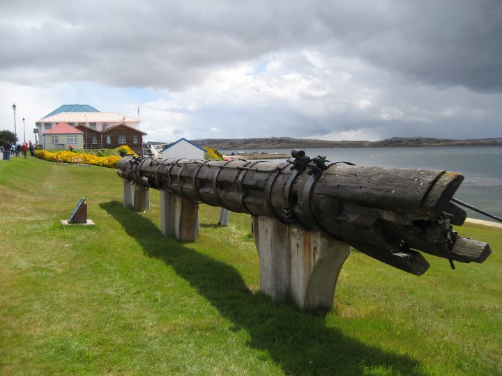
Prussia Cove is a prime example of what the Cornish coast is all about, and why so many visitors come. It hasn’t changed much in years, and was once the home of the notorious smuggling, Carter family. One of then was known as the King of Prussia, and there are pubs dotted around named ater him, most notably the one on the waterfront at Fowey. There is car parking and toilets at the top and acces to the cove is by a steepish track. Takes about five mins to walk down and although there is no lifeguard, there is some life saving equipiment, so get in and have a lovely swim. There also is another momento of the Warspite at the top in the shape of a wooded spar from the ship stuck upright on the top.

Prussia Cove today.

Prussia Cove today.
Prussia Cove with the Warspite.

Prussia Cove with the Warspite.

Marazion is a small place but extremely picturesque, mainly because of the looming presence of St. Michael’s Mount, just a few hundred yards offshore. The town has plenty of galleries and craft shops to poke about in, and you can catch the ferry to the island from near the Goldolphin Hotel when the tide is in. Otherwise you can walk across the tidal causeway to the island, which is always something of a thrill. The island is run by the National Trust and it is well worth a visit to get to see the castle at the top. Also, from here you will get a panoramic view of where the Warspite was finally cut up.

The superb view from the Goldolphin Hotel.

The superb view from the Goldolphin Hotel.

Another reminder of those days is a memorial stone to H.M.S. Warspite on the coast path near the end of the causeway on the mainland.

The memorial stone near the end of the causeway.

The memorial stone near the end of the causeway.

There are plenty of places to eat and drink in Marazion, but two of my favourites are the Goldolphin Hotel which besides serving Doombar beer (my favourite), and great meals, has a stunning view of St. Michael’s Mount.

The Kings Arms.

The Kings Arms.

Another great pub is the Kings Arms, right in the middle of the town. Again the pub serves tasty meals and has Proper Job and Tribute beer. Between the two establishments you will be able to sample the ‘Holy Trinity’ of Cornish beer. Enjoy.

Cyprus Shipwreck Trail

Within easy reach of Paphos are two shipwrecks. The first is on the road out towards Coral Bay at a hotel called the Capital Coast. You cant miss it, and there is plenty of room to park off road. At first sight you might think that it is just another ship anchored in the Bay. However, it is in fact stuck upright on a low reef, that just shows above the waves. The ship is called the Demetrios 11 and was a cargo ship, built in 1964 by J. J. Sietas, at their shipbuilding yard in Hamburg-Neuenfelde, Germany. The Honduran-flagged M/V Demetrios II ran aground off Paphos Lighthouse on 23 March 1998 in heavy seas, during a voyage from Greece to Syria with a cargo of timber.

The Demetrios,easily seen from many places on the road to Coral bay.

The Demetrios,easily seen from many places on the road to Coral bay.

At the time of the accident, the ship had eight crew members, 4 Greeks, 2 Pakistanis and 2 Syrians. The crew were rescued and airlifted to the safety of Paphos by a British Military Helicopter. In the investigation that followed it was found that the Greek Captain and the Pakistani First officer were operating with forged competency certificates. It was considered to expensive to drag the ship off the reef and so it has been left to break up, but astonishingly it has survived many storms and a small earthquake and is still stuck fast sixteen years later.(I saw it in 2014) The map starts at the Bus station, but anywhere along the front will do.

A plan was proposed to drag the wreck off the reef and sink it as an attraction for divers, but the authorities concluded that it was in too bad a state and might well disintegrate and end up on the beach. So there she sits waiting for her end.

Here you can see the reef she is stuck on.

Here you can see the reef she is stuck on.

Although she is some way offshore you can take good photos of her with any half decent camera, and if you are really keen for a close up, you can get a boat trip around her from Phaphos harbour. The second shipwreck, the Edro 111, is a few miles along the same road towards Peyia and the beautiful Sea Caves area. This wreck is right on the shore and at first glance from the road above, it looks as if it is at the bottom of someone’s garden, and it almost is.

The Edro 111, almost at the bottom of this Villa's garden.

The Edro 111, almost at the bottom of this Villa’s garden.

To get down to the shipwreck you have to get off the main road and go down Sea Caves Avenue. This unsurprisingly takes you past the Sea Caves hollowed out of the cliffs. The water here is gin clear and azure blue and I found the whole area very atmospheric. (again you can get a boat trip for a closer inspection) The road weaves its way down through fields of banana plantations, with villas dotted around, covered in brilliantly coloured bougainvillea, towards the shore where the Edro 111 lies hard up against the rocks. So how did she manage to fetch up there? The Edro 111, of 2517 tons, is eighty three meters long and was on a voyage from Limasol to Rhodes carrying a cargo of plasterboard. She left on 7 December 2011 in bad weather and soon the strong winds and heavy seas caused the vessel to drift off course. About ten miles from Paphos, she struck a rock and became disabled, drifting at the mercy of the storm until she finally went ashore near Peyia about 5 o clock on the morning of 8th December.

You can easily view this wreck from all angles.

You can easily view this wreck from all angles.

You can easily view this wreck from all angles.

You can easily view this wreck from all angles.

You can easily view this wreck from all angles.

A helicopter of the British Army stationed in Limassol, winched seven of the nine crew members of the ship up. They were brought ashore where they were given precautionary medical check-ups. The captain and the chief engineer remained on board. The crew comprised seven Albanians and two Egyptians. The Edro III was built in 1966 by Kaldnes Mekaniske Verksted at Tonsberg in Norway, and at the time of the accident was registered at Freetown in Sierra Leone. Although it is not clear how they will get the ship off the rocks (they don’t have our tide range) the plan is still to refloat and repair her.

The atmospheric Sea Caves.

The atmospheric Sea Caves.
The great beach at Agios Georgios.

The great beach at Agios Georgios.

By this time you will probably be ready for a drink and a swim, so I recommend that you get back on the main road and continue up to Agios Georgios a couple of miles away. This has a great monastery, a fabulous sandy beach, with beautiful clear water to swim in, with a small beach café. It also has free parking. Enjoy. If you zoom the bit of the map with the red mark, you can see the Edro111

Wreck of Romanie at Polridmouth Bay

Cornwall has so many wrecks that you can literally trip over them, and that’s just what I did with the wreck of the Romanie whilst I was on a walk out to the Daymark on Gribben head. I had often seen the Daymark from the sea as I pottered around Fowey in my boat, and so decided to struggle up to the top of Gribben Head to see it properly.

Gribben Head

Gribben Head

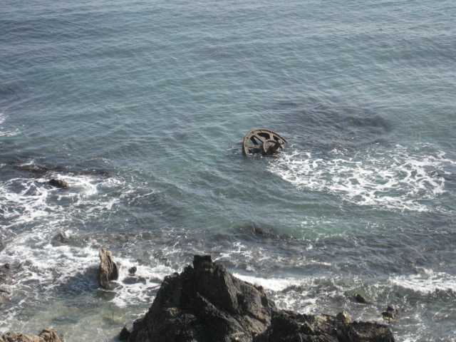
The walk of about two miles, started in the car park near Menabilly farm. This is provided by the farmer, and as you make your way along the footpath down to Polridmouth Bay, you come across his farm with a milk churn on the path for you to pay the 50p parking fee. The path is well signed and easy walking down to the bay, with lots of sheep and cows in the adjacent fields, and masses of primroses in the grassy walls lining the path. (I was there in the early spring) When I got to Polridmouth bay, locally pronounced Pridmouth, I saw that the path led off to the right for Gribben Head, so I wandered down to the beach to have a look around. Over to the right of the bay I saw some strangely shaped rocks, and when I looked at them through the tele-photo lens of my camera, I saw that they were not rocks at all, but the twisted metal of a shipwreck. I was delighted. A walk is all very well, but a shipwreck is far more interesting, especially one with an unusual connection.

Wreckage.

Wreckage.

This part of Cornwall is Du Maurier country, because Daphne du Maurier, the world famous author, lived here for many years, and used the county as a backdrop for most of her books. One of her most famous books is ‘Rebecca’ written in 1938. Years ago when Du Maurier had first visited Fowey, she had walked across to Pridmouth bay and seen a wrecked boat on the beach. Years later she made that beach the setting for Rebecca’s murder and the wreck of her boat.

Rebecca

Rebecca

So what was the boat, and how did it come to be wrecked on the beach?

Wreckage on the beach.

Wreckage on the beach.

The wreck was called the Romanie and she was a steel three masted sailing vessel with an auxillary engine. Built in 1918 in Holland, she was originally called the Ymuiden. She was just over a hundred feet long, and around 260 tons. On January 16th 1930 she was on a voyage from Fowey to Par in ballast. Caught out by a sudden storm, she lost power and was flung up on the rocks a Polridmouth bay. Her Captain, H.Tielemans and all of his crew managed to get off the boat and safely to shore. There was no point in trying to salvage her, so she was left to go to pieces.

Gribben Head

Gribben Head

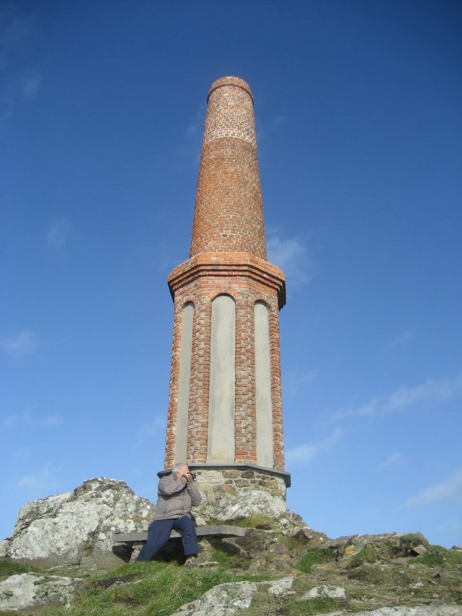
After the excitement of finding the wreck, it was time to wend my way up the path towards the Daymark on Gribben Head. It’s a bit of a climb, but the views out across the sea, especially towards the Dodman are spectacular and well worth the effort. The daymark is a sort of castelated Greco Gothic square tower which was erected in 1832, enabling seafarers to easily find the entrance to Fowey harbour.However it is not the first beacon to be on the site. Iron Age people and medieval farmers used it as a lookout point and in Elizabethan times Gribben Head was one of the chain of beacon sites, which in 1588, helped carry the news to London of the approaching Spanish Armarda.

Inscription

Inscription

Just north west of the daymark are the remains of an old signal station, one of many established along the south coast to bring warning of a possible French invasion. During daytime, signals were relayed with flags and balls, and at night they used lights and fires.

Old Signal Station.

Old Signal Station.

During the Second World War, Polridmouth bay was used as a decoy site with lights placed around a large ornamental lake to the left of the bay. The object of this was to lure ennemy bombers away from Falmouth Harbour, particularly during the build up to the D.Day landings, when over 2000 American troops were stationed in and around the town. The tower is painted every seven years, and on selected sundays you can climb to the top. Good luck to you. (see National Trust)

The Tower.

The Tower.

Once you are back at the car park you will be in need of a drink and something to eat, and you can get all that at nearby Polkerris. The Pub is called the Rashleigh Arms and serves excellent food andale, and some rather nice wine as well. You can have everything from pasty and chips to sea bass with blushed tomatoes, or a selection of sanwiches, so you are in for a treat.

The beach at Polkerris is great for kids with lots of sand and an ancient jetty studded with old cannons.

The beach at Polkerris is great for kids with lots of sand and an ancient jetty studded with old cannons.
Old Cannons.

Old Cannons.
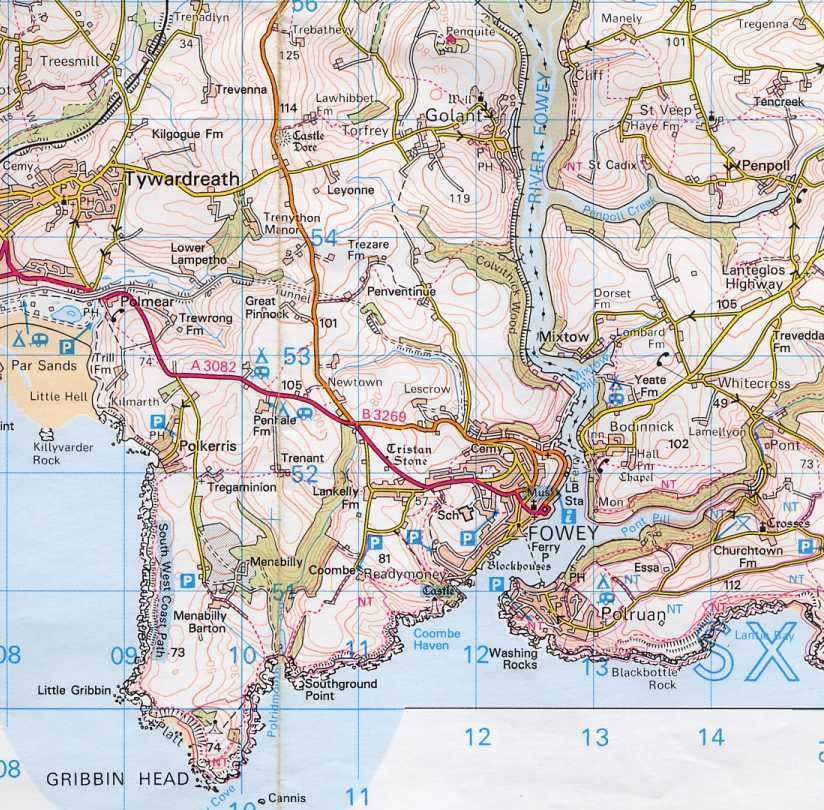
Map.

Map.

The Wreck of the Bellem at Northcot Mouth

The great cliffs north of Bude seem to attract shipwrecks, and in the old days the cliftops were dotted with iron stanchions and cables remaining from previous salvage work. The Bellem, a 1925 ton Potugese ship was originally launched in Flensburg, Germany, as the Rhodos for the Hamburg America line, but was seized by the Allies in Lisbon in 1916.

The wreck of the Bellem.

The wreck of the Bellem.

On 20th November 1917 she was on a voyage from Gibralter to Barry in ballast when she grounded in dense fog at Northcot Mouth, only a mile from Bude breakwater. By chance she had foundered close to where the London Collier Woodbridge had spent April 1915 high and dry before being floated off. The Bellem was not to be so lucky. 33 men, including two Royal Navy gunners,the Bellem was armed with a stern gun, were taken off by breeches buoy. The Bellem soon broke her back and was declared a total loss, being later broken up for scrap.

Bellem wreckage.

Bellem wreckage.

Another casualty was the trawler Scotia, which stranded in in a May fog in 1917, at near by Menachurch point, which the skipper had somehow mistaken for Rame head.

Woodbridge

Woodbridge
Scotia

Scotia

The Walk Today you can easily see the boiler and some plating of the Bellem, from the cliffs at low tide. If you want to get closer, you will have to climb over the pebble beach, across the rocks and down to the sand at spring low tides, and hike it around the point. I did not do this as the tide was coming in and I could see all I wanted from the cliff top. There is a handy seat right above the spot, so you can’t really miss it.

Looking south, seat on top of Menachurch Point.

Looking south, seat on top of Menachurch Point.

There is a set of steps going up the cliff to give easy access and the large pebble beach in that area is scattered with old triagular concrete tank traps. There are some wonderfull views along the cliffs, and you can easily see the large dishes of GCHQ to the north, busy hoovering up our emails and telephone messages, so mind what you say.

Path up to Menachurch Point.

Path up to Menachurch Point.

In the 1980’s some local people recovered the ships prop shaft and supposedly donated it to the Bude Museum. Others however,say that the shaft was used to suport the barrel on the rock at the end of the breakwater.

Old concrete tank trap.

Old concrete tank trap.

Northcot Mouth is well signed, and the car park is right near the beach, so you can see the cliff steps from its entrance.

The Wreck of the SV. Carl at Booby’s Bay

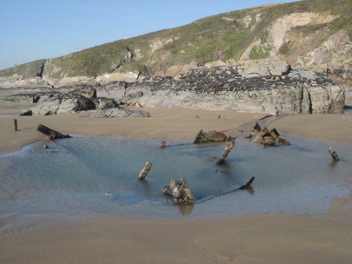
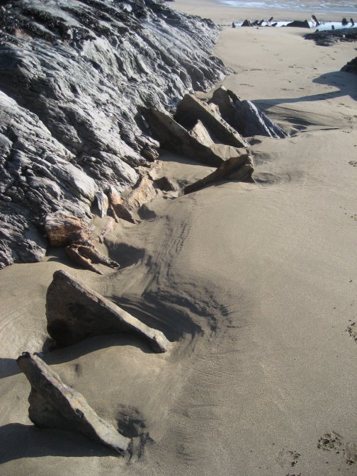
The violent storms that have lashed Britain’s coastline this winter have caused untold damage and misery. But for those of us that like old shipwrecks, there has been an unintended silver lining as a long forgotten shipwrecks has been exposed on the North Cornish coast, at Booby’s Bay, near Padstow.

The ill fated SV. Carl.Courtesy Daily Mail.

The ill fated SV. Carl.Courtesy Daily Mail.

Locals say, that in the recent storms, over a metre of sand has been washed off the beach, leaving exposed the metal ribs of the Sailing Vessel Carl, At the outbreak of the First War in 1914, the Sailing vessel Carl, launched in 1893 by Ribson & Co of Maryport, and registered in Hamburg, found herself in Cardiff docks where she was impounded after being surprised at sea and suspected of being an enemy minelayer.

You just trip over the wreckage.

You just trip over the wreckage.

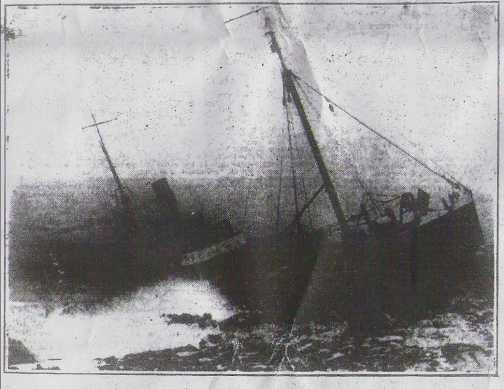
Three years later on October 7 1917, the Carl was being towed to London to be broken up for scrap, when she broke free in the storm. In a letter to the Padstow Echo in 1966, Lieutenant Commander Langford of the Royal Navy, recalled his mother’s eyewitness account of the Carl’s demise. ‘The Carl went aground on the outer reef,’ he wrote. ‘Two Admiralty tugs came from Devonport to try to refloat her. The tugs managed to pull the vessel off the reef but in doing so broke both of their towing hawsers. Completely out of control and pushed by the storm the Carl ended up on the inner reef which was only yards from the shore. She was examined by salvage experts who found no real damage, so the tugs had another go, and once more broke both their towing cables. The Carl however, broke her back in the rolling waves, and was declared a total loss.

It won't be long before it all disappears.

It won’t be long before it all disappears.

Everything of any use was stripped from the vessel, and she was left to rot on the beach, where over the years, she became buried under the sand. For 97 years she lay forgotten, until this years (2014) storms

The masts are steel.

The masts are steel.

The Walk. Well its not much of one because the car park is within half a mile of the beach, and you can park much closer if you drive down the road by the side of the golf course. When you get to the beach, you just clamber down a few rocks and trip over the wreckage. There is a lot of it, so you just can’t go wrong. On a sunny day the beach is fabulous, so if you have kids, take them along, because they will love the rock pools when they get fed up with the wreck.

Steel mast.

Steel mast.
The fabulous bay.

The fabulous bay.
The anchor.

The anchor.
You can still see the wood deck planks.

You can still see the wood deck planks.

Wreck of the Secil Japan at Hell’s Mouth

The Secil Japan was a cargo ship of 2625 gross tonnage, nearly 300ft long with a beam of about 50 ft. Built by Iami Seisakysho Kamijima, she was launched in 1982. On the 12th of March 1989, the Secil Japan was enroute from Aveiro to Liverpool when her steering collapsed of the North Cornish Coast. As darkness fell, battered by huge waves and 55knot winds, the Secil Japan was pushed ever closer to the Cornish cliffs and finally ended up wedged in the apropriately named Hell’s Mouth, between Portreath and Hayle.

The Secil Japan a few days after.

The Secil Japan a few days after.

Helicopters had already been scrambled from RNAS. Couldrose, and RAF. Brady in South Wales, with the Coastguard on the cliffs co-ordinating operations. Around midnight the rescue helicopters arrived over the wreck to be met by a fearsome sight in their brilliant searchlights. The huge waves were banging into the stricken ship and then bouncing off the cliffs creating 150 ft sheets of spray.

The bows of the Secil Japan.

The bows of the Secil Japan.

On board the ship the 16 Korean crewmen were frantic, and as the ship started to break up, they retreated to the bridge, huddling together for warmth and comfort. With one helicopter standing watch, the rescue helicoptor from RAF. Brawdy lowered a winchman, Flight Sergeant Dodsworth into the breaking waves. After being swamped several times and knocked off his feet, Dodsworth managed to make his way to the bridge where he coaxed the crewmen, one by one, into the winch strop. 15 men were lifted off safely, but one fell out of the strop and perished in the furious sea.

The wreck split apart.

The wreck split apart.

The crews of both aircraft were presented with the Edward and Masie Lewis award by the Shipwrecked Mariners Society for a most outstanding airsea rescue. Flight Sergeant Dodsworth also received the Air Force Medal for his outstanding bravery. The Walk. To get to Hell’s Mouth drive from either Hayle or Portreath on the B3301. You will find the spendidly named Hell’s Mouth Cafe situated about mid way between the two. You can’t miss it, and it has a carpark.

Part of the stern.

Part of the stern.

Just across the road you will find the South West Coastal Path. You can walk miles along this in any direction you want, seeing some very spectacular scenery. However the bit we want is just a few hundred yards away to the right of the carpark. Hell’s Mouth is stunning, and at low tide it is easy to see what is left of the Secil Japans wreckage. If you are lucky, you will also see some seals on the rocks below.

More wreckage.Photos by Dave Page

More wreckage.Photos by Dave Page
A seal. Photos by Dave Page

A seal.Photos by Dave Page

I hate to do a bit of ‘elf and safety, but these cliffs are terribly unstable, and whole chunks have slid into the sea in recent times, due to all the bad weather we have been having. The National Trust, who maintain the path, have roped quite a lot off, but provided diversions so that you can still see the wreck and the seals. If you don’t believe me, have a look at the video.

There is no pub nearby, you will have to go to Portreath, but the cafe is great, serving good food at reasonable prices. Give it a go.

Hell's Mouth cafe.

Hell’s Mouth cafe.
Map of the area.

Map of the area.

Titanic Museum-Belfast

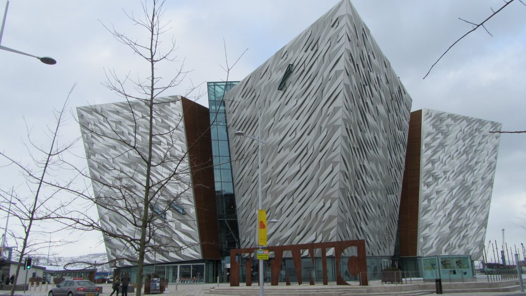
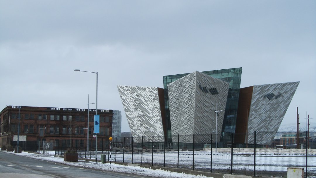
Museums to me are often or not dull affairs to which I am forced to go to find the information or artefact I require for my research. The Titanic museum in Belfast is a very great exception to that rule. After all this time, and after all the books and films, we should know all there is to know, or want to know, about the Titanic. But the Belfast Museum turns the whole thing on its head and tells the story of the ill-fated Titanic from the point of view of the people who built it, launched it, and then had to deal with the aftermath. The Museum is located in the Titanic Quarter of Belfast, where the old Harland and Woolfe shipyard was. It hasn’t all been developed yet, but you can still see the huge graving dock where Titanic was built, and the Pump rooms that filled it.

The Titanic Museum/

The Titanic Museum/
The Titanic Museum

The Titanic Museum

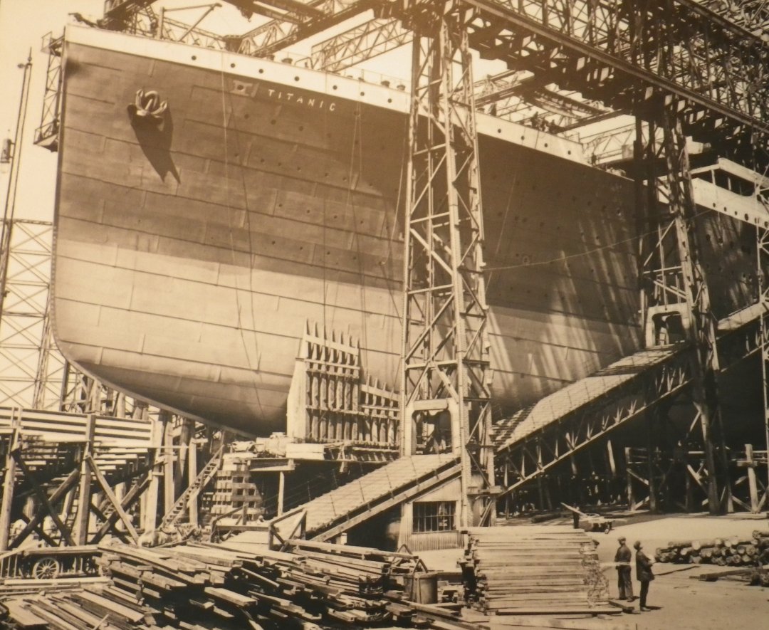
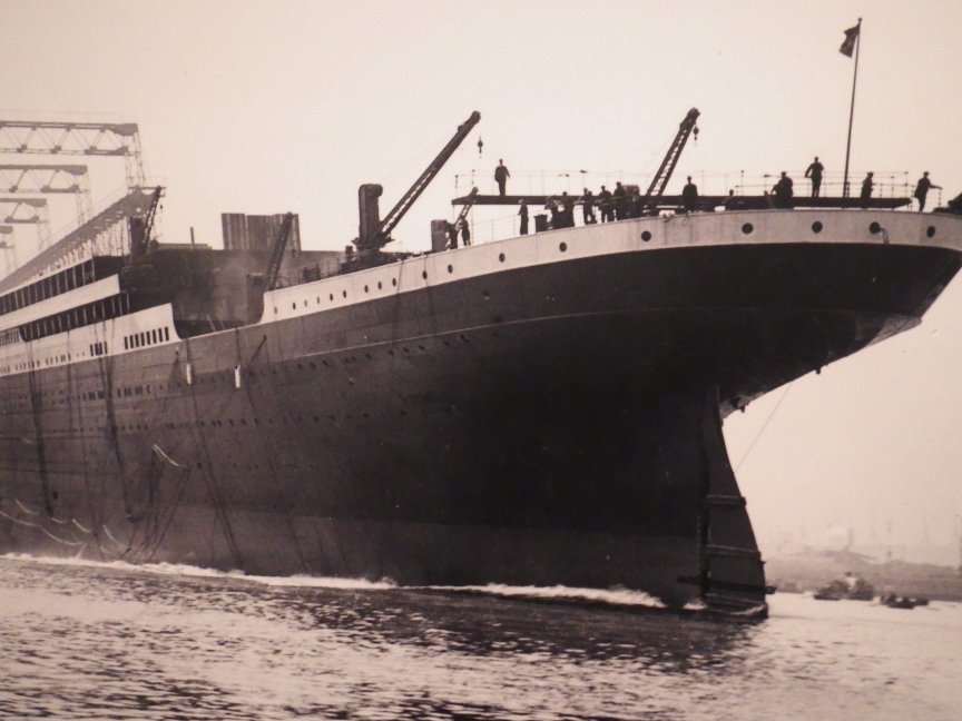
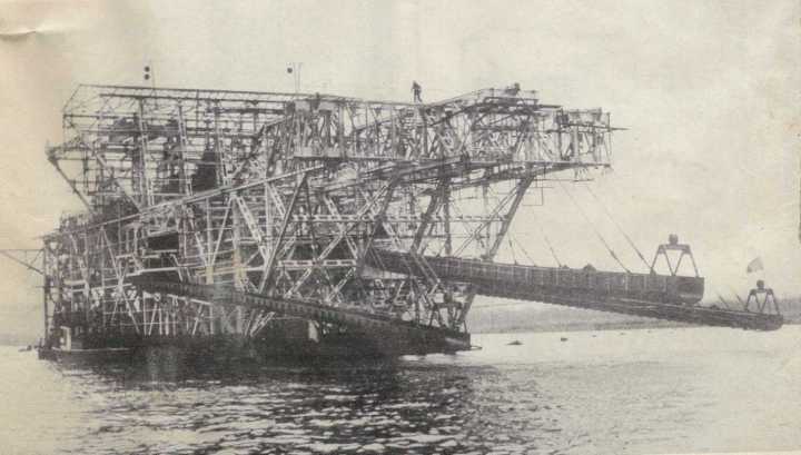
The building is absolutely stunning (no exaggeration) being shaped in the form of four bows of a ship representing the four ages of shipbuilding in Belfast – Wood, Iron, Steel and Aluminium. It also mirrors the massive Arrol Gantry where Olympic and Titanic were built side by side. The museum stands in the old dockyard right near the graving dock that was used to build her. When I visited, (2013) it was in the teeth of a howling snow blizzard, with the taxi driver making bad jokes about the whereabouts of icebergs.

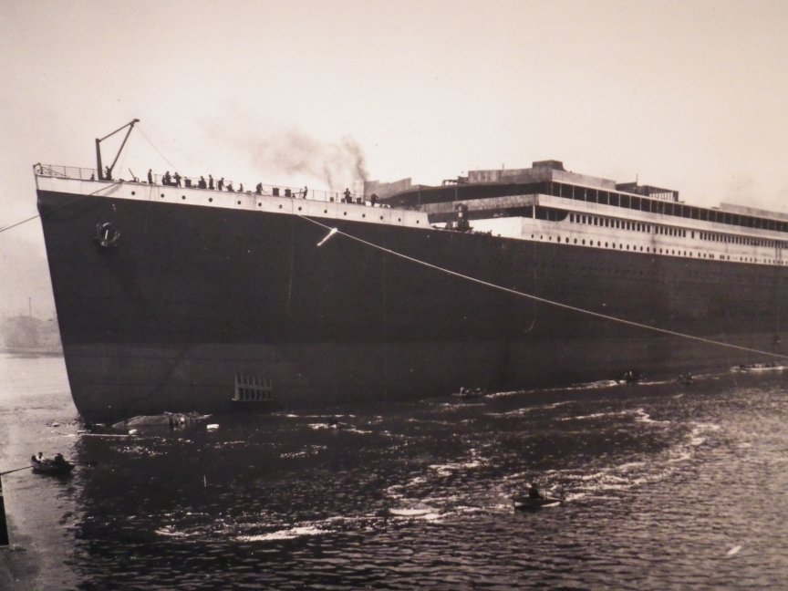
Titanic prior to launch.

Titanic prior to launch.

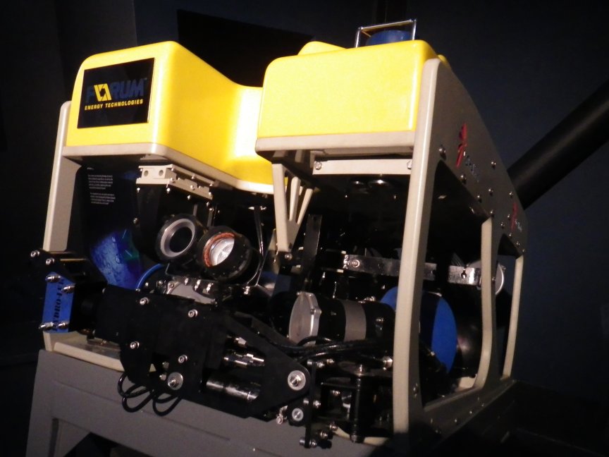
Inside the museum is on six floors with a cinema showing video from the sunken Titanic. This is not the usual material that we are all familiar with but new footage showing the ROV’s at work. Most poignant for me was the placing of several memorial plaques from relatives on the wreck. There is also one of the ROV’s in the cinema for you to have a look at.

One of the ROV's used to take film of the wreck.

One of the ROV’s used to take film of the wreck.

Instead of just having a lot of artifacts (although they have quite a few) the museum has instead used the latest in film and projection technology to bring alive the streets of Belfast where the dockyard workers lived, so as you walk along a gallery one of the walls becomes film and sound and guides you towards another part of the story. It is very well done and not at all intrusive to your enjoyment. It can be a bit spooky when animated characters start speaking to you. There is a vast amount of material, but you are faithfully guided around, almost by the exhibits themselves.

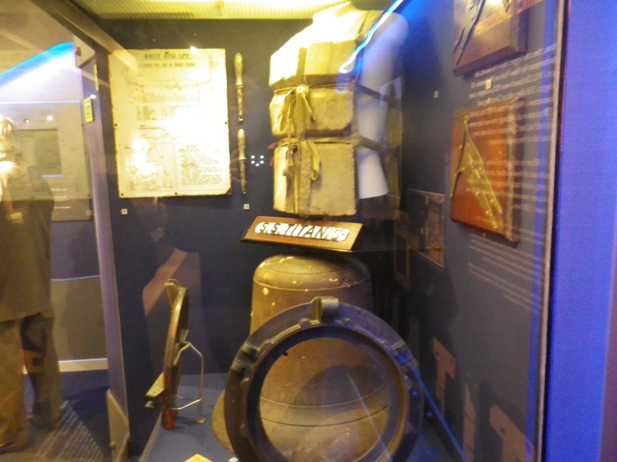
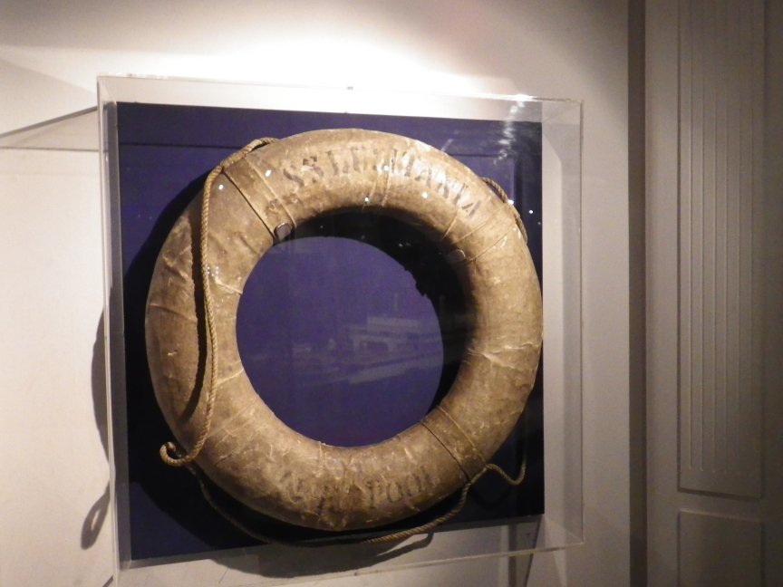
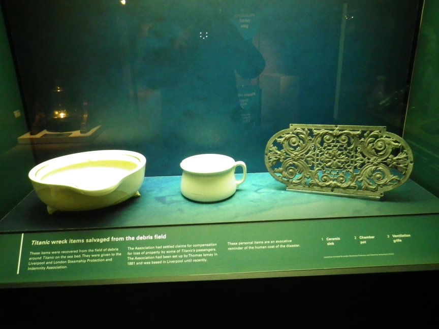
Some of the many artifacts in the museum.

Some of the many artifacts in the museum.

Some of the many artifacts in the museum.

Some of the many artifacts in the museum.

Some of the many artifacts in the museum.

One of the most imaginative galleries was no 5, The Maiden Voyage. Here you get to know the crew and passengers – hear about their dreams and learn about their lives on board Titanic as they set sail for America. A highlight for me was a representation of the Titanic thundering down the slipway, for her first taste of the element that was to destroy her. Amongst all the film and interaction was a bit of virtual reality that was inspired. You stand in front of a dark wall and suddenly you are in the engine room of the Titanic with all the engine room alive around you. Bit by bit you are transported up a cut section of the ship showing steerage, first class, public lounges and dining areas, up the Grand Staircase (so immortalised in the film) until finally you arrive on the bridge. It is a great piece of theatre and informative too. There are the usual coffee shops and eateries and a souvenir shop that sell a good range of items. If you buy one thing, buy the souvenir guide Titanic Belfast. It has some wonderful photos and is really informative.

Titanic launch

Titanic launch
Titanic launch

Titanic launch

I spent over three hours looking around and could have stayed a lot longer, it’s that good. For those of you who worry about the situation in Belfast, don’t. The people are extremely friendly, the pubs and resturants great, and apart from the odd flare up, away from the city centre, usually around the marching season, the city is as safe as any in mainland England.

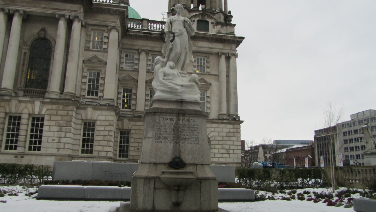
Titanic Memorial in Belfast City Center.

Titanic Memorial in Belfast City Center.

Morthoe Shipwrecks-Collier,Newtown,Priestfield and H.M.S.Weazel

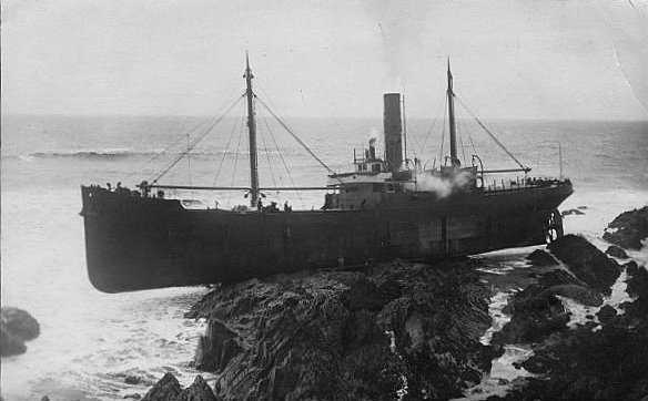
Mortehoe is a jewel of a village set almost on the coast of North Devon. Nearby is Morte Point, Baggy Point and Rockham Bay. All of them have seen shipwrecks and storms so the beauty of the area is deceiving. However there is no denying its beauty and a short walk to Rockham Bay( about 20 mins ) will allow you to sample it to the full, as well as the chance to examine the wreckage of the S.S. Collier wrecked here in January 28th 1914.

The SS Collier

The SS Collier
The SS Collier

The SS Collier

The path to Rockham Bay is well signposted from the village and wends its way down through part of the village to the top of the cliffs. You can easily see where the path branches to the left to go to Morte Point, but we go right through a gate, and down a half path and half steps towards the Bay. At the top of the Bay, there are some concrete steps and a very steep wooden set of steps that get you down to the beach. It is very easy going down, but a killer coming back as the treads are quite high. From the top of the cliff you can easily see the boiler of the wreck so that will help you go in the right direction when you get down onto the sand and head out over the rocks towards it.

Watch the steep ladder.

Watch the steep ladder.
The boiler.

The boiler.

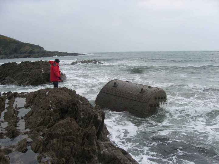
The S.S. Collier was on her way from Milford to Avonmouth, when she ran aground in Rockham Bay. The Coastguards were alerted about half past two in the morning and dispatched the lfracombe lifeboat. By the time it turned up, the seven crew, the ships dog,cat,and a goldfinch in a cage, had managed to get into the ships dingy. The lifeboat found them off Bull Point and managed to transfer all of them to safety. Efforts were made to get the vessel off the rocks but to no avail, and she soon went to pieces where you can see her today. Interestingly, she was one of the first steamers to carry Mail to Australia.

SS Collier wreckage. Boilers,engine block and an iron propeller.

SS Collier wreckage. Boilers,engine block and an iron propeller.

SS Collier wreckage. Boilers,engine block and an iron propeller.

SS Collier wreckage. Boilers,engine block and an iron propeller.

When you have finished rooting around the wreck and staggered back up the ladder to the top of the cliff you can either go back to Mortehoe or take the path towards Morte Point. It is a beautiful walk and the Point is now the haunt of seals. You can get a tripper boat from Ilfracombe to go out and see them. It was also here that the S.S. Priestfield went aground on Slipper Rock in May 1912 just south of the Point.

The S.S.Priestfield.

The S.S.Priestfield.

Extract from Coastguards Log May 8th 1912 S.S.Priestfield of Newcastle from Antwerp, bound to Barry in Wales for orders. Stuck on Slipper Rock (south of Morte Point) and remained. Her keel being visible from the shore broadside on. The watchman heard unusual sounds at 12-10 a.m. The watchman J.Parkerson and Samuel Yeo climbed round the rocks and found the position of the Steamer. Returned and called Rocket Brigade. I notified the coastguard at Ilfracombe at 12-5. Started with waggon at 1 a.m arriving at the ship 1-15a.m. Weather very thick fog and rain. Asked if they required a line, they answered ‘not yet’. We stood by her until noon. Returned at 12-15 noon. A small tug (the Devonia) tried to tow her off. The steamer used her own propellers at the same time. She was unsuccessful. At 9-30 p.m resumed towing by four large tugs that had arrived from Cardiff and got her off at 11-5 p.m. The chief mates wife left the ship and came ashore over the rocks.

Path to Morte Point

Path to Morte Point
Path to Rockham Bay

Path to Rockham Bay

If you want to carry on walking past Morte Point, you can continue on the Coastal path towards Woolacombe Bay, passing Barracane Beach where the S.S.Newtown went aground on 7th January1915. She was almost a brand new boat based in South Wales, and was homeward bound from Spain with a cargo of pit props. Although she was hard aground there was great hope that she could be refloated. However, a couple of weeks later, a strong westerly gale drove the Newtown ninety feet further up the rocks, and there she lay until she was purchased by the Cornish Salvage Company. They were unsuccessful in their efforts to refloat the vessel, so they broke her up where she lay You would think that there would be something left of her, but I could find no trace.
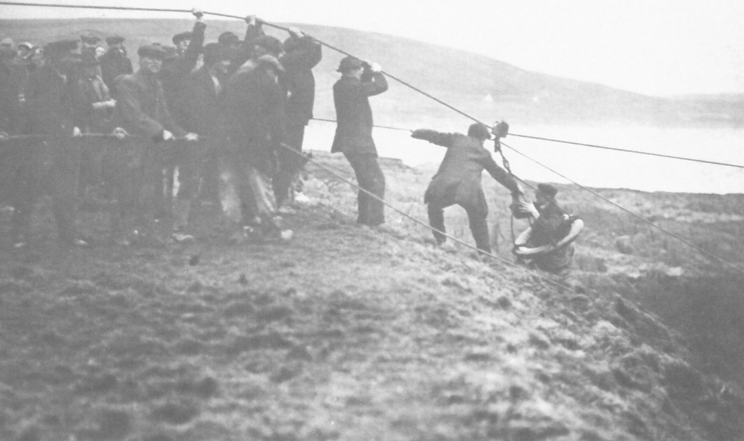
The S.S.Newtown.

The S.S.Newtown.
Rescuing the crew.

Rescuing the crew.

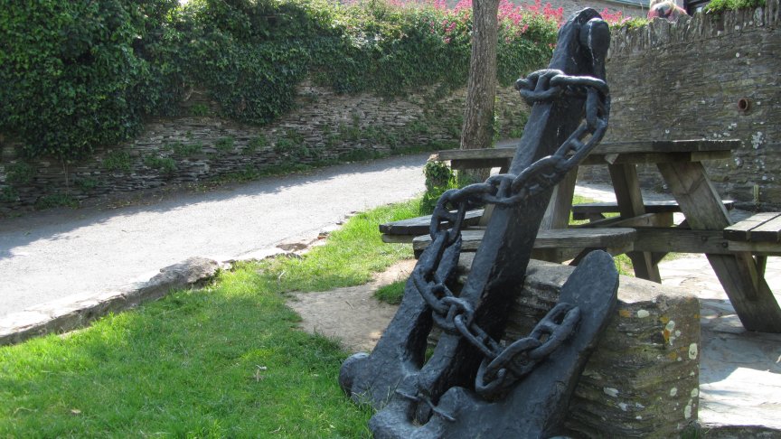
When you finally get back to Mortehoe you will find three pubs to choose from, all very nice. I went to the Ship Aground ( well I would ) which has a good range of beer and food. Outside is the anchor from the S.S.Collier, which was raised by the Sub Aqua branch of R.A.F.Chivenor and presented to the village.

The Ship Aground Pub.

The Ship Aground Pub.
Collier's anchors.

Collier’s anchors.

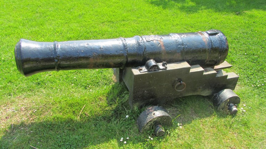
As you go back to the car park there is one more echo of a wreck. Next to the car park is the local museum, and in its garden is a cannon from the wreck of H.M.S.Weazel, lost at Baggy Point in February 1799.

The cannon was raised by a group of local divers in 1968.

The cannon was raised by a group of local divers in 1968.

H.M.S.Weazel was a 14 gun sloop o’ war which was caught out in a ferocious north-north westerly gale. She tried to claw off the coast and sent up repeated distress signals. It was all to no avail, and she broke up completely near Baggy Point taking all 106 of her crew to the bottom with her.

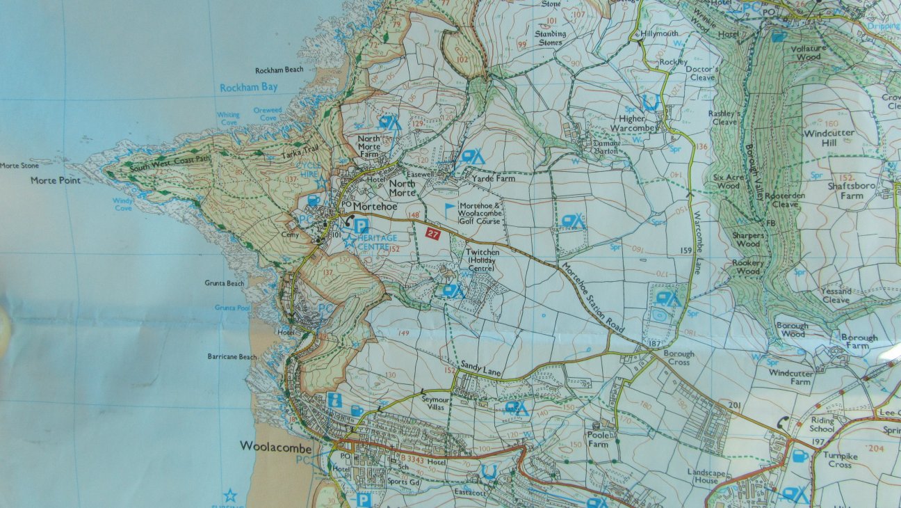
Map showing Morte Point, Rockham Bay and Barracane Beach.

Map showing Morte Point, Rockham Bay and Barracane Beach.
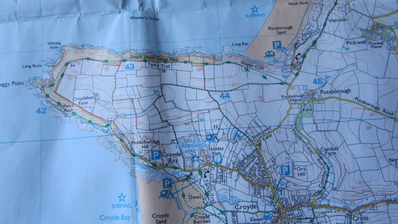
Map showing Baggy Point.

Map showing Baggy Point.

The Wreck of the Athina B

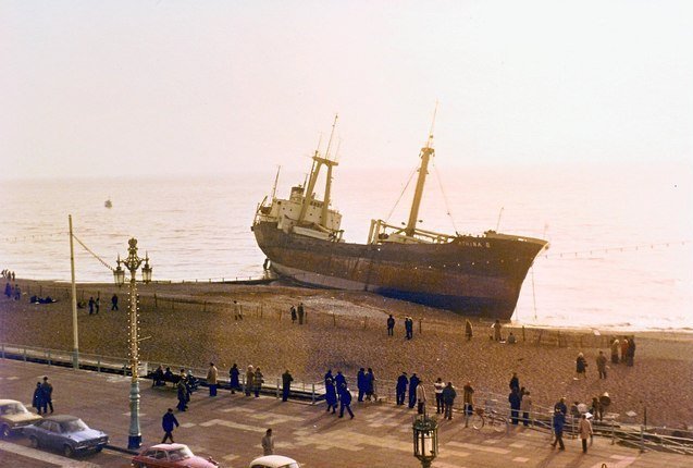
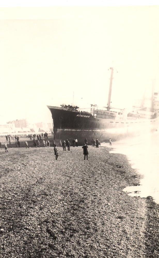
I lived in Brighton until I was about 24, and in all those years we never had a shipwreck, in spite of seeing loads of ships sailing back and forth on the horizon. There once was a dead whale washed up near the West Pier (now burned down) which drove the café owners wild with anger at the stink of its rotting carcase, and there was a horrible large sort of squid which washed ashore one evening and washed away by the next dawn, but never a shipwreck. All that changed on 21st January 1980 when the cargo ship Athena B ended up hard aground on the beach near the Aquarium to the east of the Palace Pier, now called the Brighton Pier.

Photo courtesy Clive Warneford.

Photo courtesy Clive Warneford.

Originally built as the Kojima Maru at Hiroshima in 1968, she was renamed several times until ending up in Greek ownership and being renamed the Athena B. On her last trip she left the Azores on December 11th 1979 loaded with 3000 tonnes of pumice stone bound for Shoreham by Sea. During the voyage she had problems with her radar compass and generator and put in to La Rochelle for repairs. As the Athena B left France the weather worsened and when she arrived off Shoreham on the afternoon of the 20th January the winds were gusting Force eight and she couldn’t get into the harbour which has a fairly narrow entrance. While the ship hovered outside the harbour her engines lost power and she started to drift towards Brighton. Luckily the Shoreham Lifeboat was close at hand and she managed to take off half of the crew including the Captains family. The rest of the crew had to wait till the morning of the 21st January when the lifeboat after four attempts managed to get all the crew to safety. It was a very difficult rescue and the Cox’n, Ken Voice was the awarded the RNLI’s Silver Medal.

Athina B being unloaded.

Athina B being unloaded.

Athina B being unloaded.

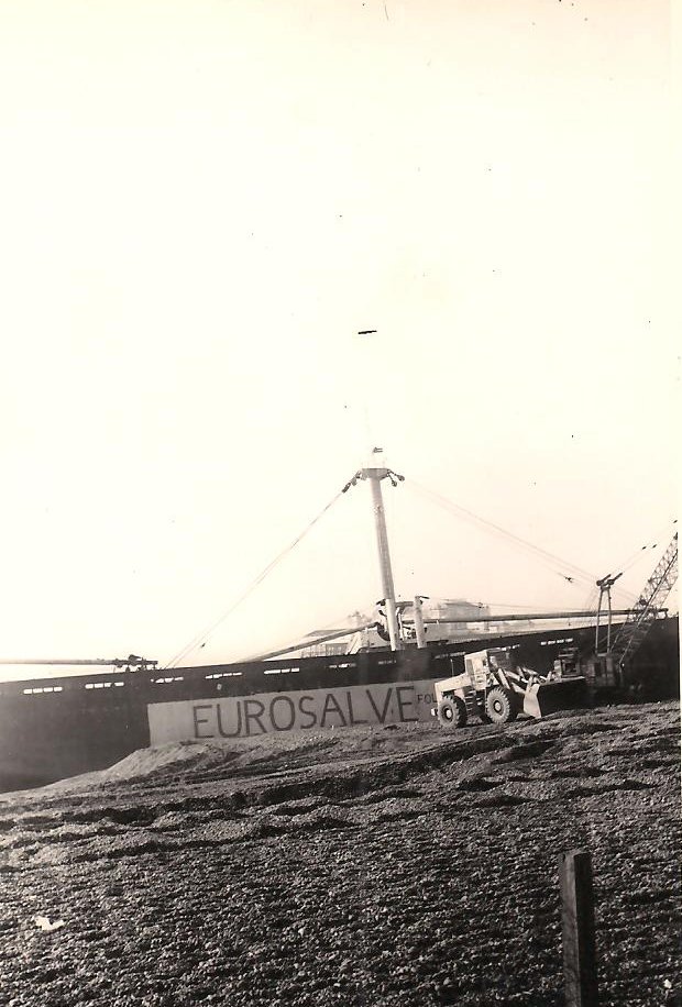
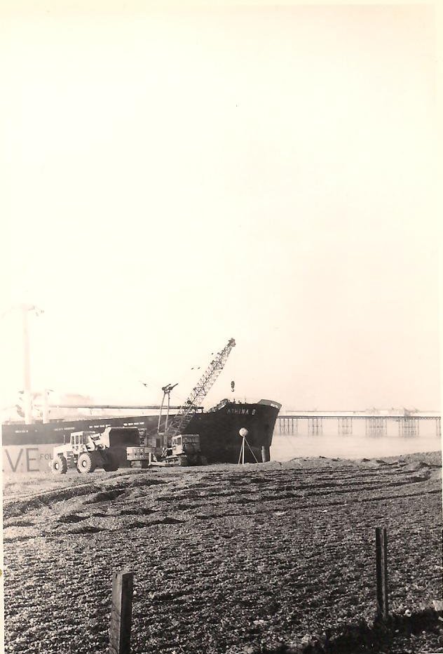
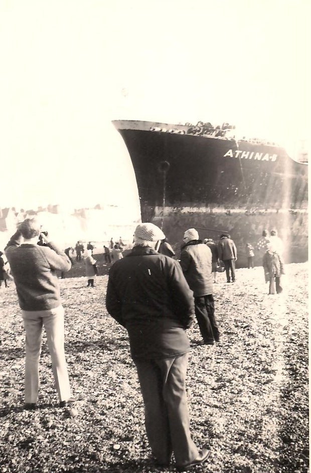
After all the crew had been taken off the ship the Athena B continued to drift in the gale force winds and ended up beached on the shore, where she broke her back, and was declared a complete write off. Very soon the salvors, engaged a mobile crane and started to off load her cargo of pumice stone. The job took about a month and in that time the shipwreck became a very popular tourist attraction with thousands turning up to see her, so much so that she had to have a Police guard to prevent souvenir hunters stripping the wreck of anything that was not screwed down.

Mind the waves.

Mind the waves.
Mind the waves.

Mind the waves.

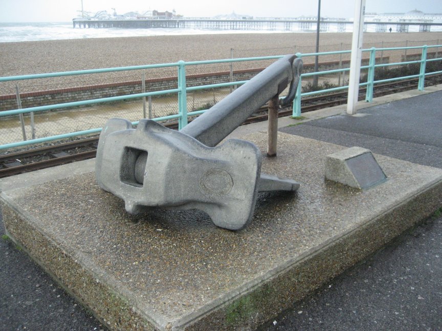
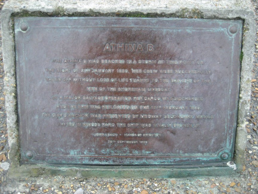
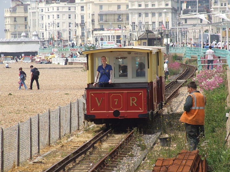
Stalls were set up along Madeira Drive as the traders cashed in on the wreck and Volk’s Railway, the oldest operating electric railway in the world opened up especially during that winters month to give the tourists something else to do. On the 21st February 1980 all the excitement came to an end as the Athina B was floated off the beach and towed to Rainham to be scrapped. All that is left of her now is one of her anchors mounted on a stone plinth by the seafront.

The anchor.

The anchor.
Comemmorative plaque.

Comemmorative plaque.

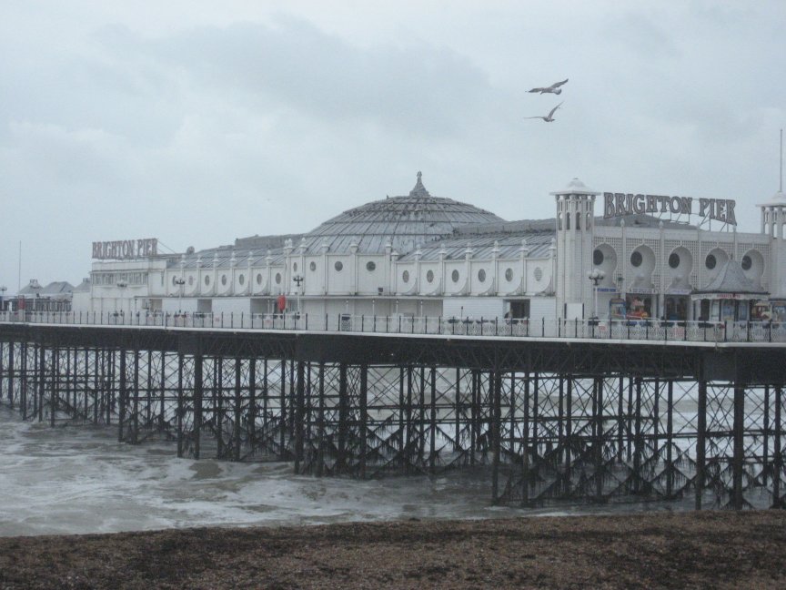
A walk along the seafront of Brighton is always a pleasure. If you start at the Ruins of the old West pier and walk towards Brighton Pier there are plenty of little pubs , restaurants and coffee shops whist on the upper walk you can still see many original buildings that have not changed much since Victorian times. The Grand Hotel that was wrecked by an IRA bomb back in the 1980 has been so carefully restored that only locals can see the join. A stroll on the Pier (free) allows you to see the full impact of the seafront and nearby is the famous Aquarium. Just to the east, on the pavement alongside the seafront, you will find the Athina B’s anchor and the entrance to Volk’s Railway, which will take you east along the seafront to Black Rock near the Brighton Marina where you will find plenty of shops restaurants, pubs and of course boats.I can think of worst ways of passing a day.

The Brighton Pier.

The Brighton Pier.
The Brighton Pier.

The Brighton Pier.
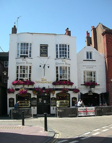
The Cricketers Pub

The Cricketers Pub

I always like to recommend a pub on these walks because usually they are out of the way places. But Brighton has literally hundreds of pubs to suit every taste. However since you will probably end up near the famous Lanes, you would be well advised to have a drink at the Cricketers Arms. It’s a real Victorian Pub immortalized by Graham Greene in his book Brighton Rock, and apart from the beer (much better) it hasn’t changed much in years. There has been a pub on the premises since 1547, and one of their most famous customers was Jack the Ripper and in The Greene Room bar, (upstairs), you can spend some time following the story of his origins and how he planned his murders from this very spot. The Cricketer’s has a unique charm of its own and is a relief from some of the more fashionable ‘chain pubs’
View Larger Map If you enlarge the map you will see the seafront with Volks railway marked.

The Wreck of the Suevic

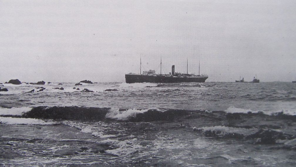
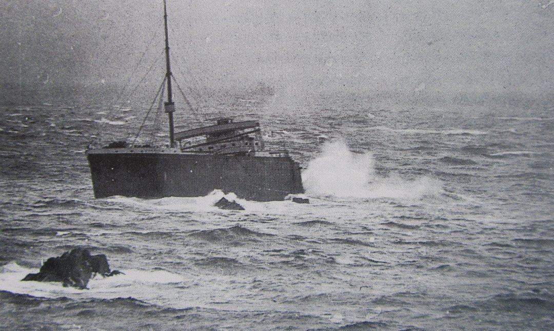
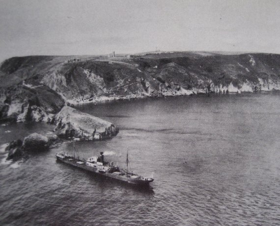
Many ships have fallen foul of the Lizard with its dense fog and treacherous seas, and in 1907 the White Star liner Suevic joined that infamous club when it was wrecked on rocks just yards from the Lizard lifeboat station. The wrecking was notable for setting the record for the greatest number of lives saved since the RNLI was founded in 1824, a record that still stands.

The Suevic held on the rocks.

The Suevic held on the rocks.

The Suevic was a vessel of 12,500 tons outward bound from Australia to Liverpool with a total complement of 456 passengers and crew and carrying a cargo that included frozen meat, butter, and copper bars. After calling in at Plymouth she set off on her last leg to Liverpool, but as the Suevic approached the Cornish coast dense fog surrounded the Lizard and unknown to her captain an error of navigation had placed the ship much closer to the shore than she should have been, and to cap it all the Liner was stemming at almost full speed, far too fast for the conditions. On the night of March 17th all these factors came into play and the Suevic ran full tilt into the Maenheere rocks just a few hundred yards from the Lizard lifeboat station. Her bows wedged firm between the jagged rocks which punched holes in her hull ensuring that the whole ship was stuck firmly on the rocks.

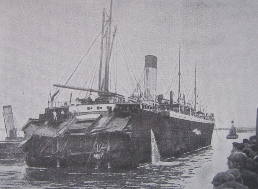
The Suevic is blown into two halves.

The Suevic is blown into two halves.

Tugs and four lifeboats arrive quickly on the scene but the dense fog and the maze of rocks and sunken ledges between the ship and the shore made the rescue extremely difficult. One lifeboat crashed into the Liner in the fog before the cox’n saw it but luckily no harm was done.

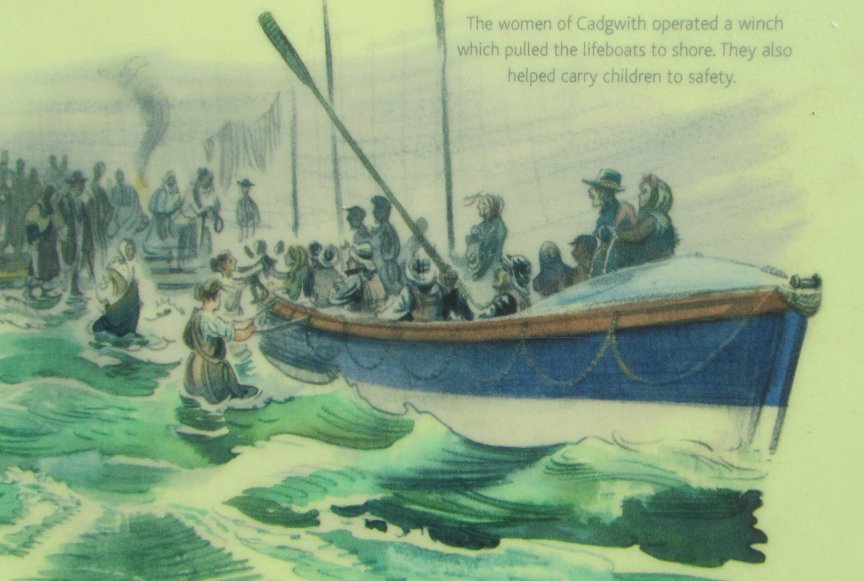
The Cadgwith Lifeboat.

The Cadgwith Lifeboat.

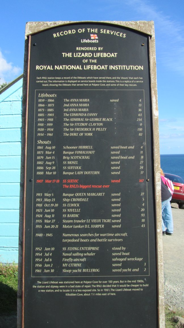
All the passengers and crew were rescued due to the magnificent efforts of the four local lifeboats. Of these the Cadgwith boat brought in 227 survivours, the Liizard boat 167, the Coverack boat 44 and Porthleven 18. Of the 456 survivors 160 were women and children.

The Bow is left to sink.

The Bow is left to sink.
The Stern is towed away.

The Stern is towed away.

Two days after the stranding every available lighter and coaster in the West Country was assembled to offload all the cargo and passenger belongings in a race against worsening weather. Divers were sent down to inspect the hull and because the forepart was so damaged they used explosives to shear off the bows from the relatively undamaged remainder of the ship which then floated free. Since this part of the ship contained all the machinery , boilers and passenger accommodation it was decided to tow it to Southampton. The owners, The White Star Line, they of Titanic fame, had a new bows built in Belfast , towed around to Southampton where it was grafted onto the old part of the ship. Thus the Suevic was reborn to sail another day. During the First World War she served as a troop ship, then in 1929 was sold to a Norwegian whaling company and renamed Skyttern. She survivd as a whale factory ship until 1942, when during the Second World War her crew scuttled her in the Skagerrack to prevent her falling into German hands.

The Lizard Lifeboat station with survivors fron the Suevic

The Lizard Lifeboat station with survivors fron the Suevic
R.N.L.I. plaque commemorating the event.

R.N.L.I. plaque commemorating the event.

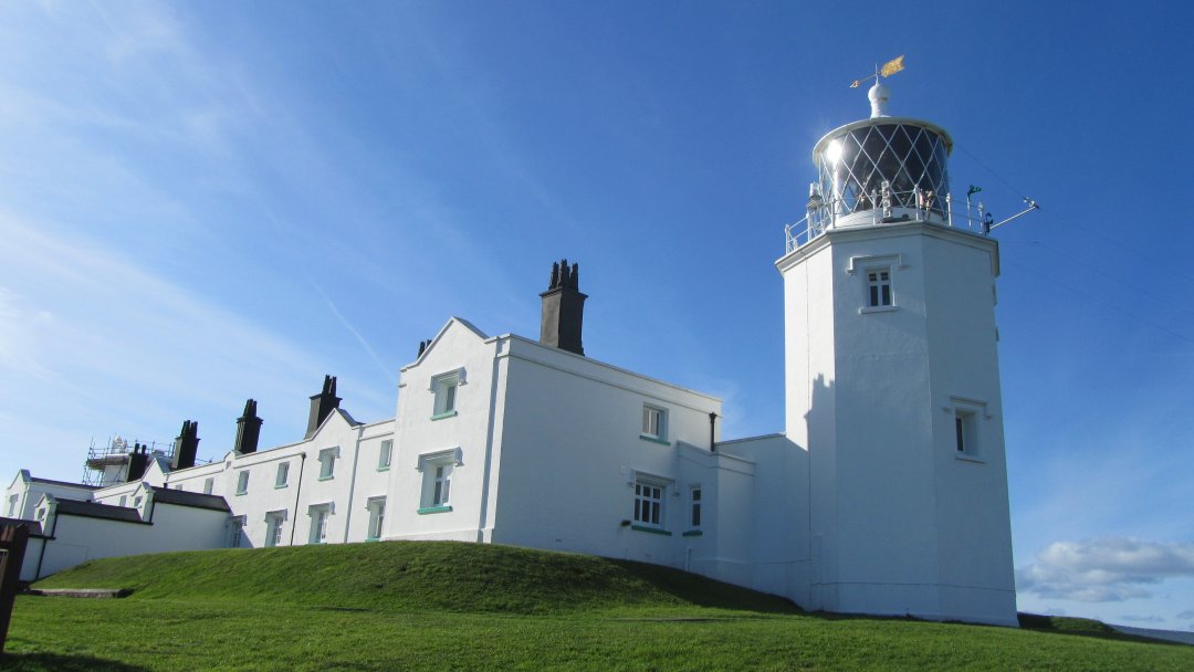
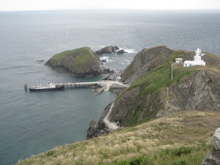
You can still get down to the old lifeboat station on the Lizard and it is easy to see the rocks where the Suevic was stranded. The RNLI have placed a board on the path near the café’s illustrating the story. While you are drinking in the wild beauty of this the most southerly headland in Britain take the opportunity to walk up the coast path to the Lizard lighthouse. (you can drive there as well, it has a large car park) The light house was established in 1619 by a philanthropic Cornishman, Sir James Killegrew. The lighthouse is 19 metres high, but stands 70 metres above sea level making it one of the highest in the country and its light can be seen for 26 nautical miles.

Lizard Light

The Lifeboat station today.

The Lifeboat station today.
The Lizard Light

The Lizard Light

The whole site had been recently refurbished with lottery money and has a small but interesting museum, a shop and of course you can also do conducted tours of the lighthouse which is great because you get to stand right at the top with the light going around revolving on its bed of mercury. The views are breath taking and the whole area is still relatively unspoilt. The cafes further down are very nice and not too expensive. For the more hardy among you let me recommend the walk across the cliffs to Kynance. The scenery is magnificent, and you feel that you are in a separate country all off its own. Well that’s Cornwall for you.
<

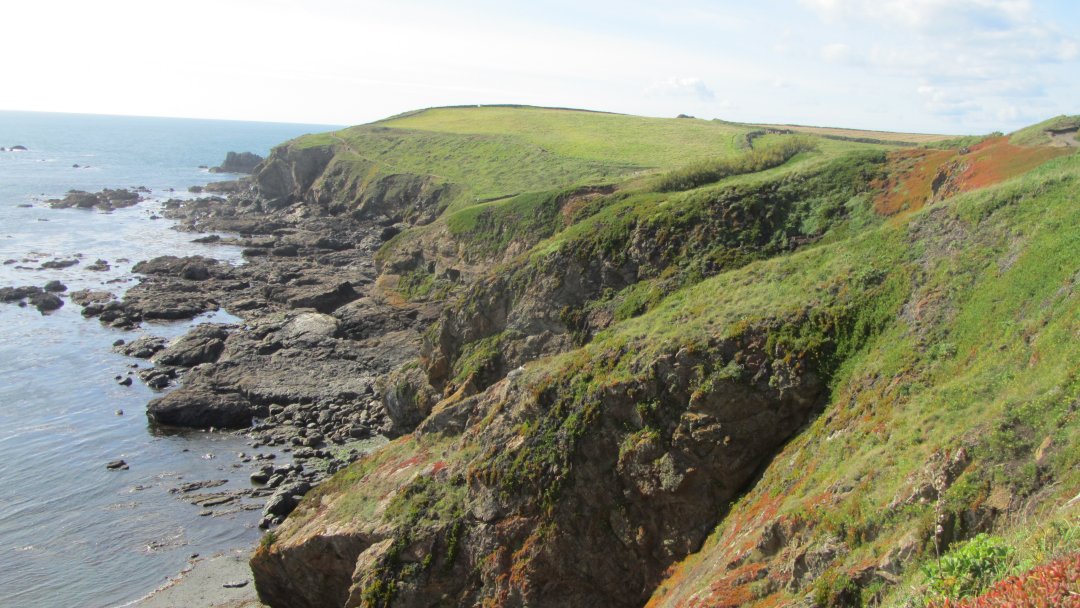
The fantastic view across the cliffs towards Kynance.

The fantastic view across the cliffs towards Kynance.

View Larger Map

Simon the cat

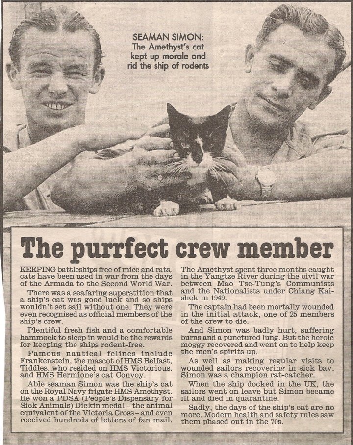
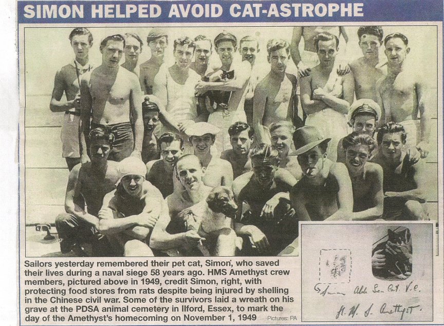
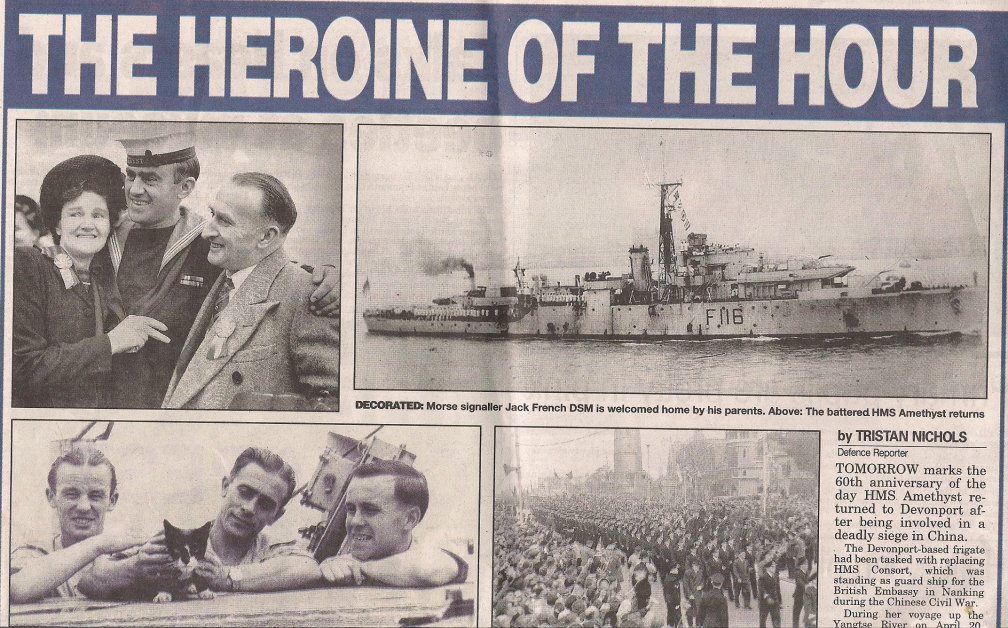
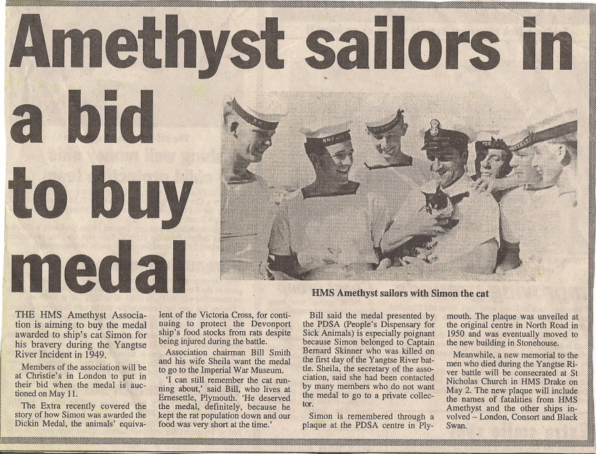
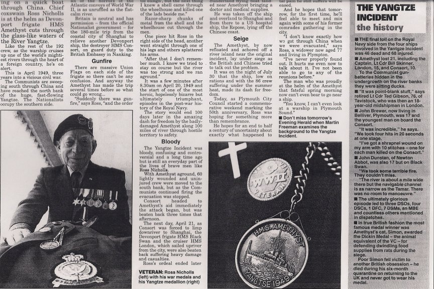
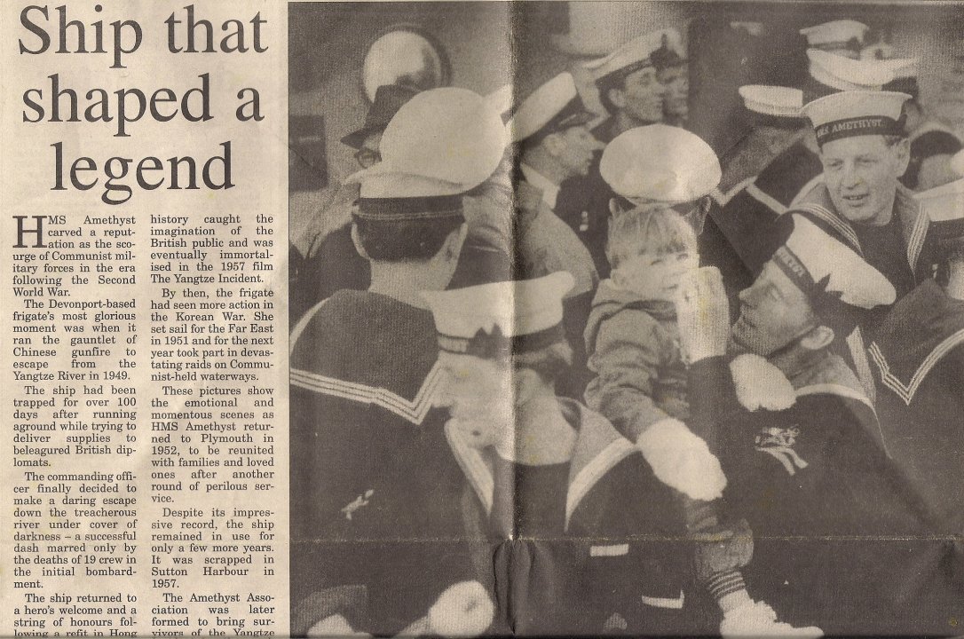
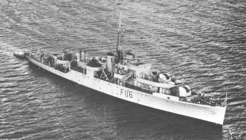
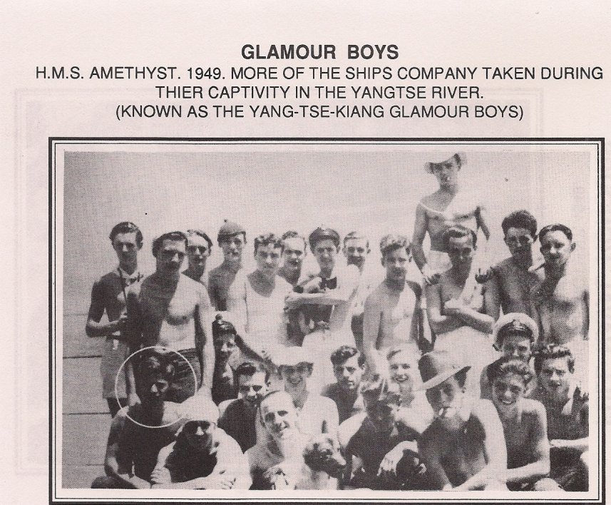
Simon was the ships cat on H.M.S. Amethyst.For his outstanding behaviour in keeping morale up, and the rats down, during Amethysts troubles, even though he was wounded by shellfire, he was awarded the Dickinson medal. This is the equivilent of the animal V.C. and was the first time it had been awarded to a cat.

News Stories

News Stories

When the ship returned to England Simon became world famous with bags of fan mail delivered daily. Unfortunately Simon had to be placed into quarentine far away from all his sailor friends.He didn’t last long there and soon died. Whether it was the loss of his friends, or more probably his age which caused him to die, we will never know. He was buried with his own gravestone in a pet cemetary in Essex.

News Stories

News Stories
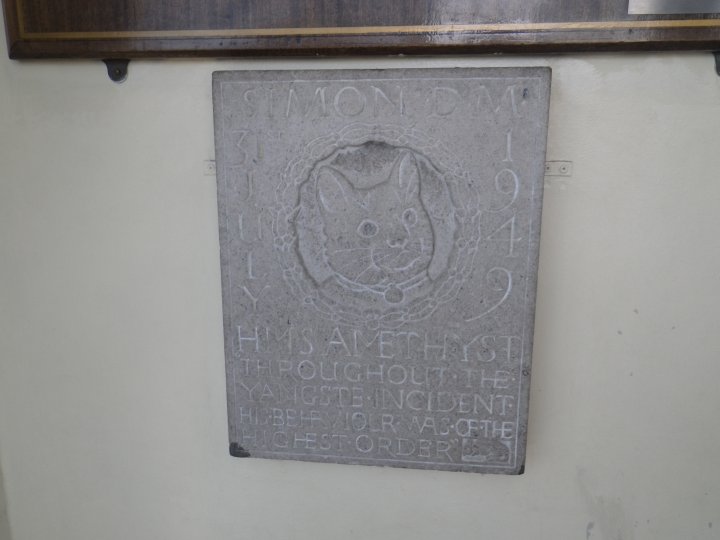
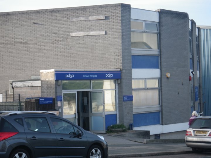
There is a memorial plaque to Simon, at the P.D.S.A surgery in Durnford Street, Plymouth.

There is a memorial plaque to Simon, at the P.D.S.A surgery in Durnford Street, Plymouth.

There is a memorial plaque to Simon, at the P.D.S.A surgery in Durnford Street, Plymouth.

Amethyst News Paper articles

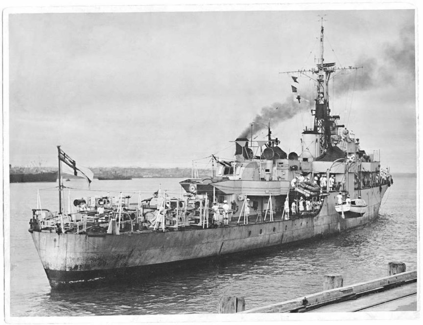
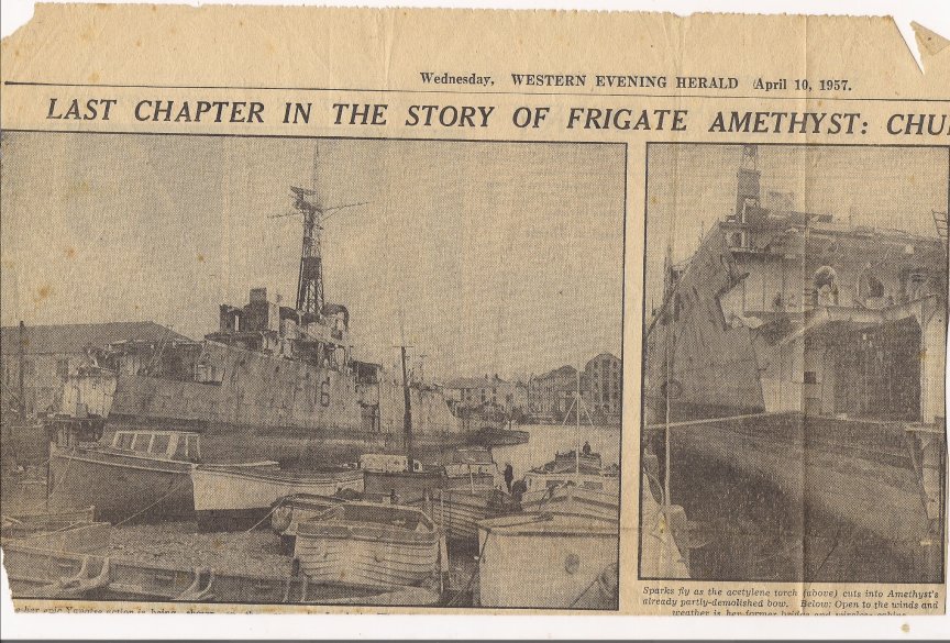
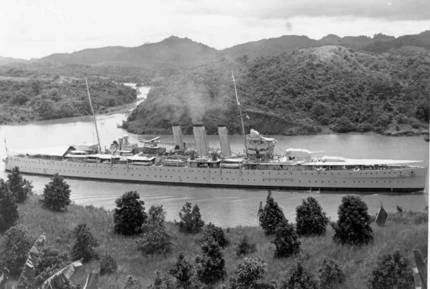
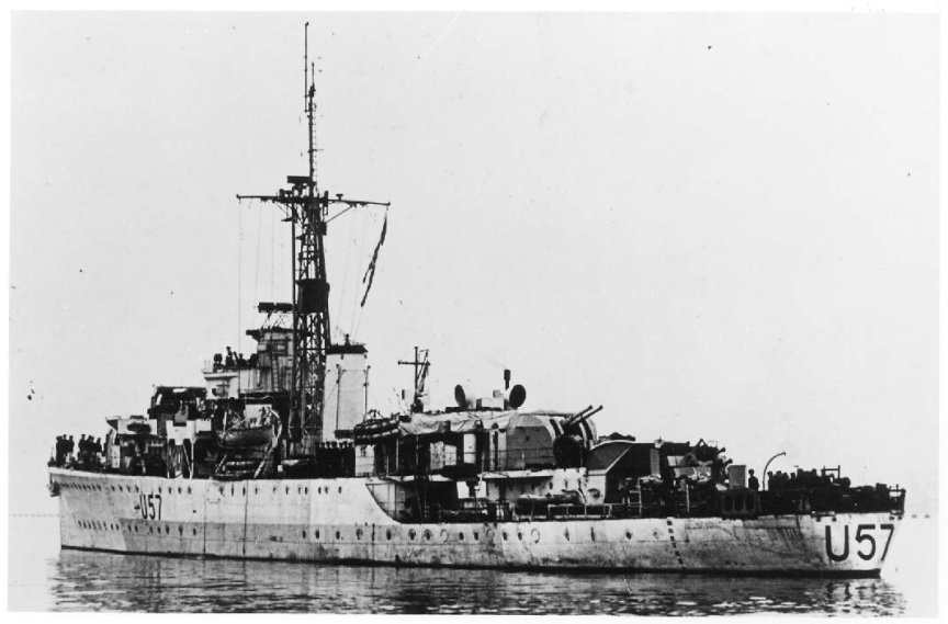
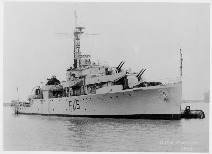
'Amethyst'before all the troubles started

‘Amethyst’before all the troubles started

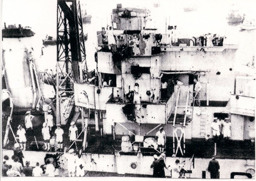
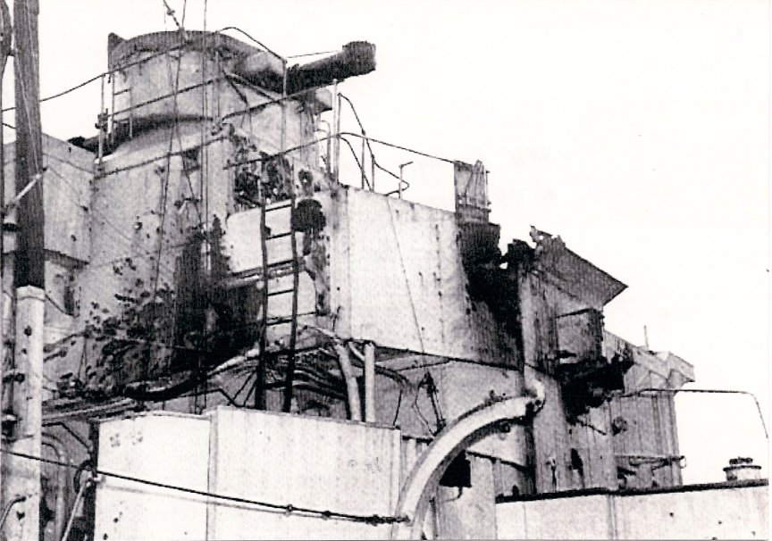
The whole Amethyst affair became a huge news story all over the world. Here are a few of those stories.

News Stories

News Stories
News Stories

News Stories
News Stories

News Stories
News Stories

News Stories
News Stories

News Stories
News Stories

News Stories
News Stories

News Stories

Boy Seaman, Sidney Horton’s Story

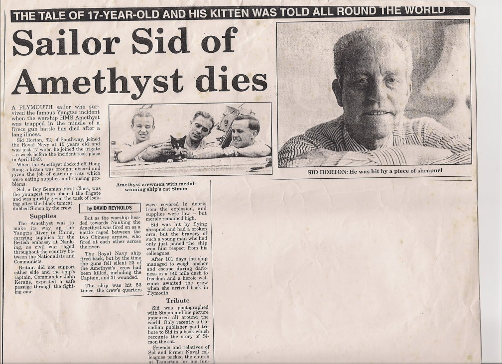
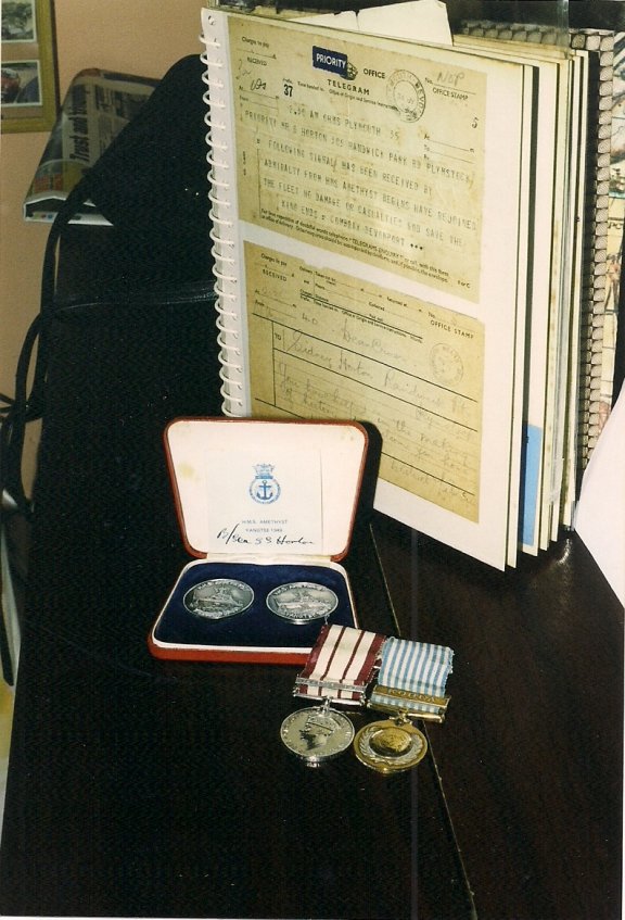
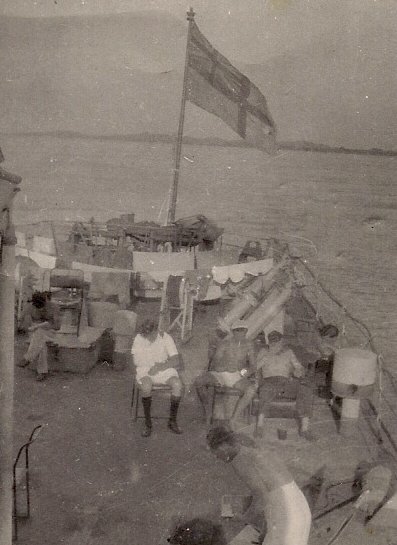
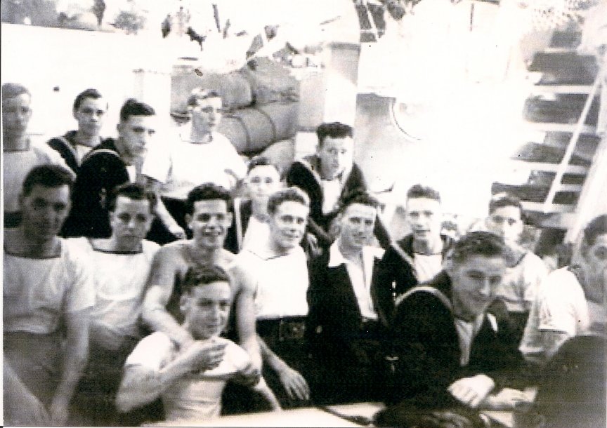
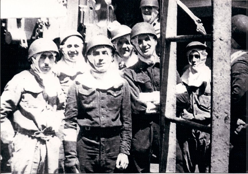
I am extremely grateful to Mrs Marlene Horton for allowing me to post her son’s letter, and for lending me the photos and video footage below Sydney Horton joined the Royal Navy on 15th July 1947 as a Boy Seaman. He did his basic training at H.M.S.Ganges (alas no more) and joined H.M.S.Norfolk. Sydney stayed in the Royal Navy for twelve years, bought himself out for a while and and then re-entered the Service for a few more years. When Sydney finally left he went to work for the Paper Converting Company, based in Plymouth for 28 years. Sadly, Sydney Horton died of Asbestosis on 28 January 1995.
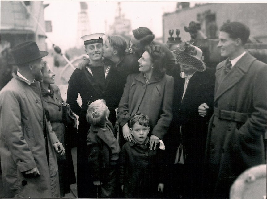
Sid Horton with his family, on his return home.
Sid Horton with his family, on his return home.

Here is Sydney’s own description of what happened on H.M.S.Amethyst. Dear Sir, In answer to your request for any information regarding H.M.S. Amethyst, I will give you a build up of how I started my Naval service and ended up on the Amethyst. I Joined H.M.S. Ganges as a boy seaman on 15th July 1947, did my basic training and left there on 1st July 1948 to join H.M.S. Norfolk which was a 6 inch cruiser stationed on the East indies ( Tricomalee ) for a two and a half year commission. When Norfolk sailed for home waters on completion of her commission, 90 of her boy seamen were drafted to other ships, mainly in the Far East to complete their two and a half years.

H.M.S. Norfolk

H.M.S. Norfolk

Myself and fifteen other boy seamen ended up on our way to join H.M.S. Amethyst in the far East. We joined Amethyst in Hong Kong in March and sailed for Shanghi. We left for Nanking on the 19th April and anchored overnight with some Nationalist warships. Early next morning we got underway and proceeded up the river. Around nine o’clock we were closed up at action stations. My station was on ‘B’ 4 inch gun just below the bridge when I heard rifle fire and shortly after gunfire, and shell whooshed over the bows which had canvas Union Jacks draped over the sides, but luckily there had been no hits to the ship. About twenty minutes later there was more gunfire and this time shells hit the wheelhouse, the bridge and other parts of the ship, and within minutes the ship started to turn to port very quickly and ran aground on a small island known later as Rose Island. With the ship stuck on the mud of the Island ‘B’ guns crew were of no further use because the guns could not bear on the target. We dispersed as a crew and tried to be of help in other parts of the ship.

Effects of gunfire on 'Amethyst'.

Effects of gunfire on ‘Amethyst’.
Effects of gunfire on 'Amethyst'.

Effects of gunfire on ‘Amethyst’.

I found myself going up the wheelhouse steps and found the place in chaos. The Coxswain and telegraph men had all been hit leaving the second Coxswain the only man on his feet. There was an awful smell of smoke, and I helped to get the wounded down into the seamans mess deck, went back up to the bridge and helped to bring the injured men down below, noticing Lt. Berger had most of his clothes blown off by the blast. The ship by now could only defend herself with ‘X’ gun back aft, which she did until ‘X’ gun also had a direct hit. I found myself taking small arms up to the upper deck, and within minutes down below again because any movement on the upper deck was met with small arms fire from the shore. The upper deck was a shambles, there was bits of boat, bodies and wounded, who we took below to the messdeck. By now the ship reeked of smoke, cordite, sweat and blood.

Next came the order to abandon ship and take the wounded to the whaler to get them ashore out of the way, but even with men in the water following the whaler to the shore the small arms fire never ceased. My next job was down below tidying up the living quarters and tending to the wounded that was left onboard. I was given the job of lookout on ‘B’ gun deck, looking out for the destroyer Consort coming down from Nanking. What a thrill Consort gave me when i first sighted her, the gunner asked the signalman to flash her. On the way down towards us she opened fire to Port and I could see her hits on the gun positions on the banks, there was bits of everything flying in the air that was once gun emplacements. She came down to a position almost abreast of us and slowed down to make signals, then went down river to us and turned around and came back up never firing her guns to starboard, the sight of how calm and collected her crew were made me feel very proud to be British.

H.M.S. Black Swan H.M.S. Consort.

H.M.S. Black Swan H.M.S. Consort.

H.M.S. Black Swan H.M.S. Consort.

The Consort then turned around again and with a whacking great bow wave which was sweeping the banks away disappeared out of sight down river. Not long after a couple of nationalist fighter planes shot overhead and straffed the banks with what sounded like machine guns. My next job was helping to lighten the ship so as we could have a go at getting the ship off the mud. We looked at anything of weight, and if it moved, threw it over the side, and by this means, plus pumping oil over the side we managed to free the ship from the mud and moved a couple of miles up river and anchored. My next task was helping tidy up the ship and the awful task of collecting the dead from around the ship from around the ship and placing them on ‘X’ gun deck, this was made easier by a couple of tots of spirits.

Sydney's medals,with the famous telegram, and the return home.

Sydney’s medals,with the famous telegram, and the return home.
Sydney's medals,with the famous telegram, and the return home.

Sydney’s medals,with the famous telegram, and the return home.

My next thrill was being told that the cruiser London, and the frigate Black Swan were on their way up river to help us out. I had heard the sound of distant gunfire, but this came to nothing because both ships had come into heavy gunfire. When the London and Black Swan failed to reach us just about everyone left on board felt utterly dejected. There were rumours about submarines and aircraft trying to help us, and to our surprise a Sunderland flying boat circled us then landed and left us a doctor and medical supplies, but left us minus our ships gunner.

H.M.S. London

H.M.S. London

We next moved further up river and re- anchored where the new Captain of our ship came aboard from a Nationalist landing craft. He walked around and assessed the damage to the ship and almost right away arranged the burial of our dead into the Yangste river . A couple of times after this we were told to be ready to abandon ship, the Captain had charges placed and had plans to scuttle the ship seeing we never had enough boats to row ashore.

We watched the Communist Army make its crossing of the river in every boat imaginable, then for week upon week we fell into a ships routine again, tidying up, making different parts of the ship better to live in, and better protected against shrapnel and small arms fire if that arose. Over this period the Captain had been in touch with the Army ashore, and our ‘Jack Dusty’ had been able to procure eggs and fresh vegetables with bartering against a trader from ashore. One afternoon I was working on the cable deck, forward, making an adjustment to a steel cable holding a bolt of timber between the ships bows and the anchor chain, when the cable suddenly came under load and broke my right arm at the elbow.

Sid with broken right arm.

Sid with broken right arm.

Sid with broken right arm.

A couple of weeks after breaking my arm, I was sent ashore with the R.A.F. Doctor and given an X ray, and returned back on board. When the captain decided to make a break for it, I and one other was stationed back aft in the tiller flat to steer the ship if the wheelhouse was hit on the way down. The ship reached Woosung, and was met by the destroyer Concord, and on coming up from below what a beautiful sight she made and what a lovely feeling it was to feel free at last. After much cheering, laughing and shouting, we headed for Hong Kong.

H.M.S. Amethyst and the Yangste Incident

H.M.S. Amethyst

H.M.S. Amethyst

photo courtesy navy-photos and M.Pocock

Ask most people over Fifty years of age about the Yangtze incident, and they will tell you about the film staring Richard Todd, in which he Captain’s H.M.S. Amethyst through shot and shell from the Communist Chinese, and eventually wins home to freedom down the River Yangtze. It’s a typical story of its time about plucky Brits defying great odds and the film was a great success. The real story is even more startling for the hardships and bravery suffered by the crew, who had no realistic hope of escape, but kept the faith even though many had died, and eventually they arrived home to a tumultuous welcome.

Film Poster

Film Poster

It is hard to believe that after all the Amethyst had done that she should end up being scrapped alongside one of Plymouths most popular pubs, the China House. But all ships eventually have to die, only their story lives on and what a story it is. There are four articles about the ‘Amethyst’ including a first hand account from the youngest crew member, Boy seaman Sidney Horton.

  • H.M.S. Amethyst
  • Boy Seaman Sidney Hortons Story
  • Simon the Cat
  • Amethyst News Paper stories

H.M.S. Amethyst

Amethyst before the trouble started.

Amethyst before the trouble started.
photo courtesy navy-photos

H.M.S. Amethyst was a modified Black Swan class sloop built by Alexander Stevens and Sons in Govern Scotland and launched in 1943. During the Second World War she made her mark by depth charging and sinking U1276. After the war she was re-classed as a frigate, renumbered as F116 and in 1949 found herself based at Shanghai. At the time there was a civil war going on in China between the Chinese Communists and the Kuomintang. The British Embassy was at Nanking, and because of all the fighting H.M.S.Consort was standing by as guard ship. On the 20 April 1949 the Amethyst was ordered to proceed up the Yangtze to Nanking to relieve Consort and prepare to evacuate all British citizens that were being caught up in the advance of the Chinese Communist Forces. She travelled in company with Kuomintang warships, who busily shelled any enemy batteries that they could spot, causing over 200 casualties. According to the Communists, the Amethyst was also firing, a statement that later, the Amethyst strongly denied. In any event, at 0800 hours, a Communist field gun battery on the north bank of the river fired a salvo of ten shells that fell short of the Amethyst and were assumed to be part of the regular shelling of the Nationalist forces on the other bank.

The Amethyst increased her speed and unfurled two huge battle flags to show her identity. The firing stopped, but an hour later as she was approaching Kiangyin further upriver, another battery opened fire hitting the wheelhouse and killing the Coxn. Another shell burst on the bridge, mortally wounding the Captain Lt.Commander B.M. Skinner and injuring the First Lt. Geoffrey Weston. In the ensuing confusion the ship ran aground on Rose Island and as the shelling continued the sickbay was hit, along with the port engine room and the main generator, but not before the injured Weston managed to get of a signal saying that they were aground and under heavy fire. By now the gyro compass was disabled and due to the lack of power the electrical firing circuits were inoperable leaving the Amethyst a helpless target.

17 Mess and Royal Marine Gunners. Photos courtesy of Lawrence Ives

17 Mess and Royal Marine Gunners. Photos courtesy of Lawrence Ives

17 Mess and Royal Marine Gunners. Photos courtesy of Lawrence Ives

Due to the way the ship had grounded, the two front turrets were unable to bear, so the rear turret fired over thirty rounds at the batteries until it was hit, knocking out one of its guns. The remaining gun carried on firing but Weston ordered it to stop as he thought that might cause the battery to cease firing. It was a vain hope. The shore batteries stepped up their fire with both heavy and light artillery causing more casualties and extensive damage to the ship. Weston prepared for the worst by arming the rest of the crew with rifles and Bren Guns to prepare to repel boarders.

Glamour Boys

Glamour Boys

By 10-30 hours no attempt had been made to board the ship, but the shelling and small arms fire carried on unabated. Lt.Com. Weston decided to evacuate as many of the crew as he could to the opposite bank of the river which was controlled by the Kuomintang. Everybody who could swim was ordered over the side, whilst the walking wounded and non swimmers were squeezed in the one remaining boat. Fifty nine ratings and four Chinese mess boys made it to safety, but several more were cut down in the water by machine gun and artillery fire. Those that made it were taken to a Nationalist Hospital and then trucked back to Shanghai. Left on board the Amethyst were forty able bodied men, twelve wounded and fifteen dead. By now the shelling had stopped but everybody had to stay under cover because of the snipers. By the time the shelling stopped at 11-00 hours the casualty list had grown to twenty two men dead and 31 wounded. In all the Amethyst had received over fifty hits mostly below the water line which the crew franticly plugged with hammocks and anything else that came to hand.

Amethyst on Marrowbone Slip

Amethyst on Marrowbone Slip
The same area today

The same area today
photo courtesy navy-photos

While this was happening H.M.S.Consort was seen steaming towards them at twenty nine knots displaying seven White Ensigns and three Union flags. She came under heavy fire but managed to opened fire and destroy some of the batteries as she tried to take Amethyst under tow. However the heavy shelling made this task impossible, so the Consort had to abandon her efforts and retire having suffered ten men killed and three wounded.

Lt. Commander Kerans

Lt. Commander Kerans

All efforts were now concentrated in trying to get the ship afloat. Everything that could be removed was jettisoned to make the ship lighter, and on April 26, after being aground for six days, the ship was floated of in the dead of night and moved up river to Fu Te Wei. However she couldn’t stay there, so H.M.S. London and H.M.S. Black Swan were sent to escort her down river. Before they got to her, they came under very heavy fire from batteries near Bate Point causing considerable damage to both ships. London was holed in twelve places and lost twelve killed and twenty wounded. Black Swan had seven wounded so it was decided to disengage and return down river to safety. Amethyst removed the worst of her wounded by sampan and went a further ten miles upstream where she anchored and received her new Captain, the British Naval Attache, Lt.Commander J.S.Kerans, who immediately started negotiations with the Communists. These proved largely futile as the Chinese wanted an admission that Amethyst had fired first, which of course the British couldn’t agree to. So months passed while the Chinese took over the whole area, and refused to give the ship and crew vital supplies.

By July things were getting increasingly desperate on the ship and it was becoming obvious that they could all die stuck in the Yangtze, or try to make a run for it. It was a risky decision but on the 31st July Lt. Commander Kerans slipped the mooring cable and slid down the river to start her one hundred and four mile dash for freedom. Running the gauntlet of enemy guns now on both sides of the river she steamed resolutely forward ,streaming black smoke during the worst of the shelling to confuse the Chinese gunners. By 0500 hours she was coming up to the forts that guarded the entrance to the open sea. H.M.S. Amethyst, swept by brilliant searchlights for the batteries on the forts, ploughed on at full speed to the mouth of the river where she met H.M.S.Consort and made her famous signal ‘have rejoined the fleet off Woosung—God save the King.

Nowadays Sutton Harbour is a bustling marina with lots of new waterside apartments and restaurants, and bears little resemblance to the harbour when the Amethyst came to her final rest on Marrowbone Slip. Just a short walk away is the historic Barbican where the Pilgrim Fathers set sail for the New World, and is full of old Pubs and art gallery’s. The fish quay has been moved across the pool near the Marine Aquarium, and with it went some of the character of the Barbican. Still it’s a fine place to see all the boats sailing in and out, and if you walk up the hill, you soon come to Plymouth Hoe with its wonderful panorama of Plymouth Sound. There is so much history here, from Drake, to the Warships still carrying our soldiers to fight in foreign lands. Much has been forgotten, like the Amethyst, but still, a walk around where she was, can still conjure up memories of brave deeds done, and after all’s said and done, that is all that will be left, just memories.


View Larger Map

Afterwards refresh yourself in the China House where they have a good selection of photos to show you what the old Barbican looked like.

Submarine L1, and the Battle Ensign of H.M.S.Revenge

On the 29th March 1930, the submarine L 1 came adrift from its tow and drifted without fuss onto the rocks at Penanwell Cove, near Porth Nanven in Cornwall. The submarine, a veteran of the First World War, had been launched by Vickers at Barrow in 1917 and at the time of her stranding had been on tow from Chatham to Newport in Wales for the purpose of being broken up for scrap. It wasn’t worth trying to refloat the submarine, so she was scrapped where she lay.

The L1 stranded.

The L1 stranded.

Now I would have thought that any evidence of her would have disappeared after all these years, but not so. There is still quite a big piece of metal left half buried in the sand, so much in fact that the National Trust, who owns the Cove, have marked it with a buoy and put some warning notices up. You can’t really see anything until a spring low tide, and I arrived at the wrong time, because the tide was still going out. So is it worth the bother? Well yes it really is, and not just for the wreck.

Warning Sign

Warning Sign
Penanwell Cove

Penanwell Cove

Penawell Cove is a wild and beautiful place, only a mile or so from the dramatic Cape Cornwall, right in the middle of an old Cornish mining area. To find the Cove head straight to Porth Nanven, where there is a National Trust car park. (voluntary donations) the cove is the beach. All around are adits for mine shafts tunnelled right into the cliffs. Whilst the views are spectacular, the whole cove is something of a history lesson as its eroded banks show the tale of the global warming that happened after the last ice age.

The eroded cliff.

The eroded cliff.

Modern erosion has cut through the cliffs to form their present shape, but they also show you the granite cliffs, and the raised boulder beach of the warm climate 120,000 years ago. This is all overlaid by thick deposits of angular frost shattered rock, the remains of the permafrost flows of the ice age. The Trust has put up some helpful boards with all the info you need to know.

Looking towards Sennen.

Looking towards Sennen.
Adit cut into the cliff.

Adit cut into the cliff.

If you are feeling fit you can walk the mile or so over the cliffs to Cape Cornwall, or, (like me) drive the car down narrow winding lanes into a Cornwall that doesn’t seem to have changed much since the 1950’s. The scenery is stunning. In the distance you can see the ruined towers of the mine shafts, and in the foreground there is an ancient church surrounded by hugely horned cattle, and all around, the crash of waves on the rocks, and the cry of the seabirds. It’s marvellous.

St. Helens Oratory - Cape Cornwall.

St. Helens Oratory – Cape Cornwall.
St. Helens Oratory - Cape Cornwall.

St. Helens Oratory – Cape Cornwall.

Because I had got the tide wrong, I had a couple of hours to kill, so I drove back the nearest town, St. Just. It’s typically Cornish. Granite buildings grouped around a central square, a pasty shop, a couple of pubs, and now because of the tourists, a couple of gallery’s, an organic cafe and deli. It doesn’t sound much, but it’s charming and friendly, and for the Naval Enthusiast it harbours a big surprise.

H.M.S. Revenge

H.M.S. Revenge

The church of St. Just in Penwith lies just of the main square. There has been a church on this site since around 428 AD, and over the years bits have been rebuilt and changed especially in the 14th century. I always like looking around church yards because you so often find quite a lot of information about shipwrecks. I was unlucky outside, but inside was a revelation. Draped across the north corner of the church, near the bell tower, is the Battle Ensign of H.M.S.Revenge.

The Battle Ensign

The Battle Ensign

This flag was presented to the church by Captain Russell Grenfell. His family originated from the area, and as a junior officer he served on the battleship when it was part of the First Squadron of the Grand Fleet, and saw action at the Battle of Jutland. It was to the Revenge, that Vice- Admiral Burney transferred his Flag when his ship H.M.S. Malborough was torpedoed. The Revenge had been launched in May 1915 and served through-out both Wars and was finally scrapped at Inverkeithing in Sept 1948.

St.Just Church

St.Just Church
St.Just Square

St.Just Square

To find St.Just, make your way down the A30 to Penzance, then take the A3071 all the way to St.Just. Once there,take the Bosorn Road down to Porth Naven.

Location of Porth Nanven and Cape Cornwall.

Location of Porth Nanven and Cape Cornwall.

The Trawler Yvette

I have always had a soft spot for Prawle Point, because it has a wild and beautiful seascape. This wildness, had been the cause of many, many shipwrecks (see Prawle Point and Dimitrios) over the ages, and so I have often tramped over its cliffs and costal paths to view the latest shipwreck. Even now you can still see signs of the Dimitrios and the Hey-P at low tide. However, if you come out of the National Trust car park and turn left, you will leave the cliffs and steep paths of Prawle Point behind you and proceed along an altogether flatter and easier coast path towards Langerstone Point. The scenery is quite breathtaking, with wonderful views towards Dartmouth, and besides picking blackberries, there are endless opportunities to clamber onto the rocks to examine the rock pools and watch all the different sea birds at work. If you are lucky you might see a hawk gliding on the thermals before stooping towards its prey. There are usually plenty of cows wandering about, so be mindful of not going to near, especially with dogs.

Prawle Point

Prawle Point
The beaches near Landing Cove.

The beaches near Landing Cove.

At low tide, lovely stretches of sand appear, to delight young children, and the bathing is safe and calm. It’s hard to believe that in bad weather, all this beauty turns into a death trap, but that’s exactly what happened on 12 March 1978 to the Brixam trawler Yvette. Steaming near Prawle in a big swell the fog suddenly came down and caught the crew on the hop. The radar didn’t work properly and so the skipper was momentarily uncertain of his true position. It doesn’t take long for small mistakes to suddenly become full blown disasters, and soon the Yvette hit the rocks off Langerstone Point. All attempts to get her off failed, and the crew of three had to be rescued by line from a rocket apparatus. The skipper was taken off by helicopter, and the Yvette soon became a total wreck about half a mile east of Landing Cove where some of her remains can still be seen today.

I am gratefull for ‘Mark’ of www.trawlerphotos.co.ukfor suppying these photos of the Yvette.

Yvette

Yvette
Yvette

Yvette

In fact there is quite a lot left , which surprised me, especially as this is such an exposed bit of coastline. The main winch and the stern gantry are easy to see, as well as some of the hull. A bit further away in a gulley are the propeller protector and some more iron plate. If you search around you will find plenty more small bits and pieces, some of which are already crudded into the rock.

The main part of the wreckage including the winch.

The main part of the wreckage including the winch.

The main part of the wreckage including the winch.

Looking at the Yvettes smashed remains, you realise how small the boat was, and how lucky the crew were to get off alive. It’s a shame some off the Euro bureaucrats and our own Government can’t see this wreck, as it might bring home to them how dangerous the job is. A little more protection of our fishing fleet and less regulation would make their lives a lot easier, and safer.

The stern gantry and the back of the winch.

The stern gantry and the back of the winch.

The stern gantry and the back of the winch.

Arromanches-Mulberry Harbour

In 1942 the Allies mounted a disastrous raid on Dieppe to see if it was feasible to capture an enemy held port to help with the invasion. Among the many lessons learned was the fact that the German defences around the Channel ports, the so called Atlantic Wall, were very heavily defended especially around the beaches that were most favourable to the Allies invasion plans. In the planning stages of ‘Overlord’ the invasion of Europe, it soon became obvious that in order to supply the huge amount of supplies and troops that would be needed once a bridgehead had been established after the initial invasion, the Allies would need a port. Actually they would need two, one for the Americans and one for the British. Since the Germans occupied the ports that were the most useful to the Allies, the only answer was to build their own. But where? The planners came up with a revolutionary, some said insane, idea. Why not prefabricate the harbours in England and then simply tow them across to Normandy. The Mulberry Harbour as the project became known (The name Mulberry was chosen at random, but since a mulberry tree grows quickly to a great size, the name was seen as a good omen) became the greatest military engineering project in history, but at the beginning the problems seemed insurmountable. Luckily Churchill took a personal interest in the project and squashed all doubts. He famously said “bring me the best solutions, do not waste time talking about the problem’s, they will take care of themselves. With Churchill brooking no delays, the project swiftly got underway.

The huge Phoenix Caissons

The huge Phoenix Caissons

To get a grip on the size of the project think of the Port of Dover which the Mulberry Harbours were supposed to replicate. During the Second World War the Port covered 310 hectares, and was capable of discharging 1250 vehicles and 600 tonnes of supplies a day. Dover had taken seven years to construct, but the Mulberry harbours were designed and built in just one year. The main elements of the harbour were essentially an outer ring of sunken block ships, which were also used as workshops, temporary accommodation, and huge concrete Phoenix caissons to take the brunt of the sea and weather. Inside this ring were floating quays with pontoon roadways to the shore. Once the bridgehead was in position all of these elements had to be towed across the Channel and installed in less than two weeks.

Floating Jetty's

Floating Jetty’s

The building of the Phoenix caissons caused the greatest headaches because every boatyard and jetty in the country was already fully occupied with building the landing craft for the invasion. In the end special basins were excavated along the banks of the Thames in which the caissons could be constructed. The plan called for 146 caissons, but 212 were eventually constructed in six different sizes to accommodate the different types of seabed upon which they were to be sunk. Some of the surplus, were later used to repair French ports that had been destroyed in the fighting, and to prop up sea defences around the coast and the dykes at Walcheron in Holland. The largest caissons were sixty metres long by seventeen metres wide, eighteen metres high, and displaced over 6000 tonnes . There were over 8000 men involved involved in the project, and each caisson took four months to build. Their construction consumed 600,000tonnes of concrete, 31000 tons of steel, and a million and a half square metres of corrugated steel sheets.

Floating roads to the Beach Head

Floating roads to the Beach Head

By the 6th of June all was ready and the block ships set off soon after the invasion force so that they would be sunk in position ready for the arrival of the Phoenix caissons and the other elements of the harbour which was scheduled for the 8th of June. It took over 130 tugs to tow all the parts into place, and soon the installation of the Mulberry Harbours commenced. The American harbour Mulberry A , was stationed off the Omaha invasion beach, and Mulberry B off the beach at Arromanches. The work went on night and day. Each caisson had its own anti aircraft battery to protect them as well as barrage balloons and a thick artificial fog to disguise the whole enterprise. Up until now the Germans had no idea what was going on, but by June 16th the penny finally dropped and they launched ferocious airstrikes against the harbour. It hardly made a dent. The work carried on without a pause, and soon the Mulberry Harbour was up and running right on time.

Mullberry B

Mullberry B

Designed to last only 90 days Mulberry B survived savage storms and was still operating well into November. Their usefulness however, had now been over taken by events. Roads around Arromanches had deteriorated to a point where they were unsuitable for heavy transport, and Belgium and Dutch ports, now recaptured by the Allies, were much closer to the forward battle zone. A lot of port equipment was wasting away in the Mulberry’s that could be much better employed in the ports opening further up the coast, so a decision was taken to strip the Mulberry harbours of all useful equipment, and abandon them to the sea.

Then

Then
After

After

Arromanches, before and after. The resturant is on the extreme right of the photo
During the war the town of Arromanches was in the thick of the fighting, and was badly damaged, but today much of the town has been rebuilt as it was, and is a delightful place to visit. At low tide the brooding mass of the ruined Mulberry Harbour dominates the beachscape, but still leaves plenty of space for building sand castles and going for bracing walks. It is quite something to walk out to some of the nearer ruins and realise their sheer size, and if you venture onto the cliff tops you can quite easily see what’s left of the outer ring of the Mulberry, the huge Phoenix caissons seemingly impervious to the pounding of the sea over all these years.
Right at the corner of the beach is a Hotel with a great little restaurant, and in the evening you can have a meal there overlooking the beach. Usually some of the caissons are lit up, and after your meal, as you stroll along the promenade in the half dark it’s not hard to imagine the sound of shells exploding, bullets whipping by, and the shouts and cries of the troops as they thunder ashore bound for glory or oblivion. Thank God they did, but the sacrifice was high as the nearby cemeteries attest. Even so, without the Mulberry Harbour things could have been a lot bloodier. To get a proper perspective on the Harbour and the Invasion in this area, go to the excellent museum just up from the beach and afterwards don’t forget to linger on the nearby invasion beaches to give thanks to all those brave men. At Arromanches you can purchase a great little guide book:Arromanches-History of a Harbour.

Emma Christ

This is one of the first shipwrecks that I saw on the Cornish coast. It is on the beach over towards Polhawn Cove on the Rame Head side of the Bay. There is a convenient car park, and the path down to the beach is easy to find and not too steep. It is a lovely part of the Bay, much loved by families and their children as the sea is usually sheltered by Rame Peninsula and so safe to bathe in. In 1975, Mr. Burland put most of his savings into a boat called the Emma Christ which he bought from the Ministry of Defence. The idea was to convert it into a diving tender. During the rest of the year the work proceeded at a good pace and by November 1976 she was ready to take her Board of Trade Survey, which was held in Dartmouth. N Saturday November 8th the Emma Christ set sail from Plymouth to conduct trials in Whitesand Bay. After an hour or so the engine stopped due to a fuel blockage, and the ship rode at anchor for three hours whilst the crew tried to sort the problem out.>

Emma Christ

Emma Christ

Suddenly there was a loud bang as the anchor cable parted and the ship started heading for the shore. Although there wasn’t a full blown gale the seas had got up and as the ship neared the rocks the surf became much more severe. The crew couldn’t start the engine, because the air bottles needed to turn it over were empty, and the air compressor seized up after only working for a few minutes.

Emma Christ

Emma Christ

In desperation two more anchors were thrown over but they didn’t hold and within minutes the Emma Christ was swept onto the rocks. Mr. Burland sent up flares and the Lifeboat and Helicopter were scrambled. When the helicopter arrived the ship had been pushed under the two hundred and fifty foot cliffs, was beam on, and being buffeted quite strongly by the waves. Two crewmen had scrambled off the ship on to the rocks, but the Lifeboat could not approach near enough to rescue the other two crew, so the helicopter, hovering very close to the cliffs winched the other two off the boat to safety.

View from above.

View from above.

The next day Mr. Burland stood on the cliffs looking down on his ruined boat. The Emma Christ was already starting to come apart and he new that salvage was not an option. His hopes of running a diving tender were over, and all that was left was the dream.

All thats left.

All thats left.

Now a days there is not a lot left of the Emma Christ except for a rusting boiler half buried in the sand and masses of iron plate sticking up out of the sand. Still the walk is great, even if the climb back up is a it of an effort.

All thats left.

All thats left.

H.M.S. Montagu-Lundy Island

Twelve miles North West of Hartland Point and the North Devon coast lies the rugged granite island of Lundy. Just three miles long, this little island of volcanic origin lies right at the entrance to the Bristol Channel, directly in the path of what once were the major shipping routes to the coal ports of south Wales and Bristol itself.

One of the many wrecks over the years.

One of the many wrecks over the years.

Although Lundy has probably more than its’ fair share of shipwrecks, it is nowhere near what it could have been, considering how many ships have passed this way in the last two centuries alone. It is estimated that in its heyday, almost a million ships passed the island every year. Even so, in 1786, the merchants of Bristol were so concerned at the losses suffered around the island, that they offered to build and maintain a light house at their own expense.

The Carmine Filomena wrecked in 1937.

The Carmine Filomena wrecked in 1937.

Lundy has a recorded history going back to the time of King John and since then its ownership has changed many times. With only one landing place and three hundred foot high cliffs, Lundy is a natural stronghold and it’s no surprise to find that over the years it has been home to pirates and smugglers alike. With no natural resources other than stone there was not much to offer anyone that wanted to settle on Lundy and anyone who did could be storm bound on the island for weeks.

The one and only landing spot

The one and only landing spot

Today the island is owned by the National Trust but maintained by the Landmark Trust as a nature reserve. There are tons of birds to spot including puffins, loads of seals and dolphins and the occasional basking shark. It’s a magical place that’s easy to visit for the day by getting on the M.V.Oldenburg either from Ilfracombe or Bideford. If you want to stay on the island you can stay in chalets (you have to book well in advance) and there is a great pub that does excellent meals. It’s a great day out, and has the added attraction of a really fantastic wreck story with a walk to match.The wreck in question is the battleship H.M.S. Montagu.

H.M.S. Montagu.

H.M.S. Montagu.

On the afternoon of 29 May 1906 the almost new battleship anchored off Lundy during a Fleet exercise. Her job was to communicate with the Isles of Scilly using the recently installed wireless telegraphic signalling apparatus. This equipment was the cutting edge of technology at the time and the Admiralty was expecting great things from it. However the distance to the Scilly Isles was too great, and in normal circumstances the Montagu would have steamed closer to the Islands and continued her trials. Unfortunately she was now enveloped in a thick fog and anchored as she was, right in the main shipping lane there was a real risk of another ship colliding with her. In the end it was decided to move closer to Lundy. As the great ship got under way soundings were taken, and as the Montagu crept closer towards the coast a strict lookout was kept. At about 2 o’clock in the afternoon, the depth was given as seventeen fathoms and the navigating officers was just congratulating himself in placing the ship safely four miles off Lundy when there was a great crash and grinding of metal, and the Montagu shuddered to a halt. Unknown to all on board, they had just run aground on the Shutter Rock at the south western corner of Lundy Island. The ship’s massive engines were put hard astern ripping off her propellers, but the Montagu was held fast and started to leak badly.

The Montagu as she struck.

The Montagu as she struck.

A landing party was detailed to scramble up the cliffs and go and find help. When the men got to the top of the cliffs they could hardly see where they were because of the fog but came across a rough path. If they had turned left they would have come across the lighthouse just half a mile away, but they turned right and marched the whole length of the island before stumbling into the lighthouse keeper’s cottage. The Naval Officer in charge of the party was convinced they were on the North Devon coast and railed at the poor keeper to contact the authorities. The lighthouse keeper finally realised that they thought they were at the Hartland Point Light and had to forcefully point out the Officers mistake by saying that it was hardly likely that he (the keeper) did not know which lighthouse he was serving in.

The Old lighthouse close to Shutter Rock.

The Old lighthouse close to Shutter Rock.

By now the Montagu’s lower compartments were all flooded and the hull was grinding nastily against the rocks. The Navy had no salvage equipment so they sent for the Liverpool Salvage Company and their most experienced officer Capt. Young. Since they had asked for their help you would have thought the Navy would have let the Salvage Company get on with it, but no. Capt. Young was relegated to the status of assistant and the Admiralty put in their own man, Admiral Sir A.K.Wilson. Although he was a brilliant officer he was completely out of his depth when dealing with the salvage of such a large battleship. Almost at once he ordered a huge flotilla of ships to bring all sorts of gear to the site. Working parties of hundreds of seamen were put aboard the Montagu, all with conflicting agendas. The upshot was chaos and confusion with everybody getting in each other’s way whilst the ship sank lower and lower in the water.

The ‘Atlas’ wrecked 1942

The ‘Atlas’ wrecked 1942

The arguments and conflicting ideas raged unchecked with Capt. Young of the Salvage Company being told to mind his manners. The last straw came when the Admiral seriously suggested that the Montagu be filled with cork and be allowed to float off on the high tide. It was by now obvious to all that the great battleship was lost and in desperation the Admiralty turned to Capt. Young to salvage something from the shambles. The first thing he suggested was the removal of the battleships huge 12 inch guns. Each of these weighed 48 tons and was worth a great deal of money. They also were badly needed by the Navy to rearm other ships as the supply of guns was extremely short. Overnight Capt. Young assumed complete charge of the salvage operation. All the ships were sent away along with the working parties. All that was left were the employee’s of the Liverpool Salvage Company.

One of the huge guns.

One of the huge guns.

In order to remove the guns Capt. Young and his crew blew out part of the ships side to allow the barrels to drop down into the hull. He then had massive 60 ft sheer legs constructed to lift the barrels into the waiting lighters to be taken away to Pembroke Dock. Two barrels were removed in twenty one days, and to celebrate, a ‘Sods Opera’ (concert) was conducted on the wreck. The chief diver, Alf Gloyne, amazed everyone with a stunning tap dance routine, others played accordion and Capt. Young gave a spirited rendition of ‘Blow the man Down’ to a by now happy, and very drunk audience. The two after barrels soon followed and the crew then set about stripping out the condensers, pumps and tons of non ferrous metal. Even the propellers were recovered when the anchor of one of the salvage vessels got tangled up in their remains.

The Fantastic Ariel Walkway.

The Fantastic Ariel Walkway.

By now the official salvage operation was coming to a close. The Courts Martial had found both Capt. Adair and his Navigating Officer Lt.Dathan, guilty of hazarding the ship, and they were both severely reprimanded. With the end of these proceedings the Montagu was ‘paid off’ and in January 1907 the Navy put her up for auction to be broken up where she lay. She was bought for £4250-00 by the Syndicate of South Wales Adventurers and it proved to be a wise investment. An aerial footway over 500 ft long was constructed from the top of the cliffs to the roof of the Montagu’s chart house, and also a path was made down the side of the cliff using granite steps and then footholds were carved into the rock. These became known as the Montagu Steps and you can still see them today.

You can just see the Montagu Steps.

You can just see the Montagu Steps.

Work was only possible for a short time at low tide, and so speed was of the essence. Lighters were brought alongside and slowly piece by huge piece, the armour plating was removed along with a vast amount of copper and brass. Explosives were used extensively and this had the effect of finishing of any structural strength left in the ship. By October 1907 huge storms, the worse Lundy had seen for years started to pound the wreck to pieces and so the salvors suspended their operations and retired to count their profits. Soon the Montagu disappeared completely beneath the waves and all that was left to mark her passing were the granite steps and a few bits of rusting metal that supported that fantastic Ariel walkway.

Nearly 500yards long.

Nearly 500yards long.

I am very grateful for the following information and photo from Chris Howell. He has a walking stick made by his great Grandfather’s company, the shaft of which came from the deck timber of the Montague. These sorts of sticks are known as ‘relic canes’. I confess that I had never heard the term before so Chris sent this photo of the inscription on the cane. You can just make out the inscription ‘WOOD FROM H.M.S. MONTAGU. The siver Cartouche is inscribed LS, and the hallmark date is 1907.The stick is complete with original ferrule and original length of 36”.

Walking Stick.

Walking Stick.
I am very grateful to Dave Snook, for the photo's below, of the salvors on the wreck of Hms Montagu.

I am very grateful to Dave Snook, for the photo’s below, of the salvors on the wreck of Hms Montagu.
I am very grateful to Dave Snook, for the photo's below, of the salvors on the wreck of Hms Montagu.

I am very grateful to Dave Snook, for the photo’s below, of the salvors on the wreck of Hms Montagu.
I am very grateful to Dave Snook, for the photo's below, of the salvors on the wreck of Hms Montagu.

I am very grateful to Dave Snook, for the photo’s below, of the salvors on the wreck of Hms Montagu.
I am very grateful to Dave Snook, for the photo's below, of the salvors on the wreck of Hms Montagu.

I am very grateful to Dave Snook, for the photo’s below, of the salvors on the wreck of Hms Montagu.

Whitsands Bay

Whitsands Bay, stretching from Rame Head to Looe is one of the great Cornish seascapes. Rugged two hundred foot high cliffs overlooking miles of sandy beaches provide an ideal setting for surfer’s, sailors, walkers, and divers.

Towards Rame Head.

Towards Rame Head.

It’s very setting however, open as it is to the south westerly gales, mean that over the years, it has become a magnet for shipwrecks. The last one, the Kodima (2002) almost choked the bay with her cargo of timber planks.

The View

The View

When you have finished your walks you can go to The View which is a great little restaurant/cafe serving great food and drink overlooking the Bay. On a good day this doesn’t get much better.

  • Taxiarcos
  • Chancellor
  • Emma Christ

Taxiarcos

Rame Head with its little chapel guards the entrance to the Bay. The chapel dates back to 600AD and has been used as a church and a lookout. It was from here that a beacon was lit to warn Drake of the approach of the Spanish Armada.

Rame Chapel.

Rame Chapel.

At the bottom of these cliffs lie the remains of the Greek brigantine the Taxiarcos wrecked in 1846. You won’t see anything of her unless you come around by boat and snorkel on her, but bits of her, mainly her anchors and a winch, are still there rammed into the rocks. OK, it is a bit of a stretch, but bear with me as the walk to the chapel and the views are spectacular and you won’t regret it.

The Greek BrigTaxiarcos became wrecked, not because of a storm, but because of a mix up in the course to steer and a sad lack of knowledge of the local tides.The vessel was brand new and had put into Falmouth for a Pilot. Coming up channel from the Danube under a full press of sail, the brigantine, under the command of Captain Vafrapola was bound for Hull with a cargo of grain. As she approached Rame Head on January 27th in a calm sea, the duty helmsman mistook the course and steered north east instead of southeast, and ran right into the bottom of the cliffs surrounding Rame Head.

One of the Taxiarcos's anchors. Photo Dave Peake.

One of the Taxiarcos’s anchors. Photo Dave Peake.

All fourteen of the crew scrambled ashore and sought refuge in the old chapel at the top of Rame Head.Local coast guards found the crew and gave them food and bedding, and in the morning they were taken to Cawsand for repatriation to their own country.As the tide ebbed, a heavy ground swell broke the ship up completely on the evening tide. The local press severley critisised the Pilot and advised that before he considered another job he should read up ‘The Remarks on the Navigation of the English Channel’ in the local tide tables.

Part of a winch drum? Photo Dave Peake.

Part of a winch drum? Photo Dave Peake.

You can scramble down the seaward side of Rame quite easily (all the shore fishermen do) and overlook the site.The views towards the Mewstone are fantastic and you will probably come across some of the wild deer that like to sun themselves on the slopes.

Coast Watch

Coast Watch

On your way back to the car park you can visit the Coast Watch Station manned by volunteers. They took the place of the regular Coast Guard when the station was shut down with most of the others along the coast during a Government reorganization. They do an excellent job and are always happy to chat to you about what they do.

Coast Only candles in this church.

Coast Only candles in this church.

On the way to the car park you will have passed the little church of Rame It dates back to 1259, and has no electricity, so all the services are lit by candle light. It’s a lovely little church and is nearly always open. In the graveyard that surrounds it are plenty of reminders of the toll that the sea takes.

Plenty of shipwrecks to be found.

Plenty of shipwrecks to be found.

Mizzen Mast Of The Great Britain

Mizzen mast of the Great Britain

Designed by Isambard Kingdom Brunel, the Great Britain was launched at Bristol in July 19 1843, and was the largest ship afloat in the world at that time. She arrived storm damaged at Stanley in 1886 and remained for over eighty years being used for various storage purposes, and became a familiar part of the landscape.

what's left of the Mizzen mast

what’s left of the Mizzen mast

Finally abandoned and rotting she was recovered from these waters in a truly amazing salvage operation, transported back to Bristol on a huge barge, arriving in July 1970 where she underwent full restoration and is now open to the public.

All this was made possible due in large part to the generosity of Sir (Union)Jack Hayward O.B.E.

All this was made possible due in large part to the generosity of Sir (Union)Jack Hayward O.B.E.
Looking towards the main jetty

Looking towards the main jetty

Jhelum

The Jhelum is a 128 ft boat built in 1849 at Liverpool. Her name comes from a tributary of the Indus river in India. She left Calloa for Dunkirk on the 13 July 1870 overloaded, and rounded Cape Horn with great difficulty.

The Jhelum

The Jhelum

She managed to put into Stanley on 18 Aug 1870 and her crew had so little faith in her ability to complete the voyage that they refused to put to sea in her.

The Plans of the Jhelum.Photo stanley museum.

The Plans of the Jhelum.Photo stanley museum.

The ship was sold locally and scuttled in her present location to serve as a jetty cum workshop and storage area.

Jhelum bows

Jhelum bows

Port Stanley, Falkland Islands Wreck Trail

In 2007 I was lucky enough to go down to the Antarctic on M.V. Discovery. On the way we stopped at the Falkland Islands where, amongst all the wonderful wildlife, they also have lots of abandoned clipper ships and other vessels.

M.V. Discovery at the Antarctic Peninsular

M.V. Discovery at the Antarctic Peninsular

Many are on the other Islands, which I did not have time to see, but a few are easily accessible around Port Stanley, and there is a great museum to go and find out more.

Falklands Overview

Jhelum

Gentoo and Golden Chance

Lady Elizabeth

Mizzen mast of Great Britain

Gentoo And Golden Chance

Named after one of the Falkland islands most common penguins, the Gentoo came to the Falklands in 1927 and then spent many years carrying supplies and wool for the farming company Dean Brothers. She later passed into the ownership of Bill Hills until 1981 when she was sold to a new arrival to the islands, who intended to convert her to a houseboat. However when she was put on a new mooring she rested on the bottom and heeled to starboard and the rising tide flooded her.

Gentoo

Gentoo

All I know about the Golden Chance is that she was built in 1900’s and came to the Falkland Islands in the 1940’s for sealing protection.

Golden Chance

Golden Chance

Falkland Islands Overview

The Falkland Islands have a total land area half the size of Wales and are made up of two main large islands, and over seven hundred small ones. The islands are basically very hilly, barren and windswept rather like Dartmoor or the Brecon Beacons, and you can have sunshine and sleet in the space of a few minutes. Because of the fierce winds there are no trees on the islands and gorse bushes had to be introduced to form some sort of wind break for the sheep, which form the main farming industry.

Looking away from the main part of Stanley.

Looking away from the main part of Stanley.

Nowadays the population is nearly three thousand strong, of which two thousand live in Stanley. The remaining one thousand live on their sheep farms, which are collectively called The Camp. However the humans are vastly outnumbered by the various species of penguin, which number just under half a million breeding pairs. Since the end of the War in 1982 much has been done to improve the lives of the Falkland Islanders. New roads have been built along with schools and a hospital. All this has to some extent halted the drift of young people moving away.

The Post Office, note the telephone boxes.

The Post Office, note the telephone boxes.

Economically the Islands are now much more prosperous mainly due to the fishing which brings in upwards of 24 million pounds a years due to fishing licences in their 200 mile unilateral zone. Tourism is also starting to make an ever bigger contribution. There is oil to be found at the moment but not in economic amounts, but if that happens then the population will definitely increase.

The Liberation Monument

The Liberation Monument

Although first sighted in 1592 by the English seafarer John Davis in the ship Desire, it took until 1690 for the first recorded landing by a Captain John Strong, who claimed it for Britain. Almost certainly other seafarers had sighted the islands over the years, and that’s how Argentina’s claim started. In the 1840s the island’s capital was moved for purely Naval reasons from Port Louis to Port Stanley and was named after the Colonial secretary of the day.

Looking towards Stanleys main jetty.

Looking towards Stanleys main jetty.

At the end of the nineteenth century, the Falklands became very important strategically for Britain who used the islands as a major coaling station for their Atlantic fleet. During the Great War the first battle of the Falklands ensured the Britain’s supremacy over the German Fleet and secured the passage around Cape Horn, which at the time was vital to Britain’s interests. Cape Horn is notorious for its fierce storms, and as the amount of shipping increased with the expansion of world trade and the coming of the whaling fleets, the Falklands were perfectly placed to provide repair facilities for storm-damaged ships.

A grim reminder of the war. there are still plenty of minefields around.They will take years to clear.You can buy maps at the tourist office.

A grim reminder of the war. there are still plenty of minefields around.They will take years to clear.You can buy maps at the tourist office.

Many of the ships that limped into Port Stanley were often too badly damaged to be repaired and they were just abandoned where they ran aground, and you can still see them to this day.

Abandoned clipper ship.

Abandoned clipper ship.

Incidentally during the Second World War, H.M.S.Exeter retired badly damaged to Port Stanley after taking her part in the battle of the River Plate, which sealed the fate of the mighty Graff Spee. The museum has some great photos of her. In the sixties she became part of H.M.S.Bellerophen in Portsmouth where she trained young seamen and Royal Marines, like me, in the art of seamanship.

Lady Elizabeth

The Lady Elizabeth was a three masted barque, 223 ft long,1208 tonnes built in Sunderland by R. Thompson in 1879. her hulk now lies in Whalebone Cove to the east of Stanley harbour and is one of the best preserved wrecks in the Falkland Islands.

Lady Elizabeth

Lady Elizabeth

Up until 1889 when she was delivering bricks and cement for the construction of Stanley Cathedral, the Lady Elizabeth had had an uneventful career, but that changed in 1913 when she came to rest in Stanley harbour after her voyage from Vancover to Delagoa Bay in Mozambique was cut short. The vessel, under Captain Peterson, was battered by gales 300 miles south west of Cape Horn, loosing her deck cargo and four crew men overboard in the fierce storm.

The Lady Elizabeth limped into Berkley Sound on 12 march 1913 and on the approach to Stanley harbour she struck the Uranae Rock putting a large hole in her hull and doing considerable damage to her keel. She was eventually towed into the harbour where she was condemned as un-seaworthy and was sold to the Falkland Island Company along with her valuable cargo of timber for a mere 3350 pounds.

Lady Elizabeth as she was.Photo from Stanley Museum

Lady Elizabeth as she was.Photo from Stanley Museum

On 17 February 1936 she broke her moorings in a storm and drifted down to her present position.

Montevideo Wreck Trail

Montevideo was founded by the Spanish in the early 18th century as a military stronghold. Its natural harbour soon developed into a commercial center competing with the Argentine capital of Buenos Aires.

The River Plate is the esturary formed by the combination of the Uruguay River and the Parana River. Where the rivers join it is 30 miles wide and it runs to the southwest growing to 137 miles wide where it opens onto the Atlantic Ocean, making it the widest estuary in the world.

The narrow channel into Montevideo is full of container ships and as you aproach you can see the mast of the sunken ship Highland Chieftain. The wreck of the Graff Spee is some 3 miles to your left.

The mseum also yielded a cannon from Nelson’s former flagship Agamemnon.

The Graff Spee

The Highland Chieftain

The Agamemnon

Graff Spee

Montivideo is the largest city, capital and chief port of Uruguay. Its harbour is one of the most important in the America’s. Surrounded by beautiful sandy beaches the city of Montivideo is a mix of historic old buildings (they have just realized what they have and are now busy preserving them) large shady squares, museums and art galleries. It feels very European. The nicest part for the tourist is the old part of the city with lots of nice bars and chi-chi restaurants. The population is nearly one point five million which is roughly 44 percent of the total population of Uruguay.

Graff Spee in Montivideo Harbour

Graff Spee in Montivideo Harbour
Graff Spee scuttled.

Graff Spee scuttled.

(these two photo’s are courtesy of www.deutschland-class.dk)

This is a fantastic website. If you want to know everything about the Graff Spee, click the link

For the British and Germans however, Montivideo is most famous for the Battle of the River Plate and the destruction of the great German pocket battleship, the Graff Spee, chased into Montivideo by the British cruisers Ajax, Achilles and Exeter.Unable to escape, her Captain was ordered by Hitler to scuttle the ship, and he later commited suicide.

The massive range finder.

The massive range finder.

The massive range finder.

Right in the centre of the port is one of her huge anchors as well as the massive range finder that sat right at the top of the ship. About fifteen minutes taxi ride away along the coast is a small Naval Museum at Puerto Del Buceo.

The anchor.

The anchor.

Inside the museum has plenty of photographs of the Graff Spee sinking and the famous photo of Captain Langsdorff giving a naval saluted at the graveside of his fallen crew members when everybody else was giving the Nazi salute.

Langsdorff's sword.

Langsdorff’s sword.

Some say that Hitler was insenced by his actions, seeing them as disloyal and this probably contributed to Langsdoff’s suicide as he would have most likely been put up against a wall and executed on his return to Germany.

Admiral Harwood's uniform.

Admiral Harwood’s uniform.

Other items of interest are Langsdorffs ceremonial sword and a uniform from one of the petty officers. Interestingly there is also a uniform donated by Admiral Harwood who masterminded the victory over the German battleship.

Gun from the Graff Spee.

Gun from the Graff Spee.

Outside the museum is a 150mm gun raised from the vessel and another small anchor around the side. Its only a small museum, but it is packed full of other stuff about the Uruguayan navy and it is all very well presented.Entrance is free and it is open from 9am to 12pm, then 2pm to 6pm except Thursdays. Well worth a visit.

Photo courtesy Reuters.

Photo courtesy Reuters.

On Feb 2006 the eagle figurehead from the stern of the vessel was recovered. To protect the feelings of those still sensitive to Nazi Germany, the swasita on the figurehead was covered as it was pulled out of the water. This reignited all the fears about neo nazism. However the idea is to salvage as much of the wreck as possible. Unfortunately this needs a ton of money so the Eagle will probably be sold, and it will be difficult to stop it getting into the wrong hands.

I am grateful to Simon Shaw for these photos.

I am grateful to Simon Shaw for these photos.

I am grateful to Simon Shaw for these photos.

Highland Chieftain

As you come up the River Plate to Montevideo you can see the mast of the Highland Chieftain sticking out of the water from miles away. The un-initiated on the ship thought that this was the remains of the Graff Spee. No such luck as she lies broken up underwater some 3 miles away.

The Highland Chieftain was built in 1929 by Harland and Wolf of Belfast, and made her maiden voyage on the London toRiver Plate service, on the 21st of February and later transferred to Royal Mail in 1932. She commenced wartime trooping duties in 1939, but was damaged on the 11th of October, 1940, during a bombing raid on Liverpool.

The mast of the Highland Chieftain.

The mast of the Highland Chieftain.

After the war she did not resume her commercial operations until 1948 on the River Plate service, and was sold out of the fleet in January of 1959 to the Calpe Shipping Company of Gibraltar and converted for use in the whaling industry,and renamed Calpean Star.

The Highland Chieftain

The Highland Chieftain

In March of 1960 she suffered rudder damage when off Montevideo, and after leaving under tow she suffered a boiler room explosion which resulted in her being abandoned.The wreck wasn’t cut up for scrap until 1965.

I am very grateful To Andy Jones for the following information and photos. He took the silhouette photo whilst serving on H.M.S.Protector in December 1967

Andy Jones: I believe I photographed the Highland Chieftain (Calpean Star) in 1967. At the time I was serving in the Royal Navy on board HMS Protector the navy’s antarctic patrol ship. We were entering Montevideo for the Christmas period. I was on the upper deck with my camera and took a sunlight silhouette photograph which later won a photographic competition. Oddly you say the ship was cut up for scrap in 1965, if the ship I photographed is the same ship then it was far from being cut up by late 1967. The photograph I have shows the two funnels, bridge and one deck below the funnels. Apart from the foremast, two derricks on the foredeck and two on the afterdeck the rest is sunken. I have viewed the photograph you have and cross matched it with my photograph and I am about 90% sure it is the same ship. Other photographs I have seen only show the foremast and the top of the front derricks. I may have the only photograph of the Highland Chieftain as it was in the 1960’s.

The Highland Chieftain. Photo Andy Jones

The Highland Chieftain. Photo Andy Jones

Article translated from Spanish. This vessel has known better times, of course. Was launched in 1928, Known as “Highland Chieftain” Part of a fleet of several cruise ships (passenger ships and cargo) identical. After passing the usual tests, entered service in 1929, A maiden voyage between London and Buenos Aires. It continued for years doing transatlantic voyages carrying cargo and passengers between Europe and South America. Displacing 14,000 tons and measured 163 meters long. Accommodate 150 passengers in the luxurious first class, 70 passengers in second class and to 500 in third class (something tells me that the latter were crowded, no?)

H.M.S.Protector at the Falklands. Photo Andy

H.M.S.Protector at the Falklands. Photo Andy Jones

At the outbreak of World War II, the British seized it for use as troop transports. In that role the ship suffered bombing that severely damage it and put it out of service until 1948. In 1959 was acquired by the company “Calpe Shipping Co., and entirely refurbished and renamed Calpan Star. In early summer of 1959The ship carrying a cargo of birds and other animals to a zoo in Germany. Among them was an albatross, Large-sized seabird. Prior to arriving in port, one of the sailors gave the albatross improper food and he died. This situation is unfortunate, in the beliefs of the seamen, who identified the bird as a “symbol of friendship” and avoid disturbing them or hurting them. So it was no surprise that on reaching the next port, Liverpool, several of the crew demanded their pay and chose to stay there, knowing that the vessel had been “cursed.”

The Calpean -  Highland Chieftain

The Calpean – Highland Chieftain

With some replacement crew, Calpean Star completed its journey, being allocated to the Norwegian fleet after the Antarctic. And there the trouble began. The ship suffered first several faults in the generators. Repaired them, then detected a leak of oil into the water supply. Then a break in the main engine compressor would leave it adrift for several days. When the repairs were completed, the rudder of the ship suffered a fracture, such that it had to be towed to Montevideo to solve the problem.

I am grateful to Craig Pearson for sending the photos below of his Uncle and two friends around 1950. If anyone knows who the crew are, please get in touch.

Crew members painting ship. Photo Craig Pearson

Crew members painting ship. Photo Craig Pearson

This was done and the necessary repairs were completed. But just as “Calpean Star”Left Montevideo, a huge explosion destroyed the engine room and started a fire. Crew members drowned during abandoning ship, which many identify with the sailor who killed the albatross. And the ship would founder hopelessly damned.

More crew-names unknown. Photo Craig Pearson

More crew-names unknown. Photo Craig Pearson

The curious fact: the ship’s remaining crew were repatriated by air. And in the first leg of the trip had a problem: the landing gear of the plane broke down when it landed in Rio de Janeiro. The seamen declared that only by coming back to their land felt that the curse was over. Believe it or not.

I am grateful to Ian Fordham for this photo of his Great Uncle, Alfred Roy Murley, and the information below

Family Photo.

Family Photo.

I attach a family photo taken in Swansea where the family lived about 1910 at some celebration, maybe Xmas? Alfred Roy Murley is on the left and his stepfather John Rowlands second right. Alfred was born Swansea in 1881, gained his masters certificate in 1902 and won the DSC at Gallipoli in May 1915 whilst Chief Officer on the Cardiganshire.He acted as a ship’s master with Royal Mail lines for many years both pre and between the wars. He served mostly on the S America run or to the west coast of the USA and Canada. At the start of WW2, I gather that the RM packets continued in service for a while before being assigned as troopships and operating with the convoys.His stepfather, John Rowlands was originally from Anglesey and also a master mariner. His boat was torpedoed by a U-boat in April 1915 off the Falklands and he went down with it. I was in a contingent of RAF trainee aircrew posted to South Africa for flying training and I boarded the Highland Chieftain in the centre of Glasgow on Sunday morning 18th July 1943. In the afternoon we sailed slowly down the Clyde and anchored in the vicinity of Gourock where a number of other ships were already assembling.The next morning we set off as part of convoy WS32 joining with convoy KMF20 the next day. We were escorted by three frigates and two sloops and joined by the cruiser Charybdis from the 22nd to 25th when we were joined by another four frigate and two destroyers until we reached Freetown on 28th.

I am grateful to Ted Gunn for the following information and photo.

Family Ted in Egypt on his return from South Africa; he is second from the right, standing.

Family Ted in Egypt on his return from South Africa; he is second from the right, standing.

We sailed from Freetown on 5th August and before arriving at Capetown on 18th and we were escorted in all by eight destroyers and two frigates. We sailed from Capetown on 19th arriving at Durban on 22nd. Living conditions throughout were atrocious, fresh water was available for two half hour periods a day which, from my point of view as non tea drinker, gave rise to some dehydration especially through the tropics. In spite of poor quality food, the galley staff managed on a number of afternoons to produce some excellent corned beef bread rolls which they sold to those lucky enough to get to them before they sold out.

The cruiser Charbydis

The cruiser Charbydis

We were accommodated in the holds of this cargo ship which had been fitted out for the refrigerated transportation of meat and those who could not find a space to sling their hammocks from the cooling pipes near the ceiling slept on the floor. We were not allowed below between meals and with around 1300 service men on board finding a space to sit on deck was a problem (there were no seats) – sitting on our lifejackets provided a little comfort. This was not a cruise that would appeal to holidaymakers.

I am grateful, again, to Ian Fordham for this information about the part the Highland Chieftan in the sinking of the battleship Graff Spee.

On 8th December, 1939, the Highland Chieftan acted as ‘bait’ to draw the Graf Spee into an attack by making an announced departure from Rio de Janeiro bound for the River Plate – but secretly shadowed by a Royal Navy force commanded by Commodore Harwood and assembled to hunt for the Graf Spee. (In fact the Graf Spee was, unknown to the RN, already bound for the River Plate looking for the sister ship of the Highland Chieftan – the Highland Princess). After the Graf Spee was sighted and attacked and damaged by Harwood’s force, it took shelter in the neutral waters of the River Plate close by the anchorage of the Highland Chieftan which had by then made port. It was being held at anchor under RN orders as it was thought the Graf Spee might sail again but was not allowed, under international law, to leave port within 24 hours of a combatant merchant ship. So, the RN was allowing one British ship a day to leave and thus blocking any departure of the warship whilst it awaited reinforcements.

Graff Spee burning - courtesy Simon Shaw

Graff Spee burning – courtesy Simon Shaw

The Germans were under the impression that the RN force assembled to hunt it and standing offshore was much more powerful than it really was and sought approval from Berlin to inter the ship or to scuttle rather than to venture out to sea and engage. Berlin ordered the scuttling as it did not want to risk the boat falling under British control at some point. The Highland Chieftan took on board 60 merchant seamen prisoners released by the Graf Spee when at anchor and was still close by on the night of the 18th December when the Graf Spee was scuttled. These events are recorded in the diary of the Master, T Purcel-Buret, held at Greenwich. The British Naval Attache in Buenos Aires, Capt (later Admiral) Henry McCall sent a message to London on 21st December, that the Highland Chieftan was ready to sail to the UK with the released seamen.

HMS Exeter showing her damage after action with the Graff Spee. Photo courtesy navy photos and Ian Morte

HMS Exeter showing her damage after action with the Graff Spee. Photo courtesy navy photos and Ian Morte

Highland Chieftan made at least 3 more voyages from the UK to the River Plate during 1940 and was damaged by German bombs when docked in Liverpool on 11th October, 1940. It then sailed twice to South Africa during 1941 following conversion as a troopship – as part of convoys WS5A and WS8B. It was thern involved in a heavy collision with the much larger troopship, Dominion Monarch during 1941 when part of convoy WS8A and, as a result, spent several months under repair in dry dock in Durban.

I am grateful to Michael Richardson for the photo of his Father, and an extract from his diary.

Michael Richardsons Father.

Michael Richardsons Father.

Diary extract: Diary of my father’s voyage from Buenos Aires to Liverpool on Highland Chieftain. Mar-Apl 1941

Sun Feb 23rd. H. Chieftain noted in Prensa. (Latin America News Agency) During the following week he was busy with a round of social engagements and completing his work in B.A. for the Gourock Ropeworks Company. Tues 4th Mar. A day on which I felt neither here not there. Furlongs came for my things about 9 o’c. …. Roberts drove me to the boat .. many on quayside seeing off volunteers (for the British forces ) .. mothers, fathers, sisters and sweethearts, I suppose. Layout of ship very familiar. Met several acquaintances in crew. At table with two ship-wrecked ships’ officers (Captain Caird and Chief Engineer from Eurylochus). Still at quayside at 10 p.m.

Wed 5th Mar. Woke up just in the same place & spent a nice sunny day by the dockside. Water too low to move. Av. Star just beside us with Mennonite settlers for Paraguay. Men with beards, women with head kerchiefs and long skirts and aprons & many children.

Th 6th Mar. We left about midnight and arrived Monte about noon. After lunch went ashore with Thomas .. back on board for dinner. Saloon practically empty. Talking to ship-wrecked Chief Engineer Creech afterwards.

Fri 7th Mar. At sea. Little to report, spent lazy day.

Sat 8th Mar. Pleasant day but not very sunny or warm. Up for P.T. with Volunteers at 7.30 and at ‘spotting’ class. Walked, talked and drank with the two ships officers etc.

Sun 9th Mar. P.T. at 7.30, quite strenuous. Service at 10.30 well attended and liked by all with the hymns all know. Played bridge after dinner with 3 Volunteers – Harding, Fitzpatrick and another.

Mon 10th Mar. Much warmer. P.T. in morning but couldn’t face second dose in evening. At classes on H.A. and Hotchkiss. Had a swim – pool filled for first time. After dinner liqueurs at Chief’s expense – he won the sweep !

Tue 11th Mar. Warm and gloriously sunny. Had a swim after morning P.T., another before lunch. H.A. and First Aid classes. Won 11/- in sweep – it all went on drinks. Dozed in deckchair till 1 a.m. Many sleeping on deck. Wed 12th Mar. Fine sunny day – got quite burned. At gun drill and Hotchkiss; 8 likely lads chosen. Up for P.T. at 7.30 & swim after it.

Th 13th Mar. Steward off sick – got no morning tea ! Swimming pool empty – to save water. P.T. at 7.30 also at H.A. gun drill and spotting talk. Sun almost overhead.

Fri 14th Mar. P.T. at 7.30 & swim in refilled pool. Military drill at 9.30. Got quite burned sunbathing & had another swim etc etc. Volunteer watches to start on Sunday.

Sat 15th Mar. Took things a bit easier. Very warm. P.T. & swim before breakfast. Boat drill in afternoon. Some excitement when we sighted another ship.

Sun 16th Mar. Cut P.T. and pool too empty for morning swim – had one before lunch. Divine Service at 10.30, siesta in afternoon. Watches begin today. I’m to start at 1 a.m.

Mon 17th Mar. St. Patrick. Did spells of duty at 1 a.m. and 3 a.m. and again in afternoon. ‘Irish’ cocktail party before dinner & I wined the table. More drinks after dinner but Caird, Creech and I quit when drunken Irish electrician arrived.

Tues 18th Mar. Up at 6.30 feeling quite fit. Had a swim, definitely cooler. On watch at 8 a.m. Sunbathed in afternoon. Had sleep after dinner and prepared for 12 o’c watch. Wed

19th Mar. Duly kept watches. Capt. C pretty bottled for his. Up 7 o’c; original cabin steward back. In sight of land (C Verde) from breakfast time and all forenoon. Siesta after lunch and slept on so kept watch 5 – 6 and 7 – 8. Dark and rather cloudy night.

Th 20th Mar. On watch 8 – 9 and 10 – 11. On first period reported ‘object’ which was shark’s dorsal fin cutting the water. We were issued with civilian respirators. After dinner we had boat drill in darkness.

Fri 21st Mar. On watch again at 1 a.m. Rising crescent of dying moon looked red and ugly. I hailed gun deck, after persuasion by partner. No 4 also reported it. Took afternoon watch. Scharnhorst and Gneisenau reported at large.

Sat 22nd Mar. Morning watch. Voyage drags. Captain Robinson hints another week.

Sun 23rd Mar. Rather cloudy. Church at 10.30. Mon 24th Mar. Wind, choppy sea and squalls of rain in forenoon. Issued with oilskins and sou’wester for morning watch. Night watch suspended.

Tue 25th Mar. Cold, windy and squally with the ship riding bravely through heavy seas. I kept morning watch. First Aid lecture by Dr Dean in afternoon.

Wed 26th Mar. Took watch from 5 a.m. Very cold and rough. Creech stayed in bed most of day. I spent afternoon in bed. Heavy seas striking the side came into cabin by the ventilator.

Th 27th Mar. Wind and sea moderated & a sunny day, though cold. On watch from 4 – 5 only.

Fri 28th Mar. Nice day, cold but sunny. Captain not having meals in saloon after today. Took watch in afternoon. On deck several times to see wonderful display of Northern Lights. North star very high – 60 ° ?

Sat 29th Mar. Nice sunny day. On watch 8 – 12 a.m. and 8 – 12 p.m. About 11.15 a short blast on the siren caused considerable excitement but it was an accident !

Sun 30th Mar. A crisp sunny day. No service as all too busy. Some light snow showers during the day. At 12.30 when I was on watch the alarm was sounded but thank God it was a Lockheed Hudson, which flew around us all afternoon. Saw some distant ships and at night lighthouses on shore. Northern Lights on view again. Mon 31st Mar. On watch from 5 a.m. to 8 a.m. The sun was red over the snow-covered hills. We came amongst the rocks and islands of the Hebrides. Saw destroyer flotilla, aircraft etc. Damn cold on watch, we had snow showers later. Siesta after lunch. Night watch postponed. Tue 1st Apl. In Irish Sea; packed in morning. Got into Mersey about 1 o’c. Played bridge till the tenders took us ashore about 5 o’c.

(He then travelled to Manchester to his in-laws house and met my mother again for the first time in eight months; they slept in the cellar that night).

Transcribed by Michael Richardson. February 2013.

Michael Richardson also sent in the drawing his dad made of his cabin with a neat description.

Drawing

Drawing

That is a very bad drawing, but actually it is a very nice cabin, and of course I have lots of room in it, as it is really meant for two persons. I’ve got clothes hangers galore, and hooks on the walls besides. We ‘black out’ at 6.30 (ships time), and the sun goes down very suddenly about 7o’c. There is little twilight. The officers are now dressed in whites. I’m running round in short (sic); the Daks are very neat, but I’m not keen on the blue. A khaki drill or linen pair would have been useful.

Michael comments: I see that there continue to be a few new comments on the website, but what would be really great would be to hear from any descendants of the two shipwrecked officers that my father mentioned.

I am grateful to William McKay for the photos and information below.

Bill McKay's dad is on the left, the other chap is called'Paddy'

Bill McKay’s dad is on the left, the other chap is called’Paddy’
y father joined the Highland Chieftain in 1939 after training at Gravesend Sea School to be a steward. At some time he left the Highland Chieftain and ended up at Portsmouth in the Lasher which supplied the troopships with goods

y father joined the Highland Chieftain in 1939 after training at Gravesend Sea School to be a steward. At some time he left the Highland Chieftain and ended up at Portsmouth in the Lasher which supplied the troopships with goods
Bill McKay's dad is fifth from left.

Bill McKay’s dad is fifth from left.
After the war he went back to his native Scotland to Cruden Bay in Aberdeenshire where he did various jobs.Fish buyer,bus depot superintendent. In 1953 he went to work at Stewarts and Lloyds the steel manufacturer in Corby doing welding and oxygen pipefitting.The rest of his life was spent in Corby.

After the war he went back to his native Scotland to Cruden Bay in Aberdeenshire where he did various jobs.Fish buyer,bus depot superintendent. In 1953 he went to work at Stewarts and Lloyds the steel manufacturer in Corby doing welding and oxygen pipefitting.The rest of his life was spent in Corby.
Card

Card
Bill McKay's Dad is 1st from left.

Bill McKay’s Dad is 1st from left.

William has also provided this photo, which he is sure is the Captain of the Highland Chieftain with his family.

I am grateful to Brian Nash for providing the information and photo, below, of his Grandad, William (Bill) Rogan

Most people will be familiar with the poem of the Ancient Mariner, by Samuel Taylor Coleridge, in which disaster follows the death of an Albatross. This is the first time I have ever come across a modern counterpart. After a ten year absence, Bill Rogan, aged sixty one, went back to sea in 1959, in order to fulfil a promise to send money back each week, to his old shipmate ‘Spud’, who had lost a leg due to an illness. Unfortunately he chose a ship, the ‘Calpean Star’ that had a reputation as a ‘hoodoo’ ship.

This photo of Bill Rogan was taken on board the Calpean Star

This photo of Bill Rogan was taken on board the Calpean Star

The Calpean Star had arrived back in Liverpool from the Antartic with a baby albatross on board. Two days later it was dead. and that’s when the troubles started. First the ships generator broke down and had to be replaced, then there was a fight and some of the crew walked off the boat to be replaced with Norwegians. A bomb hoax and a fire alongside the ship swiftly followed, and nearly a year later, Lloyds of London reported an explosion aboard the ship, which flooded the engine room, drowning Bill Rogan. He left behind seven daughters and a son.

Clipping

Clipping

One of his daughters, Mrs. Eileen Sage, said that all his friends tried to stop Bill from joining the ship, but he yearned to go back to the sea.

Agamemnon

HMS Agamemnon was a Royal Navy third-rate ship of the line with an armament of 64 guns.She was 160 feet long,44 feet in the beam and had a crew of 490 officers and men. She was laid down at Bucklers Hard on the Beaulieu River in the New Forest,and was launched on 10 April 1781. She served in the Fleet until 1809, when she was lost after running aground on a shoal in the mouth of the River Plate.

Launched during the American War of Independence, she was immediately put into commission. Initially destined for the East Indies, she sighted a large Franco-Spanish fleet in the Channel and returned home to report the news to the Admiralty.

H.M.S. Agamemnon

H.M.S. Agamemnon

In December 1781, she was part of a squadron of 12 of the line under Rear-Admiral Kempenfelt that was sent out to intercept a French fleet and convoy expected to sail from Brest for the West Indies. Early in 1782 she was sent out to join the British fleet in the Leeward Islands, arriving in time to take part in the Battle of the Saintes. After the end of the American War, she was laid up in ordinary (at Chatham?) until the outbreak of the French Revolutionary Wars in 1793.

32 pounder.

32 pounder.

In 1793, Agamemnon was recommissioned under Captain Horatio Nelson and sent out to join the Mediterranean Fleet under Lord Hood. It was during this command that Nelson lost the sight of his right eye at the siege of Calvi, Corsica, in 1794, and started on his road to glory.By 1796 she was worn out and returned home in the summer.

The crest on the top is still quite clear.

The crest on the top is still quite clear.

On 22 July 1805 Vice-Admiral Robert Calder was cruising off Cape Finisterre with a fleet of 15 of the line including Agamemnon, when the combined Franco-Spanish fleet from the West Indies was sighted to windward. The British ships formed into line with Agamemnon fifth in line and engaged the enemy in a thick fog. During the action Agamemnon, which had three wounded, and Windsor Castle lost a mast. By nightfall, with his fleet scattered across the ocean, Sir Robert made the signal to break off the action.

On 21 October 1805 Agamemnon, by then under the command of Sir Edward Berry, took part in the Battle of Trafalgar. In 1806 she took part in the Battle of San Domingo, and on 20 June 1809, while putting into the River Plate in a storm, she grounded on an unmarked reef and was lost, though without loss of life.

In 1993 the wreck was located north of Gorriti Island in Maldonado Bay. Expeditions led by Mensun Bound have documented the remains and recovered a number of artifacts of which this cannon is one.

Gritviken Whalecatchers

Albatross: This ship was 210 tons and 107 ft long, and was built in Svelvik, Norway in 1921 as a whale catcher, but was later converted to sealing.

Albatross

Albatross

Dias: This boat is an historically important vessel. She was built as a steam trawler in Beverly, England in 1906, and was originally called the Viola. She was 108 ft long and 167 tons. At first she worked out of Hull, but during the First World War she was commandeered for minesweeping and patrol duties in the North Sea. After the war she was sold to Norwegian owners and renamed Kapduen and became one of the first Norwegian trawlers.

Abandoned side by side.

Abandoned side by side.

After a few years she was converted to a whale catcher at Sandefjord, Norway and arrived at Gritviken in 1927 where she was employed as a whale catcher and then a sealer until 1964. She even served as a supply vessel for relieving the Argentine weather station on Laurie Island in the South Orkneys.

Dias

Dias

Gritviken Petrel

Whalecatcher Petrel.

Whalecatcher Petrel.

The whale catcher Petrel (245 tons and 115 ft) was built in Oslo, Norway in 1928. She was one of the first whale catchers to have a catwalk so that the gunner could run from the bridge to the harpoon gun. She was converted for sealing in 1956 and the gun and catwalk removed. (the gun on it now is a recent addition). Each summer the Petrel visited the beaches around South Georgia and collected the cargo’s of seal blubber.

Petrel with part of the floating dock showing.

Petrel with part of the floating dock showing.

Gritviken Overview

Gritviken (the word is Swedish for Pot Cove) is the principle settlement in the UK territory of South Georgia in the South Atlantic. It was so named by a 1902 Swedish surveyor who found four old English try pots used to render seal oil at the site.

The abandoned whaleing station.

The abandoned whaleing station.

It is the best harbour on the island, consisting of a bay, ,King Edward Cove,within a bay, Cumberland East bay. The site is very sheltered, provides a substantial area of flat land suitable for building on, and has a good supply of fresh water.

One of the Try pots found at the original settlement.

One of the Try pots found at the original settlement.

The settlement at Gritviken was established on November 16, 1904, by the Norwegian sea captain Carl Anton Larson as a whaling station for his company The Argentine Fishing Company. It was extremely successful with 195 whales taken in the first season alone. The whaler’s utilized every part of the animals. The blubber, meat, bones and viscera were cooked to extract the oil and the bones and meat were turned into fertilizer and fodder.

Looking out from the abandoned whaling station.

Looking out from the abandoned whaling station.

Elephant seals were also hunted for their blubber. Around three hundred men worked at the station during its heyday, operating during the southern summer from October to march. A few remained over the winter to maintain the boats and factory. Every few months a transport ship would bring essential supplies to the station and take away the oil and other produce. The following year the Argentine Government established a meteorological station.

Carl Larson

Carl Larson

Carl Larson the founder of Gritviken was a naturalized Briton born in Sandefjord, Norway and he had his wife, three daughters and two sons with him at the whaling station. As the manager of the Company, Larson organized the building of Gritviken, a remarkable undertaking accomplished by a team of sixty Norwegians since their arrival on 16 November until the newly built whale oil factory commenced production on 24 December 1904. Larson chose the whaling station’s site during his 1902 visit whilst in command of the ship ‘Antarctic’ of the Swedish Antarctic Expedition (1901-1903) led by Otto Nordenskjold.

Fur seal (they hunted these).

Fur seal (they hunted these).

On that occasion, the name Gritviken was given by the Swedish archaeologist John Gunnar Andersson who surveyed part of Thatcher Peninsular and found numerous artefacts from sealers including several try pots that were used to boil the seal oil.

King penguin.

King penguin.

Managers and other senior officers of the whaling stations often lived together with their families. Amongst their offspring was Solveig Jacobson who had the distinction of being the first child ever to be born in Antarctica on 8 October 1903.

Small elephant seals (hunted these as well).

Small elephant seals (hunted these as well).
Remains of the ovens for boiling the blubber.

Remains of the ovens for boiling the blubber.

The whale population in the sea’s around Gritviken was substantially reduced over the following sixty years until the station was closed in December 1966 by which time the whale stocks were so reduced that it became uneconomical. Some estimate that in that time over sixty thousand whales were destroyed. Even today the shore around Gritviken is littered with whale bones and the rusting remains of the whale oil processing plants and the abandoned whaling ships.

Gritviken

I have always wanted to go to Gritviken, as it is were the great Polar explorer, Shackleton is buried (see my article about him in the Tombstones section.) Also the abandoned whaling station is very evocative of those (not so) far off days. That sort of existance seems a world away from me popping in on my cruise ship.

Elephant seal by rotting workboat.

Elephant seal by rotting workboat.

All around are the rusting remains of old processing plants and of course the wrecks of the old whalecatchers. The area also abounds with elephant seals, fur seals, penguins and a huge amount of birds.

Gritviken, nestling at the foot of the mountains.

Gritviken, nestling at the foot of the mountains.

Its a stunning place with dramatic scenery. We were here in the summer with only small ice bergs in the bay. But in winter we would have been lucky to get ashore, as the ice comes right out and the buildings are almost buried in the snow.

Gritviken overview

The Whalecatchers Albatross and Dias

The Petrel

Floating Dock

Gritviken Floating Dock

Actually this is now resting on the bottom but shows quite clearly. The dock was built in 1928. The idea was that she went out to the whale catchers in the bay and they towed the whale carcasses onto the partly submerged dock.

The Floating Dock.

The Floating Dock.

This was then towed back to the slip where the whale was dragged of with heavy hooks and chains and cut up on the slip. Made the whole process of unloading quicker, and let the Catch boats get back to the whales.

Carving the whale up on the slip.

Carving the whale up on the slip.
Gives you some idea of the size of these whales.

Gives you some idea of the size of these whales.

Crackington Haven E boat S89

Crackington Haven is a small village on the North Cornish coast situated between Bude and Boscastle, and easily reached from the A39. Once it was a small port importing limestone and coal and exporting slate and local produce. As the other ports in the area like Port Isaac increased in importance Crackington Haven declined and became a sleepy seaside village. In the terrible floods of 2004 that almost destroyed Boscastle, Crackington Haven fared almost as badly with its main bridge being washed away and many of the houses and the local pub being severely damaged. However all is mostly repaired now, and you would hardly know it had happened.

Crackington Haven.

Crackington Haven.

To the right of the small beach is ‘High Cliff’ with a sheer drop of 735ft which takes its name from the fact that it is Cornwall’s highest cliff. Apparently Thomas Hardy used to love to walk all around this area. Our E boat thankfully, is to the left of the beach in Tremoutha Haven about half a mile from Crackington Haven. The Coast Path is well signed and at low tide you can see the E boat remains from the top of the cliffs. If you want to get down to the beach to have a good look it won’t be easy. There are no paths leading down, but at a very low tide you can just about walk around on the rocks from Crackington Haven.

High Cliff

High Cliff

Failing that, go past the remains until you come to a wooden bridge over a small river (more a trickle) and clamber down there. It is not for the faint hearted because the cliffs are very steep, so if in doubt, don’t bother. Once on the beach you will find it more of a boulder field which makes for tiring walking but once you get to the debris field its well worth it. There are three huge engines, a prop shaft and some gearbox and crankshaft assembly’s all grouped in one area. Scattered around are various bits of metal almost hidden amongst the rocks.

S 89 aground

S 89 aground

As you contemplate the strenuous return journey it might seem a lot of effort but the views from above and below the cliffs are stunning, and the rocks have some really interesting markings on them showing where the rock has been forced up under huge pressure. Once you get your breath back its well worth walking up to the top of ‘High Cliff’. You will see immediately why Thomas hardy loved it so much.

You can see the remains in the far bay from the cliffs.

You can see the remains in the far bay from the cliffs.

After all that exercise you will be ready for a spot of lunch and the local pub The Coombe Barton Inn is just the place to go. Parts of the pub are over 200 years old and it was originally built for the ‘Captain’ of the slate quarry. Try one of their great pasties washed down with a pint of Sharpes Doombar, it will make your legs ache a lot less. All in all a good day out

Maps of Tremoutha Haven and Crackington Haven.

Maps of Tremoutha Haven and Crackington Haven.
The green star is the wreck.

The green star is the wreck.

History of the S 89

S 89 was one of sixteen S boats ( it means Schnell-boote, only us Brits call them E boats, a catch all name for ‘Enemy Boats’ ) ordered by the German navy on 3 Jan 1941 from the shipbuilder F. Lurssen of Vegesack in Bremen. She was nearly 35 m long, 5.28 in the beam and displaced 112 tonnes when fully loaded. She was made of timber over an aluminium alloy frame, had three huge Daimler Benz engines each developing 2050 hp driving three shafts, and had a top speed of 39 knots. The S 89 was armed with four torpedos, two guns, one back and front and some machine guns. A very tough customer indeed.

One of three engines to be found.

One of three engines to be found.

After working up in the Baltic in 1943 she was assigned to the 2nd S Boat Flotilla working mainly out of Ijmuidn, but also Ostend and sometimes Cherbourg. One night in Oct 1943, S 89 was in company with some other S boats off Cromer when they were surprised by the destroyer H.M.S. Worcester and S 89 was damaged in the ensuing fight. However she got away and was repaired in less than ten days and was ready for another round of dangerous encounters in the North Sea. In 1944 things were getting a bit fraught in the Black Sea and Admiral Donitz decided to send four S boats including S 89, to bolster up the German naval forces there.

These engines developed 2050hp.

These engines developed 2050hp.

In order to get to the Black Sea the boats faced a daunting journey by river and land. They started at Hamburg, first off all having their engines and all other main equipment removed to lighten the load on the road journey. The boats were then towed up the River Elbe to Dresden where they were loaded onto massive eight axle trailers for the start of their 450 km journey overland to Ingolstadt in Germany. Here they were off loaded into the River Danube and towed to a shipyard at Linz in Austria where all their engines and main fittings were replaced. By July the work was completed and the convoy of S boats left the boatyard to continue their 1250 km voyage down the Danube to the Port of Sukina on the Black Sea.

The main debris field.

The main debris field.

Unfortunately for Donitz as the boats were on the last leg, the Russians renewed their offensive against the German and Rumanian forces. So fierce was the battle that the Rumanians capitulated and the S89 became involved in helping to fight a rearguard action. Another boat S 86 was mined and severely damaged but S 89 managed to take her in tow and successfully evaded the Russians to get them both safely back to Linz. She then did the same journey in reverse ending back at Hamburg where she joined the 1st training Flotilla.

Big boulders make for tiring walks

Big boulders make for tiring walks

Not much is known about the rest of her service, but since she was operating in the Baltic and the war was coming to its end, it’s more than likely that she spent most of her time evacuating German troops and civilians ahead of the advancing Russian army. At the end of the war she surrendered herself, probably at Willemshaven, and as a war prize proceeded under her own steam across the North Sea to H.M.S. Hornet which was acting as a central depot for all these craft.

Part of a gear box?

Part of a gear box?

With no real use for her the S 89 was going to be taken out and used as a target. To this end she was on tow to Wales, when on the 5 Oct 1946 she broke free of her tow in heavy weather and ran ashore in Tremoutha Haven. Before she could be re-floated more bad weather pushed her further up the beach and she started to break up and soon became a total loss.

Chancellor

If you drive from Rame Head back towards Tregantle you will come across Freathy and a large car park. Now don’t go down the path opposite because at the bottom are some steep rocks that block your entrance to the bit of beach you need. Instead, come out of the car park and turn left and walk up the road about 400 yards where you will see a footpath clearly marked. This will take you down to near Withnoe Point which is were, at low tide, you will find the remains of the steam trawler Chancellor half buried in the sand. So what happened to her?

Looking back to Withnoe Point.

Looking back to Withnoe Point.

On Monday 15th January 1934, the steam trawler Chancellor set sail from Plymouth bound for a few days fishing around the Eddystone. On the Wednesday the weather had got increasingly worse, and the Chancellor set off for home surrounded by thick fog and in the teeth of a south westerly gale. After a couple of hours the skipper, who could not see his hand in front of his face, was amazed to hit a rock.

The Chancellor.

The Chancellor.

Actually he had hit the bottom of Withnoe Point near Portwrinkle. Luckily the boat got wedged in between a gully which stopped it being completely turned over by the mountainous waves. The skipper ordered all eight of the crew on deck and let off all his flares. Fear full that they had not been seen, he then ordered all the bedding to be burned, and most of the crews clothes as well.

The crew of the Plymouth lifeboat 'Robert and Marcella Beck.

The crew of the Plymouth lifeboat ‘Robert and Marcella Beck.

The Plymouth Lifeboat turned up, but in the huge surf could not get close enough to get the men off. Fortunately the Portwrinkle Livesaving Crew managed to rig up a breaches buoy, and were so efficient that they managed to get all the crew off in under an hour. For the Chancellor however there were to be no miracles. Soon she went to pieces and her remains were scattered along the beach where you can still see them today.

There is still quite a bit of wreckage buried deep in the sand.

There is still quite a bit of wreckage buried deep in the sand.

There is still quite a bit of wreckage buried deep in the sand.

There is still quite a bit of wreckage buried deep in the sand.

Wreck Walks

For many people, divng is not an option. But many love wreck stories, and as I have said many times in this website, our bit of coast is littered with the rusting remains of hundreds of shipwrecks, many of which you can walk along the coast too. Quite often the walk itself will be stunning as I don’t think there is a better bit of coastal scenery any where in England, and usually there is a good pub in the offing.

Many of the wrecks can be seen at low water, but occassionally, if the story is really good, then just going to the place to see the area the ship went down is often enough.

I often warn people to check the tide tables befor they go on the coast walks. But who compiled them? Check out William Huchinson, the Tide Man.

The walks come with detailed maps, and a description of the best pub, if there is one nearby.

  • Kantoeng
  • Talland Bay Wreck
  • South Coaster
  • William Huchinson
  • Crackington Haven-S89
  • Whitsands Bay
  • Port Stanley (Falkland Islands)
  • Gritviken, South Georgia
  • Montevideo
  • H.M.S. Montagu-Lundy Island
  • Arromanches-Mulberry Harbour
  • Submarine L1, and the Battle Ensign of H.M.S.Revenge
  • H.M.S. Amethyst and the Yangste Incident
  • The Wreck of the Suevic
  • The Wreck of the Athina.B
  • Morthoe Shipwrecks-Collier,Newtown,Priestfield and H.M.S.Weazel
  • The Titanic Museum, Belfast
  • The Wreck of the Secil Japan at Hell’s Mouth
  • The wreck of the SV. Carl at Booby’s Bay
  • , The wreck of the Bellem at Northcot Mouth
  • The wreck of the Romanie at Polridmouth Bay
  • The Trawler Yvette
  • The Cyprus Shipwreck Trail
  • The wreck of H.M.S.Warspite
  • The Wreck of the Liberty at Pendeen Watch

The Talland Bay Wreck

Talland Bay in Cornwall, is just between Looe and Pollpero and is very popular in the summer. There is not much sand, but the rocks are easy to walk on. There is a nice little cafe and the swimming is very good. Just at the top, and overlooking the bay is the local church, and it was while I was wandering around the churchyard that I paused to look out at the view. It was low tide, and there on the rocks was the unmistakeable shape of a ships boiler. I wasn’t surprised, the whole area is littered with wrecks, but I was unaware of any here. A bit of research soon turned up the vessel. She was called the Marguerite and was a 220 ton steam trawler based in Boulogne.

The Marguerite.

The Marguerite.

On the 3 rd of March 1922, the Marguerite was thrashing up and down the Channel with all her nets out. In spite of the heavy sea’s and strong winds the Skipper was determined to land a big catch in Plymouth the next morning. As the crew fished on in rapidly deteriorating conditions Captain Bonnjon lost his bearings and as a dense mist came down he got completely lost. He thought he was somewhere near the Eddystone, but unknown to him the ship was fast being driven towards the shore. The nets by now were full of fish so they were hauled in and the Marguerite set what she thought was the right course to make Plymouth Sound. As the sea got rougher and the winds grew stronger, the steam trawler was pushed evermore towards the shore. At about half past five in the morning just before dawn broke, the Marguerite ran full tilt onto the jagged rocks in the middle of Talland Bay.

The boiler at low tide.

The boiler at low tide.

Luckily the ship was equipped with wireless and sent out an S.O.S. and also blasted her siren off in the hope of attracting attention. The crew of twenty three became extremely anxious as the waves continued to bash into the ship, and the Captain, who had his ten year old son on the trip, strapped him to his shoulders in case the child was swept away Meanwhile in Looe, the Lifeboat had been launched and for some reason was directed to set off towards the Eddystone. When the mistake was realised she was recalled by the use of flares, and as she shaped a course for Talland Bay, she was joined by the Trawler Dorothy, who, because she had a much better turn of speed than the lifeboat, took her in tow and proceeded the three miles down to Talland Bay.

The Crew

The Crew

On the Marguerite things were taking a turn for the worst as the ship had been lifted by the huge waves and dumped into a cradle of sharp rocks further up the beach, and left broadside to the sea. The constant banging of the hull on the rocks pierced the hull and water started flooding into the hold. The rudder and propeller were broken off and the crew started to get desperate. As dawn finally broke, some of them launched the single boat that they had and headed for the shore. They soon realised that they would not be able to land and were at the end of their tether when the Lifeboat and the Dorothy hove into view. The Dorothy put the Lifeboat as near as she could and then bore away leaving the Lifeboat to drop her anchor and lay back towards the wreck. The Captains son was the first to be passed over, but the Captain waited for all his men to be rescued before he allowed himself to leave his stricken vessel.

The crew were all safely transported to Looe where they were made very welcome and given plenty of food and hot drinks. The Looe Lifeboat( the Ryder) had saved many lives in its career, but this rescue was the largest amount of people it had ever rescued at one time. Later in the day the crew joined the crowds come to see the wreck, which because it was now low tide was more or less high and dry about a hundred yards off the beach. They managed to retrieve their personal belongings and were then taken off to Plymouth for arrangements to be made to send them all home. The Marguerite was never fully salvaged and broke up where she lay.

Today the boiler only becomes visible at low tide even though it is pretty large, and that’s about all there is. You can have a great snorkel in about ten feet and see bits of metal and some ribs stuck down the sides of gullies. It’s an incredibly pretty area full of wrasse and Pollock, and I even saw a four foot conger swimming quite freely about the rocks. I search up and down that bit of the bay but didn’t find anything else. But because the gullies are so deep a lung dive at high tide might produce more. Even so it’s a great area for a swim and a walk, and the Talland Bay Hotel do a good lunch. Say no more.

Ryder Lifeboat

Ryder Lifeboat

Above, is the Ryder lifeboat that did the rescue. She was restored and in the summer is usually on show at Polperro.

The South Coaster

If you take a train ride from Plymouth to London the train slows right down as it approaches Dawlish and runs along the coast for a few miles, and then enters the Exe estuary. It’s all very scenic, but in the winter months can be a bit fraught as huge waves often wash right over the train. Along one bit of the run, as it nears Starcross, you can see a forlorn looking wreck with a bit of mast sticking out of the water near the railway lines. This is all that remains of the Cardiff steamer, South Coaster.

Uncovered at low tide.

Uncovered at low tide.

Built in 1916 by John Berg of Delfzijl in the Netherlands, she was originally called the Oostvoorne, then a few years later, Cwea, then the Martin, until finally she ended up with the name South Coaster. She was registered at 513 tons and at the time of her stranding her managing agents were G.J. Livanos of London. In December 1943 the South Coaster had been chartered by the Admiralty to carry coal from Marsden to Exmouth. Now Exmouth is not the easiest of harbours to get into because the channel is very narrow with a large sand bar to one side, and guarded on the other by the Pole Sands. Many ships have run aground here, and the South Coaster was happy to follow their example by going hard aground on the eastern edge of Pole Sands on the morning of 13th December.

Aground

Aground

No damage seemed to be done and the local Naval unit sent a landing craft and a tug to see if they could pull her off. However try as they might nothing would shift the South Coaster. After eight days they were still trying, when a south westerly gale blew up in the early hours of the morning, and fearing the worst, the skipper who was still on board with all his crew asked the navy permission to abandon ship. By this time things were getting much worse with big seas breaking against the side of the stranded coaster and the Navy asked the Lifeboat to assist. With great difficulty the Lifeboat managed to get alongside and rescue all thirteen crew. The storm however must have loosened the ship because sometime later Admiralty tugs managed to re-float her and beach her in her present position, in the shallows close to the main railway line.

She is quite big close too.

She is quite big close too.

The storms had damaged her so much that it was uneconomic to repair her, and so she was cut up for scrap. Although the wreck is awash at high tide, at low tide you can easily walk out to her over the mud flats. At Starcross is the excellent Anchor pub. If you walk up the road from there you will see the railway line and a crossing point that leads to a small beach. The mud flats stretch nearly all the way to Exmouth, leaving just small narrow channels and the whole area is alive with huge flocks of birds, especially Oyster Catchers,Dabbers, and if you are really lucky Advocets. The walk out to the wreck can be a bit of a bind as the mud is really sticky and it’s easy to loose a welly. Also you should avoid lots of little tile shelters and old bits of clome pipe. This is not discarded rubbish but a very effective form of crab trap.

High and nearly dry.

High and nearly dry.

Once at the wreck you will be surprised at how big she is. From the outside her bows and hull are substantially intact, and once on board the wreck you can see that there is more inside than shows above the mud. The forward hold is easily recognisable and you can climb along what’s left of the side decks to what’s left of the main superstructure. The mast that you can see from the train is really just part of one of the loading booms and was lashed to the wreck to act as a marker. Aft the ships deck is smashed in but the shape of the bottom of the hull is plain to see, and outside you can still clearly see where the prop was, and in fact the brass collar around what is left of the prop shaft is still there. On the seaward side of the wreck is quite a large scour in the mud, and sometimes you can find bits and pieces like door fittings, brass foot plates, and the inevitable broken pottery and electrical fittings. It all depends on the tides however, as the scour seems to change shape and position with every new tide.

Parts are well broken up.

Parts are well broken up.

Because the area is so flat you have to watch the tides very carefully, as the sea rushes back in at a tremendous rate and it’s easy to get caught. Also a word of warning about the trains. They hurtle past the crossing as high speed, so stand well back so as not to be dragged into their side. There was a tragic accident further down the line on the seafront, so don’t get complacent.

I am gratefull to Mark Urry for the following information and photo The “South Coaster” was the first ship my father commanded after obtaining his Master’s certificate. As an armed merchant ship designed to protect unescorted coastal convoys she carried raised gun platforms on the fo’csle and the poop deck, and also had circular gun nests mounted either side of the bridge. These platforms were salvaged for use elsewhere when the ship was declared a total loss.

Capt.Sydney Ralf Bastiani Urry. 1912-2002

Capt.Sydney Ralf Bastiani Urry. 1912-2002

The photo shows Marks father in his new Captains uniform about to join his first command, the “South Coaster”. She was mostly plying coastal waters with coal and supplies for the military. The “South Coaster” was grounded shortly after he left her to join his second ship. Capt Urry was eventually disabled by a dive bomber attack on his ship while berthed in Shoreham. Unable to continue his career at sea he retrained as a teacher of Art and Navigation. Right up until his death in Poole, he remained a very keen yachtsman and often returned to pay his respects to the “South Coaster”. His last visit was in 2001. The Anchor Inn at Cockwood When you have finished your exploration of the wreck go back up the road a few hundred yards to the tidal harbour at Cockwood and have a drink and a meal at the Anchor Inn. It is over 450 years old and was once a seamens mission. Inside the original part of the pub is very cosy with wooden booths with their own fireplace.

The Anchor Inn

The Anchor Inn

www.anchorinncockwood.com

Recently the pub has been extended to incorporate more dinning area’s with a lot of nauticalia as its theme. The meals here are great, and whilst they do most things, it is the fish that all the locals come for. Forinstance they can do scallops 28 different ways. While you are browsing the menu have a nice pint of Otter Ale.

Old and New.

Old and New.
Old and New.

Old and New.

The Kantoeng

The Kantoeng, at the time she was launched on 22nd of December 1936, was the largest bucket tin dredger in the world. She was built in Schiedam in Holland by A.F.Smulders for a Dutch mining company operating out of Indonesia. Because she was to be used in the swamps and jungle rivers of that country she bore little relationship to a conventional dredger, and was in fact little more than a huge floating pontoon 222 ft long, 75 ft wide and displacing over 3,500 tons. The machinery, bucket chain and superstructure was then just bolted on to the top. The Kantoeng had no means of propulsion, and had to be towed to all her jobs. However once at the site she could hold and shift her position by the use of four anchors each controlled by a powerfull electric winch.

Probably the largest in the world.

Probably the largest in the world.

Two massive diesel generators provided the power for the huge bucket chain which had 123 manganese steel buckets which were lowered through a large opening in the pontoon. Each bucket weighed 1.5 tons. After her launch the Kantoeng had two months for trials and fitting out before she left for her first assignment in Indoesia. She left Schiedam towed by two tugs on 4th March 1937 bound for Bamka in what was then the Dutch East Indies. Three days later she sprang a leak off Lands End and the Tug Master descided to turn back for Plymouth to get it fixed. The weather had been pretty bad since the voyage started and now got even worse. During Sunday night the wind got up to near gale force and the Kantoeng broke adrift near the Eddystone.

The huge buckets.

The huge buckets.

Tugs were sent out from Fowey and Torpoint but despite some men managing to get aboard the drifting vessel the tow could not be reconnected. As the leak increased, the Kantoeng took on so much water that she developed a severe list and the salvage men abandoned her. Shortly after the Kantoeng capsized and drifted upside down towards Fowey Harbour. By Monday night the vessel was about one and a half miles from the harbour entrance and there were fears that her wreck would block the harbour. The tugs and a Navy warship all tried to halt her onward path but to no avail. In the end it was her vast superstructure that saved the day by becoming stuck on the seabed on Tuesday afternoon.

The upturned hull.

The upturned hull.

The bucket chain fell out and the wreck came to rest about half a mile from the Harbour entrance. On the following weekend holes were cut in her hull so that she sank thus alleviating any more danger to the harbour, and since there were still hopes of a salvage attempt it would be easy to patch the holes and raise the wreck with compressed air. Alas a survey later on by Lloyds declared her a total loss and the owners were compensated by the insurers for her full amount which was ?50,000. Later part of her pontoon was salvaged by the firm of Risdon Beazley, but the rest of the wreck was scattered over the years by storms, so that by the early 1960’s all that was left showing above the water at low tide was a giant gear wheel.

The Bucket Wheel.

The Bucket Wheel.

However out at sea in about fifty feet of water lay the still intact bucket chain, separating drums and all the other bits and pieces of her upper superstructure. What a dive that must have been, swimming along the buckets lying over on their sides and then through the huge separating drums. Alas all mostly gone now. Since 1970 the wreck was used for underwater explosive training and in 1978 some of the buckets were raised and sent of to a foundry. The explosive training has long since stopped and now a dive on the Kantoeng is a very sedate affair and I have not dived on it for some years (hope to rectify that)

Find Coombe Haven on the map.

Find Coombe Haven on the map.

Still, it is a very pleasant dive, but because it is a bit out of my area I have included it as a walk, as there is still something to see when the tide goes out. In order to park within a reasonable distance, you need to drive to the National Trust’s car park at Coome Haven. This is to the west of Fowey, and you can easily get there without the fuss of gong through Fowey. Once at the car par, you will see a signed public footpath leading you down the valley to the beach at Coome Haven.

A steep walk.

A steep walk.

This is a lovely walk, if a bit steep, through a small woodland down to the sea. Then just carry on walking along the coastal footpath towards Polkerris until you see the bits of wreckage stickng out of the water. You really can’t miss it at low tide. Seals can be often seen in the area, and there is a lot of birdlife.

Wonderfull scenic views.

Wonderfull scenic views.

The scenic views back towards Fowey are delightfull, as are the far reaching views towards the Dodman Point. The walk from the car par to the Kantoeng takes about three quarters of an hour at a slow pace, so its not very demanding.

The Fishermans Arms.

The Fishermans Arms.

When you have done the walk you can either go into Fowey to that great pub on the quay, the King of Prussia, or go to one we found recently, The Fishermans Arms in a village called Golant. You pass nearby anyway, and the village is about one and a half miles up the river, perched right on its edge. Lovely little place and the pub does a nice lunch or sanwhiches.

William Huchinson

In 1758 William Hutchison became the Dock Master of the Old Dock at Liverpool. As a former ship’s captain he was well aware of what could happen if you misjudged the tides, and so when he swapped his life as a ship’s captain for the steady job ashore he decided to find a better way of predicting the tides. His main job of course was to oversee the arrival and departure of the ships using the Dock, and of course to do this the ships needed to come and go on a high tide.

The suggestion for taking tidal measurements came from James Ferguson, an astronomer and maker of tidal clocks, who Hutchinson met at a regular gathering of the local scientific society. Liverpool’s tidal range was quite large and very variable, and Huchinson soon saw that if he could predict the tides he could run a much more efficient organization. In 1764 he embarked on his twice daily ritual. He had a set of markings carved into the stone dock to provide accurate measurements, and as well as measuring the rise and fall of the tide he also measured the wind direction and strength, the barometric pressure and the general weather conditions, which all have a bearing on the height and timings of the tides.

His dedication soon showed positive results. His first four years of records played a vital part in producing Britain’s first accurate set of tide tables. In 1767 he gave the first three thousand entries in his log to the Holden Brothers who were mathematicians. They were working on a new way of predicting the tides and used Hutchinson’s data to prove their accuracy. In1770 they published the tide tables for Liverpool, and they were so good that all the Pilots had to use them, or pay a fine of five pounds.

Meteorology has come along way since then, but even today Huchinson’s observation are still used by modern day scientists, and modern methods have shown that his measurements were spot on.

This was not his only achievement. In his spare time he set up the world’s first lifeboat station, founded a charity to support the women and children of destitute seamen, and developed an oil fired lamp to replace the fire basket in lighthouses. A truly remarkable man.

Submerged Books and DVDs

The Wreckers Guide To South West Devon Part 1
The Wrecker's Guide To South West Devon Part 1
The Wreckers Guide To South West Devon Part 2
The Wrecker's Guide To South West Devon Part 2
Plymouth Breakwater Book
The Plymouth Breakwater Book
The Plymouth Breakwater DVD
Shooting Magic DVD
Shooting Magic DVD
Devon Shipwrecks DVD
The Silent Menace DVD
The Tragedy Of The HMS Dasher DVD
The Tragedy Of the The HMS Dasher DVD
Missing  DVD
Missing: The Story Of The A7 Submarine DVD
HMS Royal Oak DVD
HMS Royal Oak DVD
Bombs And Bullets DVD
Bay Watch DVD
Bay Watch DVD

Search Submerged

Devon Shipwrecks

  • Blesk
  • Bolt Head To Bolt Tail
  • Cantabria
  • HMS Coronation and the Penlee Cannons
  • Deventure
  • Dimitrios
  • Elk
  • Empire Harry
  • HMS Foyle
  • Fylrix
  • Glen Strathallen
  • Halloween
  • Herzogin Cecillie
  • Hiogo
  • James Egan Layne
  • Jebba
  • Liberta
  • Louis Shied
  • Maine
  • Medoc
  • Nepaul
  • Oregon
  • Persier
  • Plymouth Breakwater
  • Poulmic
  • Prawle Point
  • Ramillies
  • Riversdale
  • Rosehill
  • Skaalla
  • Soudan
  • Sunderland
  • Flying Boats
  • Scylla
  • Totnes Castle
  • Vectis
  • Viking Princess
  • Yvonne

World Shipwrecks

  • Narvik
  • Scilly Isles
  • Scapa Flow
  • Truk Lagoon
  • Falmouth
  • Other World Wrecks
  • South Africa
  • Tombstones
  • Submarines
  • The Ones That Got Away
  • Bombs And Bullets
  • Marine Archeology
  • Wreck Walks

Shipwreck Book Reviews

  • Neutral Buoyancy – Tim Ecott
  • Admiral Shovell’s Treasure-R.Larn & R.McBride
  • The Silent Service – John Parker
  • Scapa Flow In War And Peace-W.S.Hewison
  • This Great Harbour-W.S.Hewison
  • The Duchess-Pamela Eriksson
  • Stokers Submarine-Fred &Liz Brencley
  • The Wreck at Sharpnose Point – J.Seale
  • Business in Great Waters – John Terraine
  • Submarine in Camera – Hall & Kemp
  • Autumn of the Uboats – Geoff Jones
  • Under the Red Sea – Hans Hass
  • To Unplumbed Depths – Hans Hass
  • Goldfinger – Keith Jessop
  • Custom of the Sea – Niel Hanson
  • Stalin’s Gold – Barry Penrose
  • Pieces of Eight – Kip Wagner
  • The Man Who Bought a Navy – Gerald Bowman
  • The Treasure Divers – Kendall McDonald
  • The Deepest Days – Robert Stenhuit
  • The Wreck Hunters – Kendal McDonald
  • Sea Diver – Marion Clayton Link
  • The Other Titanic – Simon Martin
  • Falco,chief diver of the Calypso – Falco & Diole
  • World without Sun – J.Y.Cousteau
  • Ship of Gold – Gary Kinder
  • Seven Miles Down – Piccard & Dietz
  • The Living Sea – J.Y.Cousteau
  • The Undersea Adventure – Philip Diole
  • Life and Death in a Coral Sea – J.Y.Cousteau
  • Dolphins – J.Y.Cousteau
  • Whale – J.Y.Cousteau
  • Shark – J.Y.Cousteau
  • Sea Lion- Elephant Seal and Walrus – J.Y.Cousteau
  • Octopus and Squid – J.Y.Cousteau
  • Shadow Divers – Robert Kurson
  • A Time to Die, the story of the Kursk – R. Moore
  • The Sea Around Us – Rachel Carson

© 1999–2025 Peter Mitchell and Chris Mitchell. All rights reserved.